River Crossing Results

Woolwich Free Ferry at Sunset

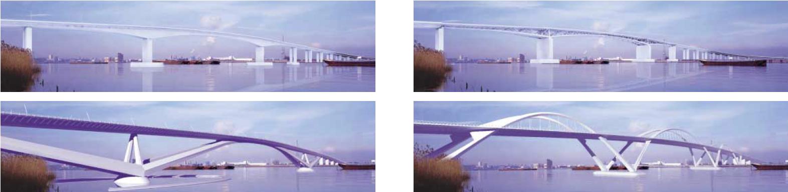
Transport for London have published the results of the River Crossings Consultation which they ran earlier in the year. It shows that more than 70% of respondents supported a Bridge or Tunnel at Gallions Reach (71%), and a tunnel between the Greenwich Peninsula and Silvertown (77%). Smaller numbers, just over 50%, supported a new ferry at Woolwich (51%) or Gallions Reach (52%).  The TfL diagram summarising the results is included below.

Interestingly Greenwich was the borough with most respondents, 34% of the total replies came from the borough. Greenwich people showed the highest percentage level of support for a new ferry at Woolwich and the highest level of opposition to the Silvertown tunnel. Those from Bexley had the highest level of opposition to a ferry or bridge at Gallions Reach, with 25% strongly opposed to a bridge out of 31% expressing opposition. Not surprising given the anticipated appalling impact of increased traffic on narrow roads in the borough such as Knee Hill.

Snippet from TfL Report on River Crossing Consultation

What happens next? Well TfL will be considering the issues raised and will produce another report responding to them later in the summer. However they do give some indicative milestones. For the Woolwich/Gallions Ferry options they are:

… the overall indicative milestones for progressing the review of Woolwich/Gallions Reach options are set out below:
• April – September 2013: Traffic modelling, engineering, economic analysis and development potential, charging strategy and wider benefits
• October – December 2013: Gallions Reach options consultation
• March – April 2014: Presentation of Gallions Reach consultation to the Mayor
• May 2014: Mayoral announcement on Gallions Reach preferred option
• Future milestones depend on option chosen but, subject to funding, it is possible to implement a ferry by 2018 or a fixed-link by 2025

And for the Silvertown tunnel:

… the overall indicative milestones for progressing the Silvertown tunnel are set out below:
• April 2013 – February 2014: Traffic modelling, engineering, economic analysis and development potential, charging strategy and wider benefits
• March – May 2014: Preparation of DCO consultation for Silvertown tunnel
• June – August 2014: Statutory public consultation on proposed DCO for the Silvertown tunnel (i.e. post decision on Gallions Reach which is planned for May 2014)
• September – October 2014: Analysis of results of statutory consultation and presentation to Mayor
• October 2014 – June 2015: Preparation of Environmental Statement and associated documents to submit DCO application to Mayor and Board for approval for submission
• June 2015: Submit DCO application for Silvertown tunnel plus any additional consents required
• June 2016: Commence procurement process with OJEU notice
• December 2016: Decision by Secretary of State on Silvertown tunnel
• July 2018: Contract award
• 2018 – 2022: Silvertown tunnel construction

If the Mayor gives the go-ahead the detailed analysis of the options – Traffic modelling, engineering, economic analysis and development potential, charging strategy and wider benefits – will be done by September this year for the eastern-most options and February next year for the Silvertown Tunnel. I suspect it is only then that the real debate can start.

I won’t repeat what I think about the proposals, it’s been covered in previous posts, apart from one observation. On the Bluebell Walk through Oxleas Woods last weekend, in the midst of the historic cants of coppiced Hazels and Chestnuts deep in the wood , the walk leader Barry Gray pointed out an old metal tube sticking up a couple of feet out of the ground. This, he explained, was a relic of the water table analysis of the proposed route through the ancient woodland of a motorway from the A2 to a bridge at Gallions Reach. There seems to be a consensus that the roads leading to the Gallions crossing are inadequate for the expected traffic flows. If we’re not careful the woods will be threatened again.

Oh, and of course it will be the end of the Free Ferry: the new crossings will all be tolled.

River Thames at Gallions Reach

Horticultural Skills Centre Planning Application

Entrance to the proposed Horticultural Skills Centre

An application for planning permission to demolish some of the buildings at the Parks and Open Spaces Depot site on Shooters Hill and create a new Horticultural Skills Centre has been added to the Royal Borough of Greenwich planning web site. However it isn’t open for comments at the moment, and it doesn’t give any timescales for when we would need to make any comments.

This is the next step in the council’s joint project with Hadlow College to develop the Horticultural Skills Centre. Hadlow College also run the Equestrian Centre further down the hill.

The planners will need to consider policies on Metropolitan Open Land and the Green Chain in making their decision about this application. A comparison of the plan of the existing buildings with the proposed Horticulural Skills Centre plan, below, suggests that the new buildings will have a smaller footprint than the existing ones which will help prove compliance with the policies.

Existing and Proposed Plans

The new buildings sound like a great improvement on the current constructions:

The form and massing of the building along with the detailing and proportions around the windows, doors and the large roof overhangs will provide a contemporary modern design. The façade materials however, have been chosen to complement the woodland setting so the scheme will relate well to its surroundings taking references from the local woodland context.
Cedar cladding will be a dominant feature of the façade, which is then broken up by window and door elements. Blue engineering bricks are proposed for the plinths. The timber boarding will be fixed vertically and will be naturally finished. Cedar contains natural oils that act as a natural preservative providing a long lasting low maintenance finish. The metal framed windows/doors and roof fascia will be finished in polyester powder coat aluminium with an agreed colour finish which will again provide a low maintenance finish.

My only concern at the moment is with the assertion in the Design and Access Statement that the site “does not contain buildings that are listed, or are of special architectural or historic interest. There is also a low potential for archaeology on the site.” The old coach house on the site may be of historic interest and I’m pleased to see that a building marked on the western edge of the site on both the current and proposed plans suggests that it is not going to be demolished. The latter statement about archaeological potential is contradicted by the council’s Areas of High Archaeological Potential document which is part of the current consultation on the Greenwich Core Strategy. It contains the map below, delineating the Shooters Hill Settlements area of high archaeological potential, which clearly includes the site of the Horticultural Skills Centre.

Greenwich Areas of High Archaeological Potential No 7 Shooters Hill

The archeological interest stems from various interesting finds over the years, such as those from the Time Team excavations. The Areas of High Archaeological Potential document mentions:

  • Bronze Age ditch and associated bronze working slag from the area east of Cleanthus Road
  • Ditch with Early Iron Age pottery sherds and 63 kg of iron slag
  • Prehistoric/Roman pits and ‘huts’ recorded from the Woolwich and District War Memorial Hospital site
  • Remains of a Saxon musical instrument from the roadside area of Shooters Hill Hospital
  • World War II evidence that identifies the area as being part of one of the ‘Stop Lines’ that ringed London

I think the council and Hadlow College need to think again about archaeological potential and allow for it in their development plans and activities. But the new centre still looks like a benefit to the borough.

Greenwich Core Strategy

Detail of Assembly by Peter Burke in the Royal Arsenal

Commenting on the Royal Borough of Greenwich Draft Core Strategy is hard work. It’s not just that the Strategy itself is 235 pages of planner-speak, but there are also a large number of supporting documents, such as the Sustainability Appraisal and the Tall Buildings Assessment. Some of them, like the  Areas of High Archaeological Potential document and the Biodiversity Action Plan, are quite interesting but still a lot of information to try to assimilate.

But it has to be done, even if these consultations seem to be cynical. The Core Strategy and other documents that make up the Local Plan will be the basis of planning decisions in Greenwich until 2028 ao it’s important that they are right. The strategy is wide-ranging. For example it proposes building an additional 32,235 houses in the borough by 2027 – the population is expected to increase by 22.5%, more than a fifth, from 2010 levels to 288,000 by 2027. It also enshrines support for the Silvertown Tunnel in policy C3, critical transport infrastructure. But it doesn’t mention betting shops anywhere.

The current consultation is the last opportunity for public involvement in deciding the planning strategy before it is submitted to the Planning Inspectorate. The Planning Inspectorate will then chair a formal “Examination in Public” (EiP), which is likely to be a number of round table hearings depending on the volume of comments. However only people who have made comments at this stage of the process, and who have indicated that they want to attend, will be able to participate.

The London Tenants Federation have been holding workshops to help tenants and other community groups  to influence planning policy. For example,  providing guidance on how to make comments on the Greenwich Core Strategy: they should be on the basis of whether the plan is a sound document, which means:

  1. Positively prepared – the plan should be prepared based on a strategy which seeks to meet objectively assessed development and infrastructure requirements, including unmet requirements from neighbouring authorities where it is reasonable to do so and consistent with achieving sustainable development;
  2. Justified – the plan should be the most appropriate strategy, when considered against the reasonable alternatives, based on proportionate evidence;
  3. Effective – the plan should be deliverable over its period and based on effective joint working on cross-boundary strategic priorities; and
  4. Consistent with national policy – the plan should enable the delivery of sustainable development in accordance with the policies in the Framework.

The LTF will be holding a workshop on 7th May which will provide guidance  for community groups who want to make written responses to the consultation. Jenny Bates from Friends of the Earth will provide analysis of the  environment & climate change and transport sections of the strategy. It will also cover topics such as Housing, Economic Activity and Employment, Regeneration and Transport. Email info@londontenants.org for details.

The closing date for comments of the Greenwich Core Strategy is 14th May 2013. You can do so through the Greenwich Consultation Portal.

The Places of Greenwich according to the Core Strategy

South-east London test of 4G interference with TV

Shooters Hill Fire Station Mast from Eaglesfield Road

Will the new 4G mobile phone system interfere with our Freeview TV reception? We may find out next week when a test is being run in south-east London, including parts of Greenwich. A company called at800, a brand name for Digital Mobile Spectrum Limited (DMSL), is running the tests. Their press release said:

A test to help understand the extent to which 4G at 800 MHz may disrupt Freeview is being run in south east London. at800 is asking viewers in the area to report problems with television reception from Monday 15 April. at800 is the organisation tasked with ensuring viewers continue to receive Freeview when 4G mobile services at 800 MHz are launched later this year.

Approximately 170,000 household and business addresses in parts of Greenwich, Lewisham, Southwark and Tower Hamlets are being contacted directly to alert them to the test. This larger-scale testing follows an initial small-scale test in the West Midlands.

Households that at800 think will be affected will be sent a postcard like the one below in the next few days.

at800 specimen postcard

The new 4G mobile broadband will use the 800MHz frequency band that used to be used for analogue TV. This is close to the 700MHz that Freeview uses. An article by Barry Fox in April’s edition of Everyday Practical Electronics explained:

The 800MHz 4G band is very close to the 700MHz band frequencies used by Freeview. Co-channel interference is inevitable, especially for homes close to a 4G base station and where aerial amplifiers are used. Interference may well be variable and intermittent, making it harder to tie cause to effect.

It was estimated by Ofcom that that the problem could affect up to 2.3million homes, but in an initial pilot study covering 22,000 homes in the Midlands only 15 homes suffered interference.

If you suffer TV  interference next week, at800 have a number for you to call:

If you live in the south east London area and notice problems with your Freeview service from 15 April, please contact at800 by calling 0333 31 31 800. You will be asked for your postcode, the type of interference and the time it occurred. This will allow at800 to restore your service as soon as possible. Freeview is the television that viewers receive through their aerial.

Most cases of interference can be solved by fitting a filter between the TV and aerial, and at800 will provide one filter to each affected household. The at800 website has details of what needs to be done in different situations, and of the support that will be provided. In the worst case, where a filter doesn’t solve the problem then at800 will provide an alternative such as Freesat or cable at a cost of up to £10,000.

Cable and Satellite TV will not be affected by the 4G signal, only over the air, digital terrestrial television, to aerials.

Planning: Severndroog, All Saints and the Eagle

Severndroog Castle on Open House day

I notice the Royal Borough of Greenwich has re-vamped the planning applications search facility, which may explain why my regular PlanningFinder e-mails have been a bit brief recently, and why links to planning documents in old e-shootershill posts no longer work. A quick browse through recent applications in the Shooters Hill ward revealed some interesting applications.

Severndroog Castle Building Preservation Trust have applications for planning  and listed building consent for their long-awaited programme of repairs and alterations to the castle which are part funded by the Heritage Lottery Fund. The summary for applications 13/0228/F and 13/0229/L on the planning page is:

Repairs and alterations including new external steps and landing, new 2 metre high perimeter security fence and gates, infilling of two external door openings, new sliding glazed doors to main entrance, new kitchen and toilet facilities, replacement of lead roofing and timber viewing platform, new electricity supply cubicle. Installation of new and replacement mechanical, electrical and telephone services in connection with the above.

I believe the work is as described in their 2010 applications 10/0346/F and 10/0136/L. There will be a café on the ground floor, a space for functions on the first floor and an education space on the second floor. There will also be access to the viewing platform at the top, which has great views over London (and a video feed for those unable to climb to the top). The documents submitted with planning applications are often a great source  of historical information. In this case the 10/0346/F Conservation Management Plan provides an excellent summary of the history of Severndroog Castle, complete with maps and copies of paintings, engravings and photographs of the castle from the early 19th century onwards.

I’m looking forward to the re-opening of the castle and another chance to enjoy the view over the city from a platform that is 46 feet above the cross on St Paul’s Cathedral.

The Eagle
The Eagle

Further down the hill in Red Lion Lane it is proposed in application 13/0186/F to convert the former Eagle Tavern into 5 flats:

Conversion of existing Public House into 5 flats consisting of 1 x 3-bed, 2 x 2-bed and 2 x 1-bed self contained flats. | THE EAGLE TAVERN, 78 RED LION LANE, PLUMSTEAD, LONDON, SE18 4LE

The application says that the “street scene will not alter ” as a result of the conversion. The frontage of the pub will be retained, but a light-well will be excavated at the front of the building to allow windows for the basement flats. The style of these windows will be carried down from the feature windows of the pub. There will also be a pair of light-wells at the back of the building.

Yet another pub lost. Any comments about the application need to be in by 09/04/2013.

All Saints Church
All Saints Church

Another planning application, 13/0495/F, proposes major changes at All Saints Church on Herbert Road:

Demolition of existing parish hall, erection of a new parish/community hall and vicarage, parking and associated works, remodelling of church entrance to provide level entry.(Reconsultation). | ALL SAINTS CHURCH, HERBERT ROAD, WOOLWICH, LONDON, SE18 3QH

The idea is to replace the old church hall that is to the right of the church with a new 4-bedroom vicarage and to build a new church hall on the Ripon Road facing grassed area to the left of the church, which the agents acting for the church describe as “surplus land”.  The new church hall would be single storey, sedum-roofed and connected with the rear of the church. The Church wish to replace the old timber-framed prefabricated church hall because it is in extremely poor condition, uneconomical to repair, has poor accessibility and is inadequate to the community’s needs. They also feel the old vicarage is unsuitable because it is too large to economically heat and furnish and it doesn’t allow separation of the public and private aspects of the incumbent’s life.

The development is to be funded by selling the vicarage, over the road at 106 Herbert Road and, more controversially, building two 3-bedroom terraced houses, a 2-bedroomed flat and a 1-bedroomed flat on the back garden of the vicarage in Ripon Road. Sounds to me like a bit of garden grabbing. The covering letter for the application says:

These proposals are directly linked to our clients’ residential proposals on land adjoining no. 30 Ripon Road. A planning application seeking outline consent for the erection of 2×3 bed terraced units, 1×2 bed and 1×1 bed flats is submitted simultaneously with this application. From the details accompanying both applications it will be noted that the two developments are closely linked and for this reason it is requested that both proposals are determined together.

I couldn’t find the second planning application on the Royal Greenwich web site, and it is not clear whether it is still possible to comment on either application – the comments tab for application 13/0495/F says that “Comments may not be submitted at this time”. Together these applications would be a significant change to that small area.

Update: A notice on the lamp post near the church in Ripon Road says that comments should be sent to the council before 16th April 2013.

I guess the Royal Borough of Greenwich planning page changes are still bedding in. They didn’t allow me to register to make comments – giving the message “Unable to complete your registration – Unable to send confirmation e-mails at this time. Please try again later.”

The Vicarage
The Vicarage

Horticultural Skills Centre

Greenwich Parks and Open Spaces depot

I wasn’t aware that there were plans for a Horticultural Skills Centre on Shooters Hill, as well as the Equestrian Skills Centre, until I saw ?Stewart Christie’s  (@5tewartChristie) tweet yesterday about Greenwich Council’s decision to give a grant of up to £495,000 to Hadlow College for the development of such a centre. Hadlow, who also run the Equestrian Centre just down the hill,  will put £73,000 towards the cost and will be responsible for any overspend and  ongoing running costs.

It is proposed that the new centre will be built at the Parks and Open Spaces depot opposite Eaglesfield Road, which is going to be empty from April. The site already has buildings on it and from the preliminary plans it looks like the new centre will have a similar layout and footprint as the existing development, even keeping the little roundabout at the entrance. It will “encompass a teaching, administration and a facilities block, alongside polytunnels and raised beds for planting and growing”. They still need to get planning permission for any work, so we will have a chance to comment on the plans. They are working to a tight timetable: they reckon the work will take 3 to 4 months, but want to be able to open the new centre by the end of summer in time for the start of the autumn term.

As well as the grant the council will let Hadlow College have a 15 year lease on the site for a peppercorn rent. The Equestrian Centre also has just a 15 year lease.

Preliminary Plan for Horticultural Skills Centre

The aim of the new centre, according to the council report is:

This element of the Skills Centre is designed to exploit the potential for horticultural jobs both in the Royal Borough, including the Borough’s Council’s own parks and open spaces, and in surrounding areas. The Service Level Agreement will set out the scope of the skills training to be delivered, which will include pre-apprenticeship and apprenticeship training at levels 1 and 2, adult and community learning, NPTC short courses in areas (e.g. pesticide spraying), embedded literacy, numeracy and IT skills, with the aim of equipping students with a range of transferable skills that will increase individuals’ employability, and provide potential access to a range of jobs and careers.

On the 1894 and 1914 OS maps of Shooters Hill the area where the Parks and Open Spaces depot is now was occupied by a mansion called Summer Court about which I know very little, though it was occupied in 1900 by a bankrupt named William Carter. From the old maps it’s possible that an old coach house on the site, pictured below,  may be a remnant of the Summer Court buildings; I’m glad that the preliminary plans show that it will be retained within the Horticultural Skills Centre.

Old building in the Greenwich Parks and Open Spaces depot

At the bottom of Shooters Hill the Hadlow College Equestrian Centre is now occupied and has its first students, though it won’t be fully running until the start of the 2013/14 academic year in the autumn. One of the conditions of their planning approval was that they had to submit a community use scheme, allowing  for a minimum of 82 hours of community access each week, to the council planning authority and get it approved.  The Greenwich Council planning pages show that Hadlow have submitted a scheme, but the document itself is not included and comments are not being accepted. Its status is “Pending Decision”. When I dropped in to the Equestrian Centre earlier today I was told that they planned to provide riding lessons for local residents in the evenings and at weekends starting at the end of the summer.

The Horticultural Skills Centre sounds like a good idea to me, and an enhancement to the area, but like the Equestrian Centre it seems that Greenwich Council are going about it in a slightly odd way.

Cynical Consultations?

MOPAC  Draft Police and Crime Plan Front Cover
MOPAC Draft Police and Crime Plan Front Cover

Scene at King William Court, University of Greenwich:

Question: Why are you reducing the size of the Safer Neighbourhood Teams?

Answer: We’re increasing the number of police in the Safer Neighbourhood Teams.

Later ….

Question: The Safer Neighbourhood Teams work really well, why are you reducing their size?

Answer: We’re increasing the number of police in the Safer Neighbourhood Teams.

Later still ….

Question: I’m against the reduction in the number of officers in the  Safer Neighbourhood Teams, why are you doing it?

Answer: We’re increasing the number of police in the Safer Neighbourhood Teams.

I felt a strange mixture of confusion and deja-vu  by the end of the Mayors Office on Policing And Crime (MOPAC) consultation event at the end of January. We had been told that each Safer Neighbourhood Team would be reduced in size from two police officers and three police community support officers (PCSOs) to one police officer and one PCSO. We had also been told that the number of officers allocated to SNTs in Greenwich would be increased by 88 (and that we should be grateful for that). Why the difference? No-one was saying, even after a direct question about how SNT resourcing works. It was quite easy for the panel to avoid questions because the chair had cunningly combined questions into groups of three before they were answered, so some questions just weren’t addressed. We did find out that the Deputy Mayor for Policing and Crime had to attend a large number of consultation events (poor chap), but not what was so interesting on his mobile phone. We’re also going to have sheriffs apparently.  Hopefully the Sheriff of Shooters Hill won’t meet Robyn Hood in Oxleas Woods.

I think what was being proposed was that each individual SNT would have fewer officers assigned permanently to it, but there would be a larger pool of officers who would be temporarily assigned to individual SNTs on an as needed basis. It would have been nice to learn how this would work in practice, but the consultation event was kept strictly to one hour, which wasn’t really enough to cover all the issues raised by the new Police and Crime Plan 2013-2017, which also proposes the closure of Woolwich and Greenwich police stations.

The Consultation on the Police and Crime Plan 2013-2017 finishes tomorrow, 6th March 2013, so there’s not much time to register our views. There’s an on-line form for comments.

A consultation has also started on the Draft Fifth London Safety Plan (LSP5) which, amongst other things, proposes the closure of 12 fire stations including Woolwich. Again there is an online survey to give our views, and we have until the 28 May 2013 to do so.

Entertainment at the start of the Save Lewisham A&E March

The MOPAC consultation event made me wonder whether it was worth responding – will it make any difference if everyone says they don’t want police stations to close, or will they just go and do it anyway? There is a recent precedent with the consultation about the South London Healthcare NHS Trust and the proposal by the Trust Special Administrator to close  Accident and Emergency at Lewisham Hospital. Despite the majority of respondents saying they were against the proposal, and despite 25000 people marching through Lewisham to object, and despite nearly 35000 people signing a petition against the proposal,  the Secretary of State for Health, Jeremy Richard Streynsham Hunt,  decided to do it anyway.

The Transport for London consultation about the Thames river crossings and the possible closure of the Woolwich Free Ferry seemed to be better than others inasmuch as their reports on previous public feedback suggested that some notice was being taken of our input. But now we hear that Greenwich Council is trying to get the power to build a bridge at Gallions Reach whatever we say and whatever TfL decide!

What a lot of consultations!  And it can be quite hard work to respond to them: the TSA draft document about South London Healthcare  was some 373 pages of largely impenetrable management gobbledegook; not an easy read. Is it worth the effort when it seems that politicians treat the result so cynically? Yes, I think it is as it is one of the few ways possible to make our views known. But politicians shouldn’t complain about public disengagement with the political process, such as low turn out at elections, when they themselves fail to engage with the public when they get the opportunity.

One last consultation to mention, as it will shape future planning decisions in Greenwich.  As the council’s e-mail about it said:

Royal Greenwich is preparing a new planning policy document called the Core Strategy with Development Management Policies.  This document will replace the existing planning policies for the Borough (the Unitary Development Plan) and will be used by the Council to help shape development up to 2028.

I found the Unitary Development Plan very useful as a means of making reasoned objections to proposed property developments –  it lays down the policies that the planners use to decide what can be built where – so it’s important that its replacement is suitable for the same role. As the Planning Consultation Portal says:

When it is adopted, the Core Strategy with Development Management Policies will become the key strategic planning document for Royal Greenwich. It will be used to help shape development and determine all planning applications.

Key features of the proposed strategy are explained in the latest draft document. They include:a significant number of new homes by 2028 the creation of two new mixed use urban quarters at Charlton Riverside and Greenwich Peninsula West. Strategic and development management policies will be used to guide development applications in the borough. These cover a range of topics such as open spaces, infrastructure and environment and climate change.

Following previous public consultations on the Draft Core Strategy with Development Management Policies we are due to begin our 12 week consultation period on the Proposed Submission Version on the 19th February 2013.

We have until 14th May 2013 to comment through the Planning Consultation Portal. You will need to register to be able to comment.

Woolwich Fire Station _ London's oldest operational fire station
Woolwich Fire Station – proposed for closure
The Blue Lamp at Woolwich Police Station
The Blue Lamp at Woolwich Police Station – also proposed for closure


Lewisham Hospital March on Saturday

Save Lewisham A & E Leaflet

The campaign to save Lewisham Hospital’s Accident and Emergency Department have organised a march to object to the SLHT Administrator’s recommendation to close it to help sort out financial issues at the South London Healthcare Trust,  which includes our local Queen Elizabeth Hospital.

Why should we be concerned? Well apart from the effect on the health of people living near Lewisham Hospital who will have to travel much further if they need emergency medical help, and apart from the outrageous unfairness of closing a facility in a financially stable hospital to solve a problem elsewhere, and apart from the real terms reduction of the health care budget for south-east London and the flawed consultation process it will also add to the pressure on Queen Elizabeth A&E and increase the waiting time for patients there.

There is widespread support for the campaign,  including health professionals, Archbishop Desmond Tutu and Millwall football club and many others detailed on the Save Lewisham Hospital web site, which also gives the arrangements for Saturday’s march:

The demonstration will assemble at the main roundabout outside Lewisham Rail/DLR/Bus station at 12 noon on Saturday 26th January.

March through Lewisham shopping centre along to Lewisham Hospital, then up Davenport Road to Mountsfield Park for rally, music and giant petition. Details of the route will be available here shortly.

RALLY AT THE END OF THE MARCH
This will take place in Mountsfield Park in Catford. There will be speeches, music, food, and other entertainments.

The web site also gives details of other actions we can take to support the campaign, such as writing to Health Secretary Jeremy Hunt and to our local MP and signing the petition supporting Lewisham A&E and maternity services.

Bridge Going Nowhere

The Ski Jump in Beckton

The bridge going nowhere in the photo above is known as the ski jump.  It’s a section of road over in Beckton that was built in preparation for the Thames Gateway Bridge, but  currently leads to nowhere apart from a dangerous drop.  Maybe it’s a metaphor …

I’ve been enjoying reading about the  various attempts to create a river crossing between Thamesmead and Beckton over the last few days. It’s a fascinating tale: from  the Ringway suggestion back in the 1930s which became Ringway 2 in the 1960s, then the East London River Crossing in the 1980s and 90s, the Thames Gateway Bridge early this century and now TfL’s Gallions Reach Ferry proposal and the Royal Borough of Greenwich’s campaign for a bridge.

The historical background and  story of People Against the River Crossing is well told in David Black’s “The Campaign to Save Oxleas Wood” which details the inquiries and court cases, both UK and European, that eventually led in 1995 to the dropping of plans to put a motorway through Oxleas Wood and Plumstead and build the East London River Crossing. A group of local residents known as the Oxleas Nine risked financial ruin from  huge legal fees to appeal to the High Court against the compulsory purchase orders needed to allow the roads and crossings to be built.

Unfortunately the documents relating to the 2005 Thames Gateway Bridge Public Enquiry are no longer available online, but those I have seen show a similar level of opposition from local residents concerned about issues such as the health effects of air pollution and the risk to Oxleas Wood from the need for improved road links to the A2.

My reading about the bridge also led me to the Beckton ski jump. It can be seen circled in red on the Google Maps snippet below; it is also one of the possible routes for traffic to TfL’s proposed Gallions Reach Ferry.  Its other claim to fame is that it appeared in a car chase in the TV series Bugs, which culminated in a car driving off the end of the ski jump to explode in the waste land beyond. It’s on YouTube here, starting at about 46minutes in.

Google Map snippet showing the Beckton ski jump

The map also shows another complication to building a bridge here – the proximity and orientation of the runway at London City Airport, which limits the possible height of the bridge. Campaigners in favour of east London river crossings make much of the disparity in the number of crossings to the west and east of Tower Bridge. Two obvious reasons for the difference are that the Thames is wider the nearer it gets to the sea, and large ships sail up the Thames to Central London (and potentially to a cruise liner terminal in Greenwich). Consequently bridges need to be wider and higher and  are more expensive to build, which seems to lead to them having to carry more traffic. The artists impressions of the proposed Thames Gateway Bridge, below,  from TfL’s brochure show the likely size of a bridge at this location.

Artists impressions of bridge from TfL's The Thames Gateway Bridge A new bridge for East London
Artists impressions of bridge from TfL’s The Thames Gateway Bridge A new bridge for East London

The required height of the bridge means that it has to have longer run-up roads so the overall length is much longer than just the distance across the river, making it very pedestrian unfriendly. Not to mention the high winds in the middle.

When I started writing this post I intended to focus on traffic modelling. I’m not an expert, but it seems to me that changes to the road infrastructure need to consider the whole network because increasing capacity in one place will simply move the bottlenecks to somewhere else in the network, so improvements should be across multiple sites to try to even out the flows.  Also traffic management measures need to be included to discourage cars and lorries from small, residential roads. I’m still searching for some comprehensible detail on modelling, but I notice that the recently released East London River Crossings Assessment of Options mentions this issue and confirms my feelings about the impact that a Gallions Reach bridge would have on roads through Plumstead and Bexley:

6.285. The modelling for TGB suggested that it would provide relief for the Blackwall tunnel as well as opening up new travel opportunities further to the east. However, a  key issue is that the road network on the southern side is much less developed than on the northern side, where the road would meet the grade separated A406 and A13 as well as linking (via the A406) to the M11.
6.286. To the south, the road would meet the east-west South Thames Development Route, a useful distributor road along the southern side of the Thames, but this is lower capacity than the northern access routes, and is generally not grade separated, with congested junctions in Plumstead, Woolwich and Erith.
6.287. Other routes on the southern side are poorer still, with the roads south into Bexley being largely two lane single carriageway roads, fronted by suburban housing. There was some strong local opposition to the scheme arising from concerns over the impacts in these areas. This led ultimately to the opposition of the London Borough of  Bexley to the scheme.

This suggests that a ferry at Gallions Reach would be a better option than a bridge because there is a natural capacity limiting effect from a ferry  that will reduce the amount of traffic heading in that direction, though additional action to encourage traffic along suitable roads and away from smaller roads may be needed too. And by analogy with west London perhaps having many smaller scale crossings would be better than one or two  massive congestion generating grand projects like multi-lane bridges and tunnels; an argument in favour of  keeping the Woolwich Free Ferry as well as the new one. I’d be interested to see the results of traffic modelling with this scenario.

Are there any other possibilities for small east London river crossings, I wonder, and what is the current state of technology for swing bridges?

We have until 1st February to make any comments on the Transport for London  proposals using an online survey with just 14 questions, or by e-mail to rivercrossings@tfl.gov.uk. There is also an online petition against the Silvertown tunnel.

Friends of the Earth have arranged two public meetings  about the crossings  – one north of the Thames tonight and another at the Forum in Greenwich next Monday, 28th. They e-mailed with the details:

North side of the river:
Monday 21 January 2013, 7-9 p.m.
St Matthias Community Centre, 113 Poplar High Street, E14 OAE
http://www.stmatthiascommunitycentre.com/contactus.jsp
Nearest station: Poplar DLR
South side of the river:
Monday 28 January 2013, 6.30-8.30 p.m.
Forum@Greenwich, Trafalgar Road, Greenwich, London SE10 9EQ

Contact us


Nearest station: Maze Hill station

SPEAKERS:
-Air Pollution expert Dr Ian Mudway of Kings College London
-Transport expert John Elliott, Transport Consultant

Underneath the ski jump at Beckton
On top of the ski jump at Beckton

Woolwich Police Station

The entrance to Woolwich Police Station

What has Woolwich done to deserve this? The Victorian post office has been demolished and its architectural adornments put into storage,  the 124 year old Woolwich Free Ferry is threatened with closure, as is the 126 year old Woolwich Fire Station and now there is a proposal to close Woolwich Police Station. The police station in Market Street is a comparative youngster; it was built in 1909 – 10, just 103 years ago, though there has been a police station in Woolwich since 1840 according to English Heritage’s amazing book about Woolwich.

The Mayor’s Office of Policing and Crime (MOPAC) have proposed closure of 65 police stations across London in their draft Estate Strategy 2013-2016 which has just been issued for consultation. This includes three out of the five Greenwich police stations, as shown on the map snippet below taken from the Guardian’s datablog: Woolwich, Thamesmead and Greenwich police stations would close leaving just Plumstead and Eltham in the borough. Plumstead would be the only 24 hour station in Greenwich, so I assume that means it will be the borough’s “Grip and Pace” centre. The what centre? In the Metropolitan Police’s own words:

The new model will also see the introduction of war room-style ‘Grip and Pace’ centres where senior officers will have daily conferences with key staff, armed with the latest intelligence and data to coordinate police activities and ensure all the right resources are being used in the right places at the right times.

The changes, as you might have guessed, are being made to save money – the aim is to reduce the cost of police buildings by 30% from £205 million a year to £140 million by 2016, but at the same time they will try:

To achieve these cost and space reductions whilst enhancing the opportunities for members of the public to meet with the police through providing more access facilities in buildings across both the MPS and wider public estates as part of the overall accessibility strategy to the MPS

The  justification for the cuts seems to be partly  that the public interactions with the police via a police station front desk have reduced compared to other ways of contacting the police, and also that the police are more distributed through the safer neighbourhood teams.

There are a series of consultation events covering these and other changes to London policing. In Greenwich this will be at King William Court, University of Greenwich Tuesday, 29 January, 2013 from 8.00pm to 9.00pm. You will need to register if you want to attend.

Snippet from Guardian Data Blog Police stations in London under threat of closure

Woolwich Police Station is a Grade II listed building which was designed by John Dixon Butler who was then the Police Architect and Surveyor. Butler also designed the Magistrates Court on the opposite side of market street and a number of other police buildings throughout London, including Greenwich Magistrates CourtHackney Police Station, Shoreditch Police Station and Magistrates Court and Clerkenwell Magistrates Court. The Survey of London on Woolwich describes the Woolwich Police Station as “a strong example of Dixon Butler’s work and a subtly elegant expression of authority.” Its listing describes it as having a “restrained Queen Anne facade” and:

To Market Street, a wide and largely symmetrical frontage is of sixteen windows bays, organised into a five parts, with a steep gable with stone copings marking the end and central sections, between which are second floor dropped slated mansard roofs over a dentillated cornice. The ground floor has a deep ashlar band, the pedestrian entrance to the right hand side has an advanced ashlar entrance with ‘police’ inscribed in the frieze below the prominent cornice, and to the right an ashlar canted bay. Pair of front doors of panelled hard wood, and the stone architrave carries the 1910 date. There is a carriage entrance to the left side, this and the ground floor tripartite windows are under inset segmental arches. The carriage entrance is lined with glazed bricks, white above a brown dado. The first floor windows have exaggerated slender stone keyblocks. Rear elevation has irregular window arrangement, these under gauged brick arches, and a single storey flat-roofed extension. To the rear is a projecting cell block wing with gauged red brick arches over the sash windows; seven small cell windows, placed high, one replaced with taller window, these with small pane iron frames, chamfered stone heads and stone cills. Boundary wall to yard survives in part, but the former stable buildings to rear have been substantially rebuilt.

The listing also points out the particularly strong group value of the police station with the other Victorian and Edwardian municipal buildings of this part of Woolwich. The draft Woolwich Master Plan says of this  “Bathway Quarter”:

This area has a rich character which should be preserved though sensitive residential-led refurbishment with active uses at ground floor to create a distinct urban quarter. This area has the potential to be a high quality, high-specification, loft-style place with bars, galleries and artists’ studios together with other uses such as a jazz club and creative industries such as architect’s studios.

Hopefully this means the building will be preserved even if it is no longer a police station.

Woolwich Police Station
The Blue Lamp at Woolwich Police Station