Shooters Hill Stables?

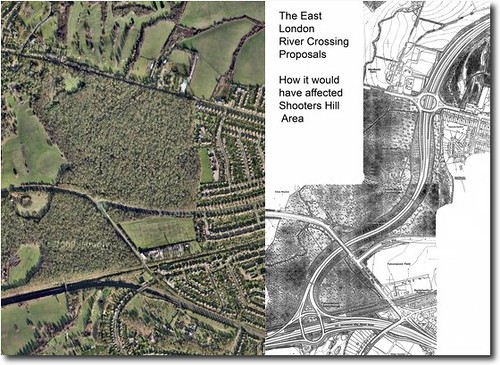
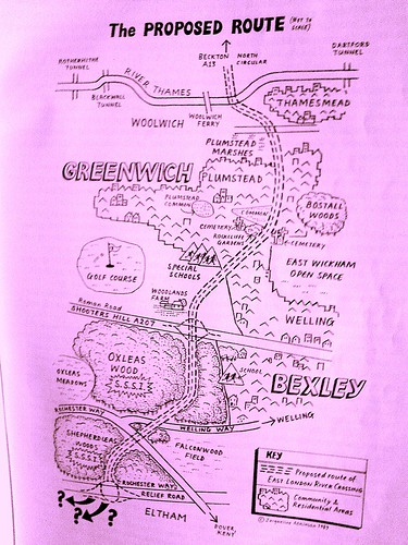
Today i was lucky enough to come across a copy of senine, a glossy and entertaining magazine that also has some excellent features relevant to the wider area. One story in this month’s edition particularly caught my eye. In a piece entitled Horse Play they detail proposals that could markedly change the Shooters Hill area by a) placing lots of horses in what is currently the donkey field between woodlands farm and thompsons garden centre, b) by exercising those horses in Oxleas Wood, and c) by increasing the to- and fro-ing of their handlers and vehicles, which may include a new horseback regiment due to move into the garrison. The SSSI designation awarded to the eastern slopes of Oxleas Wood, the attempts to build ringway2 and elrc over it, and the fairly recent development on woodland of the extended café car park and the recently permitted mixed-mode play area for christchurch school and public use (post to follow) mean that the integrity of one of London and nwkent’s last surviving, and in some ways unique (number of wild service trees for instance), areas of ancient woodland continues to require continual and vigilant protection in order to sustain it’s distinct ecology and survival.

Proposals for a new ‘Olympic legacy’ horse riding centre are on course for opening in 2012, SEnine has learned.

The centre will provide stabling for more than 40 horses on the slopes of Shooters Hill.

Maney for the £1m plus centre will come from a variety of sources, including £250,000 from the British Equestrian Federation and match-funding from Greenwich Council Olympic Legacy project.

The location is expected to be between Thompson’s Garden Centre and Woodlands Farm on a council-owned site currently grazed by donkeys from Blackheath.

Detailed plans are expected to be ready for consultation in the New Year but will run into strong opposition from members of the Woodlands Farm Trust concerned at the over-development of open land.

The new centre is intended to increase access to horse riding across the borough and will also include provision for riding for the disabled.

There will also be a link-up with the relocation to Woolwich of the country’s foremost equestrian Army brigade, the King’s Troop, Officers from the Troop, who will move into the former Royal Artillery barracks, will give their time to training at Shooters Hill as part of their commitment to community engagement

As well as stabling, there will also be new indoor and outdoor exercise rings. However, plans to allow the horses to gallop on surrounding land are expected to be opposed by Woodlands Farm and conservationists. Oxleas Woods, are designated as a Site of Special Scientific Interest and horse exercise would churn up paths and leave droppings which could change the area’s delicate ecology.

Chair of the Trust Dr Barry Gray said: “It would be a massive over-development of Metropolitan Open Land and lead to increased traffic in the area. The council seems to take no notice of its own policies for nature conservation and open space.”

I also found a relevant story from 17 December 2009 on the british equestrian federation site, so this is not a new idea at all. I’m not sure why it’s surfaced on the pages of senine now, and can’t find any planning applications on the council website, the land is apparently theirs, so I’m not sure what the consultation process would be, but presumably if it’s going to happen, it’s going to happen some time this year.

Andrew Finding, Chief Executive of the British Equestrian Federation says: ” … The centre, which is proposed at Shooters Hill, just a stone’s throw from the Olympic equestrian venue [I’d like to see someone throw a stone to Greenwich Park, ed.], will provide a lasting sporting, community and educational legacy for the equestrian community in the city. This project will also be supported by significant local authority funding. ”

Councillor Chris Roberts, Leader of Greenwich Council said; “We see the London 2012 Olympic and Paralympic Games as a tremendous opportunity to inspire people to take up sports and are doing all we can to develop a new equestrian centre in Greenwich, as well as a host of other new sports facilities.

“A new equestrian centre will not only introduce thousands of London children to the thrill of horse riding, it will also provide educational and training opportunities for many people for years to come. Our plans are to provide a top quality training centre so that people can gain skills and qualifications in an area that will open up opportunities across the world.

“The Games aren’t just a 17-day sports event for London – they are a chance to create new opportunities and inspire people and we have to start now so that the benefits can last for generations to come.”

Ringway 2

Ringway 2 Proposed Route
A recent discussion over on plummy mummy’s website, has reawakened my interest in the incredible story of the long (and so far successful) struggle of the residents of south east london against the urban motorway planners that just will not go away: the creators of the dreaded ringway2/elrc/tgb historical trilogy of vastly unpopular road building schemes.

In an effort to win favour with the people, the proposal has actually been watered down each time; starting out from a bold 1960’s dream/nightmare of a three carriageway bypass running through oxleas wood, the blueprint was gradually scaled down, ending up with the most recent suggestion that through-traffic could simply drive down residential streets to access the so-called ‘local’ bridge that the tgb was supposedly going to be.

Well, thinking back to the state of play in the 1970’s, if you are curious which parts of the area would have been concreted over if ringway2 been built, there is a website that can demonstrate! A motorway enthusiast, who runs an online road directory has painstakingly researched the history of the London Ringways, and has produced an accurate map showing what the route would have been. [click on the image to zoom].

People Against the River Crossing: Were You There?

people against the river crossing
People Against the River Crossing

July the 8th 1993, central government withdraws the Oxleas Woods section of its infamous Roads to Prosperity scheme. The hill is saved!

I’ve been asked whether I’d like to investigate this, and since this is quite possibly one of the most significant things to ever happen here, it seems like a good idea for this site to cover this part of the Shooters Hill story.

Since this is a relatively recent episode, and an example of people power, I’m hoping to include some thoughts from those who participated in and observed the saving of the woods. So, if you were there, and would like to reminisce, I would like to hear from you. If you are interested please get in touch via the email address at the foot of the page.

parc-maps

The map shows how the bypass would have run right through woodlands farm, oxleas wood, and sheperdleas wood to meet the a2

At some point this year a post on this will appear, but for the time being, here’s the oxleas section of an alarm uk publication from 1995 (taken from the limited online information I’ve found so far):

“Whenever I used to visit Oxleas Wood I would visualise the proposed road cutting through it. It’s hard to believe that the woods are now safe. But safe they almost certainly are!

My involvement in the campaign against the East London River Crossing began in earnest in the late eighties. By this time the road had been scheduled for construction for many years and had already been approved by the longest Public Inquiry ever held into a road scheme. That inquiry had lasted 194 days; the transcripts of the proceedings contained 9.5 million words!

Local people, in the form of People Against the River Crossing (PARC) and Greenwich & Lewisham FOE, were fighting a determined and exhausting battle against a scheme which would not only cut a swathe through 8,000 year old Oxleas Woods but would also take out several hundred houses in the quiet and pleasant suburb of Plumstead. But with approval in principle granted, and with the Government, developers and some socialist local authorities strongly supporting the scheme, the odds against stopping it were getting bigger all the time. To achieve victory, a concerted strategy was needed to make Oxleas Wood a big issue locally and give it wider significance – a strategy to make it a symbol of the environmental damage that the road programme was causing and a rallying point for the environment movement. If that could be done, then, given Oxleas Wood’s proximity to Westminster, it might force the Government to back down rather than risk confrontation with a united community and environment movement, in its own “back yard”.

Like all the best campaigns we fought on every level. There were letter-writing stalls at the popular Greenwich market, politicians were systematically lobbied and a well-presented public transport alternative was drawn-up. We organised an “Adopt-a- Tree” scheme; the aim here was to get every tree in Oxleas Wood adopted. As well as bringing in funds and publicity, it would give supporters a real stake in the campaign. And if the worst came to the worst we could invite tree adopters to turn up to defend their tree.

In order to make Oxleas a “line in the sand” for the environment movement, we got some of the large environmental non-government organisations (for example the Wildlife Trusts and World Wide Fund for Nature) to take part in an Oxleas Strategy Group. This helped lock them into a campaign that was ultimately run by local people, but which made the best use of the resources of the national campaigns.

A couple of legal lines of last resort helped propel the campaign into the national news. The Government had failed to carry out an Environmental Impact Assessment for the scheme, as required by European Community law. The heroic European Commissioner for the Environment, Carlo Ripa di Meana, took up this complaint causing Prime Minister Major to hit the roof and interrupt a Commonwealth conference to condemn the EC’s action. The complaint was never seen through by the EC, but the publicity was invaluable, as was that which resulted from a High Court case where the “Oxleas 9” (nine local people) put their assets on the line to take the Department of Transport to court over their failure to provide adequate land in exchange for the damage to Oxleas woods. The case was lost, but Oxleas had caught the public imagination and the pressure on the government was intensifying.

Meanwhile, campaigners were preparing for the worst. A “Beat the Bulldozer” pledge was launched, with the aim of getting 10,000 people to pledge to be there if the bulldozers went in. With the TV pictures of direct action at Twyford Down fresh in their minds, as well as the vivid pictures we had painted of what would happen if they violated Oxleas Wood, the Government backed down.

For me the Oxleas campaign had meant hours of hard work in meetings held in draughty halls on dark, rainy nights trying to get the best campaign that I could. For hundreds of local people it had been years of struggle. Was it worth it? Definitely. Oxleas was a turning point. We’d shown how people power could stop roads, a lesson that was quickly learnt right across the country. We’d shown that the environment movement, when it’s focused and working in harmony with local communities, could win. And of course the peace and beauty of OxleasWood has been preserved.

Jonathan Bray, founder and convenor of the Oxleas strategy group

elrc-map

East London River Crossing Trunk Road

From the oxleas woodland management plan:

The Hedgerow on the eastern side of the meadow is composed of mainly hawthorn (Crataegus spp) with some self-seeded oak. This hedgerow is rather special as it contains some examples of butchers broom (Ruscus aculeatus), which is used as an indicator of ancient woodland, as it rarely grows in regenerated woodland. It was the presence of this plant that aided the campaign to stop the East London River Crossing putting a road through Oxleas Wood. This hedgerow was re-laid in 2004 by the GLLAB New Deal project.

Traffic Modelling

Thames-Map-Big

Is Shooters Hill still safe from Ringway 2?

On Tuesday June the 30th I was on the way to work and saw a police biker at the roadside pulling over drivers so they could be interviewed by traffic surveyors modelling journeys on behalf of tfl.

According to the researchers, this particular survey is a routine exercise, and will provide London’s traffic managers with an insight into the toing and froing in this area. This sounds plausible and even sensible, however, it also transpired that similar ‘routine’ inspections are being carried out in east london. Perhaps I was wrong to infer the link, but the utterance of the words east london, south east london, and traffic modelling in one sentence immediately made me think of Ringway 2

Traffic designs linking the south/north twistulars completing an inner london ring road go back at least as far as the now infamous Ringway 2 blueprint of the 1960’s, and they seem here to stay, in design form at least. These plans were succesfully blocked by the people of south east london in 1973, 1993 and 2008. Things looked especially bad for Shooters Hill in the early nineties, but the area did ultimately fare better than Wanstead and Twyford Down…

On past form at least, Shooters Hill does appear to be safe from the bulldozers for at least another ten years. However the surrounding area may not be, as attention has now shifted to Blackwall. Clive Efford is currently lobbying for a third blackwall crossing, which would include a doglands light rollercoaster to north greenwich and onwards to eltham. His campaign has its merits, primarily it doesn’t have ill intentions for the woods, secondly it makes use of pre-existing links to the south/north twistulars and A2 (which was the original justification for the oxleas woods bypass linking the A2 at falconwood to the crossing at woolwich), and thirdly, the inclusion of a public transport link is a very smart idea as it improves the image of what is, first and foremost, a road building scheme. There are probably some potential traffic problems to be worked out however, and this will be done with traffic modelling!!

If the link at Blackwall gets improved, will it attract more traffic? Will the approach roads and residential areas on each side be able to accomodate extra through traffic?… Furthermore, Blackwall has never had a particularly good record on pollution, air quality measurements at woolwich flyover routinely fail to meet the air quality objectives, what will the building of new roads do for air quality? (Actually for balance it should be added that most of London fails to meet its pollution targets – not that that makes it alright for blackwall to be as bad as it is).

On that note, here’s the survey debrief:

TRANSPORT FOR LONDON: ROADSIDE INTERVIEW SURVEYS

This survey has been commissioned by Transport for London (TfL). Colin Buchanan is conducting it at this site on their behalf.

In order to address transport problems, we need to know more about current travel patterns and so are conducting the survey. It is taking place at a range of locations across the study area. It will last only one day at each location. Stopping vehicles in this way is the only effective way of establishing the volume and types of journeys being made on a typical day.

Thank you for taking the time to provide TfL with this important information.

We would like to apologise for any inconvenience caused by the survey. Every effort has been made to minimise disruption and congestion, but it is not always possible to achieve this as successfully as we would like.

The data you provide will only be used for transport planning purposes by TfL, its agents, London Boroughs and other agencies involved in transport planning.

Should you require any further information about the survey please contact us using the details below. Phones are not continuously manned, but calls will be returned within 24 hours.

Transport for London

T: 02071261423 E: travelresearch@tfl.gov.uk

Colin Buchanan

E: surveys@cbuchanan.co.uk

Three days ago I emailed the supplied contact details to enquire about the motivations for this survey, if I hear back, I will comment further…