Falconwood

Picture of the Falconwood Hotel from Greenwich Heritage Centre
The Falconwood Hotel (photograph from Greenwich Heritage Centre)

It’s hard to believe now that the little track running into Oxleas Wood from Shooters Hill was once the drive way to the Portland-stone Palladian mansion shown in the photograph above from Greenwich Heritage Centre. It was the home of Lords and Barons, painted by society artists and also once a hotel with 20 bedrooms. It was as grand inside as out, as shown in the set of photographs in the London Metropolitan Archive. These were taken in 1955 not that long before its demolition, and depict its elegant drawing rooms and a magnificent double-branched curved staircase as well as the boarded up exterior.

The site of Falconwood is today a butterfly-filled meadow surrounded by Oxleas Woods.

When the mansion was built in 1864-67 by the 2nd Lord Truro, Charles Robert Wilde,  it was called Falconhurst. Lord Truro was related to Sir James Plaisted Wilde, who became Lord Penzance, and lived nearby at Jackwood. In the London Metropolitan Archive there is a typed sheet of reminiscences by Major C.E.S Phillips of Castle House about Falconwood. He has this to say about Lord Truro:

Falconwood was built by Lord Truro, reputed an illegitimate son of George IV. It is on Crown Land and was granted to him free of ground rent. Lord Truro had lived much in Italy and built Falconwood in purely Italian style. When his wife died (about 1880) she was buried under the lawn at mid-night by Lord Truro and his gardener Mr. Hart. The grave was surrounded by some beautiful wrought iron work, but after Lord Truro’s death in Italy this was removed and nobody knows now exactly where the grave is.

Lord Truro left the place and a strip of freehold land on the other side of the road to a very beautiful lady of limited virtue. They were a magnificent pair on horseback, both perfect riders. The legacy proved a nightmare for the legatee, for as soon as the Earl died, the Crown Office afixed a ground rent of £400 per annum on the property and she had no means of paying it. It was put up to auction but the first time there was not a bid for it. On the second auction it was bought by Sir Clarence Smith for I think £5000. It has cost £50,000.

I am indebted to our old Mr. Hart for the matter of the 1st part of this, it was he who helped bury Lady Truro, for all the rest I have relied on my memory only as I was familiar with all the facts at the time.

David Lloyd Bathe’s “Steeped In History” gives more details of the story: it reprints an article from the Daily Telegraph from 17th October 1879 which says that Lord Truro used a light coffin so as to “not arrest the process of natural decay”, and that the burial spot was chosen by Lady Truro. It also says that they understood that the Lady’s remains were later removed by her relatives. The burial in non-consecrated ground shocked the neighbourhood, and one resident said they could smell the emanation of sulphurous gases.

The caricature of Lord Truro below is from the National Portrait gallery and is reproduced under the creative commons licence, as is the image of Baroness d’Erlanger further down.

Charles Robert Claude Wilde, 2nd Baron Truro by Carlo Pellegrini watercolour, published in Vanity Fair 1 January 1887 12 1/4 in. x 7 1/8 in. (311 mm x 181 mm) Purchased, 1970 Primary Collection NPG 4749 © National Portrait Gallery, London
Charles Robert Claude Wilde, 2nd Baron Truro by Carlo Pellegrini
watercolour, published in Vanity Fair 1 January 1887 12 1/4 in. x 7 1/8 in. (311 mm x 181 mm)
Purchased, 1970 Primary Collection NPG 4749
© National Portrait Gallery, London

“Steeped In History” details the subsequent occupancy of the mansion. After Hull MP Clarence Smith moved out in 1908 he was unable to find a purchaser and the lease reverted to the crown. It was then let to Catherine (Kate) Rose Marie Antoinette d’Erlanger (née de Robert d’ Aqueria de Rochegude), wife of Baron Emile Beaumont d’Erlanger.  Baroness d’Erlanger was known as “the Flame”  because of the colour of her hair, and was renowned for her lavish entertaining. She was very well connected, as Philip Mershon says:

Catherine cultivated the most astonishingly irreverent continental society of bohemians, artists and aristocrats at salons in her homes.  She was pals with Ravel, Debussy, Nijinsky and Proust.  She was also financial patroness to Diaghilev, The Ballet Russe de Monte Carlo and Cecil Beaton.

The Erlanger’s main home in London was 139 Piccadilly, but for weekends the Baroness “considered it wildly amusing for guests to drive eastwards down the Old Kent Road to Shooters Hill”. A glimpse of the interior of Falconwood in its heyday can be seen in Sir John Lavery‘s “The Drawing Room, Falconwood. This painting may include the Baroness’s daughter Liliane, usually called Baba, who  later became Princess de Faucigny Lucinge. Baba was also painted by Augustus John in his “Portrait of Baronne Baba d’Erlanger (1901-1945) and Miss Paula Gellibrand (1898-1964)“, and was photographed by Cecil Beaton.

Catherine herself was photographed by Cecil Beaton, and also by Lafayette Ltd in the picture below from the National Portrait Gallery. It shows her in a “tableau vivant”, which was part of an entertainment called The Masque of War and Peace held in aid of the Widows and Orphans of the Household Troops during the Boer War.

© National Portrait Gallery, London Baroness (Marie Rose Antoinette) Catherine D'Erlanger (née de Robert d'Aqueria) by Lafayette (Lafayette Ltd) sepia-toned bromide print, 1900 12 in. x 7 5/8 in. (305 mm x 193 mm) image size NPG Ax134833
Baroness (Marie Rose Antoinette) Catherine D’Erlanger (née de Robert d’Aqueria) by Lafayette (Lafayette Ltd)
sepia-toned bromide print, 1900
12 in. x 7 5/8 in. (305 mm x 193 mm) image size
NPG Ax134833 © National Portrait Gallery, London

The house next door to Falconwood was Warren Wood, home of our favourite Shooters Hill historian Colonel Bagnold, and his more famous daughter Enid Bagnold. Enid, author of National Velvet and one of Samantha Cameron’s great-grandmothers, went to visit the Baroness; an event described in a biography of Enid by Anne Sebba:

Enid, turning her ‘ardent snobbish eyes, mad with interest’ on the beau monde, soon wandered through a hole in the hedge. Announcing her credentials boldly, she told the Baroness she was a journalist poised to write books. She knew that her inadequate clothes and schoolgirl fresh face were not enough. ‘Whatever I have looked like, and what my face has not carried, I have always had a sort of vitality that did instead’. She managed to put herself over. But the d’Erlangers were installing a hard tennis court and Enid’s immediate entry ticket was her facility with a tennis racket. She quickly became a daughter of the household.

The d’Erlangers left Falconwood at the time of the First World War. In June 1924 the Baroness applied to the London County Council for a licence to hold music and dancing entertainments in the drawing room on Falconwood’s ground floor. The licence committee notes in the London Metropolitan Archive say that it was proposed  to use Falconwood as a private hotel. In 1932 the Baroness surrendered the lease and later moved to Hollywood.

Falconwood continued as a hotel under new management. In the archives there are Music and Dancing licence applications from Walter Frank Mills in 1933, Frederick Henry Clark in 1934 and F. Hugh Gough in 1936. The hotel seems to have continued in operation until after the war, but eventually failed. According to E.F.E. Jefferson’s “The Woolwich Story” Falconwood was acquired by Woolwich Borough Council in 1936  and was “laid out” in the 1950s and incorporated into Oxleas Wood. The house itself was demolished in 1959.

What is the connection between this Falconwood, near the top of Shooters Hill, and Falconwood the place down the hill?  A.D. Mills’ Dictionary of London Place names says:

Falconwood Bexley. This district was developed in the 1930s as Falconwood Park on the site of a large wood called West Wood on the Ordinance Survey maps of 1805 and 1876 (earlier Westwood 1551). It is said to have been given this name to attract new residents.

So West Wood – the wood at the west end of the Manor of Bexley – was the name of the district, and of the farm there,  until Ideal Homesteads built Falconwood Park in the 1930’s, Maybe the company was inspired by the history up the hill when  naming its new estate.

As for the site of the mansion it is now a peaceful butterfly-filled meadow only occasionally enlivened by walkers and dogs.

Site of the former Falconwood Hotel
Common Blue butterfly at site of former Falconwood Hotel
Meadow Brown butterfly at site of former Falconwood Hotel

Traffic Tunnels under Shooters Hill

Drawing from F.C. Elliston Erwood's Road Works at Shooters Hill, Kent
Drawing from F.C. Elliston Erwood’s Road Works at Shooters Hill, Kent

Traffic tunnels seem to be in vogue at the moment, whether it be the proposed Silvertown tunnel or the Mayor of London’s proposals to put stretches of the South Circular Road underground and to dig an Inner Ring Road tunnel round central London. This despite evidence from the 2011 census that car ownership in London is dropping, and research showing that building new roads generates more traffic.

Shooters Hill hasn’t been immune to tunnel planners’ dreams. An early proposal is included as an appendix to a slim 1947 monograph “Road Works at Shooters Hill, Kent, 1816”, by F.C Elliston-Erwood in the Greenwich Heritage Centre’s search room. Frank Elliston-Erwood, who lived on Shooters Hill, was a distinguished local historian. He was at different times president of the Greenwich and Lewisham Antiquarian Society and twice president of the Woolwich and District Antiquarian Society. He was a member of the WDAS for 70 years, first joining as a teenager and continuing until his death in 1968. One of his interests was the New Cross Turnpike Trust, and it was from their minute books that he extracted the information for his paper about road works on Shooters Hill.

The paper is mainly about how the New Cross Turnpike Trust tried to create employment in the economic depression which followed Wellington’s victory at Waterloo and the end of the Napoleonic Wars. It was “a period of commercial and industrial upheaval, coupled with misery, poverty and unemployment”. The Trust decided to allow £1000 out of their tolls at a rate of £50 per week to employ as many poor men as they could at a maximum wage of 10s (50p) a week in work such as the “the digging or quarrying of gravel or stones” and “the levelling or reducing of hills”. On Shooters Hill they moved gravel from the steeper parts and deposited it in hollows to smooth out the incline. The result can still be seen, for example on the western side of the hill on the road opposite Craigholm where the pavement rises above the road following the original slope of the hill. Similarly on the eastern slope there is an embankment on the Oxleas Wood side of the road.

The map and plan at the top concludes the paper. It shows a proposal for a road that bypasses the steep top of the hill, running parallel to Shooters Hill but on the Eltham side of Severndroog Castle. It was planned to run through a deep cutting and about 400 yards of lamp-lit tunnel. Needless to say the proposal was never implemented. The author of the plan clearly liked his pubs – the map includes the Bull, the Red Lion and the Fox and shows the bypass heading towards the Green Man in Blackheath. The Fox was the old Fox under the Hill, which subsequently was moved further down Shooters Hill Road.

A more recent proposal for a Shooters Hill tunnel was considered as one of the options for a new Thames Crossing which Transport for London consulted about last year. Option D6 in the Assessment of Options Report was for a Woolwich Tunnel joining the South Circular to the North Circular.  The proposal is complicated by the presence of other tunnels in the vicinity – the Woolwich Foot Tunnel and Cross Rail, not to mention the DLR, so it would have to be a deep tunnel underneath all the others. Also the steep slope up from Woolwich towards Shooters Hill makes it difficult to start a tunnel close to the river, leading to the proposal shown below with a tunnel entrance all the way up at Eltham Common. This means that the tunnel would be some five or six kilometres in length, the longest road tunnel in Britain.

Shooters Hill Tunnel section from TfL's Assessment of Options
Shooters Hill Tunnel section from TfL’s Assessment of Options
Shooters Hill Tunnel map from TfL's Assessment of Options
Shooters Hill Tunnel map from TfL’s Assessment of Options

The South Circular at Eltham Common where the entrance to the tunnel would be is shown below. Just imagine this green scene replaced by a huge, 4-lane tunnel portal, like the entrance to the Blackwall Tunnel. Fortunately the proposal was discounted. There were a number of factors leading to the decision not to take this option further. It was felt that Well Hall Road would become a bottleneck, limiting the tunnel’s capacity and reducing journey time improvements. It would be difficult to upgrade Well Hall Road because it is residential and has houses on both sides. Also it was “unlikely that the scheme could be built without negatively impacting on the housing lining the A205 through Eltham”.

The tunnel was felt to be too far away from the river to benefit residents closer to the Thames, for example in Woolwich, and would not connect to the major roads along the south side of the river, and so would not contribute to development along the river. Then there was the possible cost of up to 6km of bored tunnel, estimated at £1.5-2 billion. All things considered a Woolwich Tunnel doesn’t make sense.

South Circular at Eltham Common looking North

The TfL East London River Crossings: Assessment of Options document mentions, very briefly, another tunnel under part of  Shooters Hill. Section 6.234 on page 167, which discusses the proposal for a “local” bridge at Gallions Reach, says (my emboldening):

In the longer term, any fixed link provides the potential for the highway connections to be amended or improved over time, to best suit the prevailing traffic and regeneration needs of the area. For example, the connections to the strategic network could be improved in the long term, such as through the provision of a direct link to the North Circular together with a tunnel south to the A2. This could potentially address the local concerns about traffic on residential roads in Bexley by providing an effective by-pass, while delivering large journey time benefits to the wider area by providing a more easterly strategic orbital route. In time this could replace the Blackwall corridor as the main strategic route, and deliver benefits to regeneration in the Lower Lea Valley.

So once any Gallions Reach crossing is in place any changes in traffic level – the then prevailing traffic – could lead to the building of additional roads, such as one through Oxleas Wood, to create the major easterly strategic route.

Concern about increased traffic levels on residential roads south of the river as a result of a new river crossing at Gallions Reach were heightened by a report produced for the London Borough of Newham on the Economic Impact of Gallions Reach Crossings. It presents the results of traffic modelling of different options for a Gallions Reach crossing, generated using  Transport for London’s highway model of East London known as ELHAM. Amongst the results was a map showing northbound traffic flows in 2021 assuming a bridge was built at Gallions Reach. The snippet below shows the area south of the river.
Snippet from Figure 2.6 of Newham's Gallions Reach crossings study showing traffic flows northbound if a bridge is built
Snippet from Figure 2.6 of Newham’s Gallions Reach crossings study showing traffic flows northbound if a bridge is built

It’s a difficult map to read, and it took me some time to work out what it was saying. The green blocks represent high traffic flows, and the large block in the middle of the picture is the Gallions Bridge itself. Working southwards from the bridge, the high traffic flow roads seem to be: Western Way, down to the gyratory near Plumstead Station, then up residential Griffin Road, across Plumstead Common on Warwick Terrace and then along Swingate Road, Edison Lane, Wickham Street to meet Bellegrove Road: none of these roads is designed for large traffic flows. To the west there are also high flows  in Plum Lane, and to the east large flows down narrow Knee Hill. And, as usual, the modelling doesn’t cover what would happen if one of the other Thames crossings was blocked, which seems a common occurrence at the moment, and all the traffic heading down the A2 to the Blackwall Tunnel turned off to Gallions Reach.
There is no analysis of the impact and costs of a tunnel from Gallions Reach to the A2 in the Assessment of Options document. As can be seen on the snippet from cbrd.co.uk web site’s superb UK roads database below, if the tunnel went from Gallions Reach all the way to the A2 at Falconwood it would have to be longer than a 5-6km tunnel from Eltham Common under the Thames, and well over twice the length of the UK’s longest road tunnel the 3.2 km Queensway tunnel in Merseyside. If it were a bored tunnel it would cost more than the £1.5-2 billion estimated for a Woolwich tunnel. Should a cheaper construction option be chosen then people’s homes in Plumstead and ancient Oxleas Wood would be threatened yet again.

CBRD (Chris’s British Road Directory) Google Earth overlay for Ringway 2

If the “prevailing traffic” following development of a Gallions Reach bridge led to a revival of plans for a road to the A2, along the lines of Ringway 2, one of the consequences would be the massive road junction shown below – splat on top of Woodlands Farm. It has been suggested that a Transport for London document revealed by a recent freedom of information request shows that a road through Oxleas Wood is included in one of the traffic scenarios that TfL are modelling for the Mayor of London’s Roads Task Force.

Shooters Hill interchange on CBRD (Chris’s British Road Directory) Google Earth overlay for Ringway 2

Elmhurst

Elmhurst Cottage
Elmhurst Cottage

Six hundred thousand pounds!? For a three-bedroom wooden bungalow on Shrewsbury Lane? I know house prices are increasing, but that seems a bit much. Ah, but the advert includes the magic word “redevelopment” and also mentions a 0.3 acre plot: “Locally Listed but suitable for redevelopment, the property occupies a plot of approx 0.3 acre atop Shooters Hill on this desirable residential road.” That must explain the price, but that phrase “locally listed but suitable for redevelopment …” sounds a bit presumptuous.

Would planning permission be given for demolition of the cottage and new development? It’s debatable.  Elmhurst Cottage represents one of the last remaining links to part of the formative history of Shooters Hill, and to some of the individuals and families that shaped the Hill’s development: the Lidgbirds and the Dallins. The description in The Royal Borough of Greenwich’s Locally Listed Buildings register hardly scratches the surface of the historical associations:

No. 40 ‘Elmhurst Cottage’
Small single storey timber building – originally appeared on Ordnance Survey map of 1846, but rebuilt in previous style in 1976. Lidgebird, brickmaker for the Royal Arsenal, lived here. Built of wood with slate roof and sash windows. Decorative trellis work to sides of windows and projecting porch.

Henry Lidgbird is described in English Heritage’s Survey of London Woolwich as a “master bricklayer since 1711”,and he comes to prominence when the decision was made to build a royal foundry at Woolwich following the devastating  explosion  on 10th May 1716 at the private Moorfields Foundry that killed 17 people. O.F.G. Hogg’s detailed two volume history of The Royal Arsenal records the decision to send:

A letter to Mr Henry Lidgbird to attend the Surveyor general the 20th about providing bricks for the Royal Brass Foundry at Woolwich.

In the end  Henry provided a total of 35,534 Windsor bricks for the Foundry, plus 28,500 place bricks and 10,000 hard stock bricks for the furnace. Not to mention 17tons 2cwt of loam! He went on to work on many other developments at the Arsenal: Chapter 3 of the Survey of London Woolwich book mentions a number of them:

  • The Royal Brass Foundry of 1716–17, largely with bricks brought by barge from Windsor;
  • The site-perimeter wall near the foundry, also in 1717;
  • The Great Pile of Buildings (Dial Arch), 1717–20;
  • Building 40 (the Academy), 1718–20 and 1721–3.

Henry worked with Master Carpenter William Ogbourne on much of this work, and they are also mentioned together in the Treasury’s accounts for 1715-16, which detail Henry’s work on the repairs of a number of castles and forts sited all round the country, including the Tower of London, Portsmouth, Dover, Deal and Sandwich. The account for Hyde Park and St. James’s Park, for which Henry was paid £222 12s 0d, is a typical example:

Hyde Park and St. James’s Park: Henry Lidgbird, senior and junior, for two chimneys and pantiling the roof of the Guard House and Officers’ House in Hyde Park where the Artillery Train was encampt; William Ogborne, for work etc. about the storehouses in St. James’s Park; Henry Lidgbird, ditto

Henry must have had at least two sons as Henry Junior is mentioned frequently in the details of the work at the Royal Arsenal and John Lidgbird also appears in connection with building work in 1745.

Church of St Nicholas Plumstead

Sir John Lidgbird, according to David Lloyd Bathe’s “Steeped In History”, bought an extensive area of Shooters Hill on the north side of the Dover Road in 1733, and built a large Georgian mansion called Broom Hall. The London Metropolitan Archive have a number of photographs of both the exterior and interior of Broom Hall, and it is shown to the west of Shrewsbury Lane  on the snippet of Alan Godfrey’s 1894 OS map below. Bagnold records that John Lidgbird was a church-warden of Plumstead for several years, governor of Plumstead work house in 1740 and High Sheriff of Kent in 1741. He was still involved in building work at the Royal Arsenal: he is recorded as being responsible for building a brick wharf in 1745, and in 1760 the Arsenal bought Shooters Hill gravel from “Mr Lidgbird’s pits” for 3d a load to be mixed with Woolwich Common gravel for the repair of roads and footpaths. The Shooters Hill gravel was essential because the Common gravel wouldn’t bind without an admixture of that from the Hill.

The Church in Plumstead where John Lidgbird was church warden would have been St Nicholas, at that time the parish church. The fascinating  grade 2* listed church’s history goes back over a thousand years to 960AD, and at one time it was on the banks of the Thames. I’m indebted to the vicar there for letting me have a look round the church, and take the photograph below of John Lidgbird’s memorial plaque, which describes him as “that truly valuable man”. Just above the plaque is John’s coat of arms: “Quarterly gules and azure, a chevron ermine in chief two eagles displayed argent.”  It has been suggested that the two eagles in the coat of arms are the origin of the name of Eaglesfield Park.

Sir John died in 1771. An entry in the catalogue of the National Archives suggests his last years may not have been happy – it records a “commission and inquisition of lunacy, into his state of mind and his property”. He was succeeded by his son Henry who inherited John’s substantial land holdings in Shooters Hill, the City of London and Middlesex. This land included that where Shrewsbury House was built, and it was Henry who leased that land to the Earl of Shrewsbury. Henry died intestate in 1820, following which 9 years of litigation concluded with his estate being divided between two distant relatives: Mary Lidgbird, whose daughter also named Mary, married the Reverend Thomas James Dallin, and 15 year old Ann Wilding, who later married Mr. William Jackson of Highgate. The land holdings east of Shrewsbury Lane went to Mary Lidgbird and those to the west to Ann Wilding.  Shrewsbury Lane, which had been a winding country lane, was straightened to delineate the boundary between the two holdings. These were significant areas of land: there’s a list of the different parcels of land in the Plumstead Tithe award schedule from August 1842.

Memorial to "that truly valuable man" John Lidgbird in St Nicholas Plumstead
Memorial to “that truly valuable man” John Lidgbird in St Nicholas Plumstead

The Rev. Robert Dallin was also associated with the church of St Nicholas: he was curate there in 1814 when the vicar was the Rev. Henry Kipling. The Rev. Dallin ran an  academy for gentlemen in Wickham House, one of the buildings that used to be part of the old Bull Hotel. As well as the academy he presided over services in the Shooters Hill Chapel, which was created from the Bull’s Assembly room. In both of these endeavours he was assisted by his son, the Rev. Thomas James Dallin, who continued both after his father’s death in 1833. Thomas’s marriage to Mary Lidgbird was reported in the Spectator on 29th June 1839:

On the 20th inst., at Trinity Church, Marylebone, the Rev. T. J. DALLIN, A.M. of Wickham House, Shooter’s Hill, Kent, to Miss MARY LIDGBIRD, of Buckingham Place New Road.

Both the Dallins and the Jacksons had large houses built on the land they inherited in  Shrewsbury Lane, each with substantial grounds. On the West of the Lane was Haddon Lodge which was built by William Jackson in about 1860 and on the East Elmhurst was built by the Dallins in 1859. Bagnold reports that these two were the only houses recorded on the lane in the 1862-67 ordnance survey map. The snippet from Alan Godfrey’s 1894 OS map below shows both houses. Haddon Lodge is labelled, and Elmhurst is the property on the other side of the Lane directly to the South of Haddon Lodge. Elmhurst Cottage is shown just over the road from Haddon Lodge. It can also be seen on the accompanying snippet from Google maps. The1894 map also shows John Lidgbird’s mansion, Broom Hall.

Later residents at Elmhurst included Lord Ribblesdale  who served in Gladstone’s government as Master of the Buckhounds and chief whip and was immortalised in John Singer Sargent’s painting.

Snippet from Alan Godfrey's 1894 Ordnance Survey Map of Shooters Hill
Snippet from Alan Godfrey’s 1894 Ordnance Survey Map of Shooters Hill
Google Maps Snippet showing Elmhurst Cottage


The Rev. Thomas James Dallin made another contribution to the area, as the Rev. Cecil Fielding records in the section about Christ Church Shooters Hill in his 1910 book The Records of Rochester:

The Church was built through the efforts of Revs. T. J. Dallin and J. S. Masters. There is a window to the first, and the Choir Stalls are a Memorial to the other. There is also a Lectern in memory of Mr. Woolfield-Hardinge, Churchwarden 1884-1890. The Registers date from 1855.
1855, Thomas James Dallin.
1865, John Smallman Masters.
1897, Thomas Benjamin Willson.

The money to build Christ Church, some £2000,  was all raised by public subscription. Dallin himself laid the foundation stone on 22nd August 1855, and presided over services from its opening on 1st December 1856 until his death in 1865.

Lidgbird’s Broom Hall was demolished in 1937, replaced by the houses on Shooters Hill and Hill End. Elmhurst and Haddon Lodge are also now housing, with just a remnant of the Lodge’s perimeter wall surviving at the side of Occupation Lane.  Elmhurst Cottage is a last reminder of all that local history, a reminder that will be lost if the cottage is demolished and redeveloped.

Is that likely to happen? Well the Greenwich Core Strategy seems to give strong protection to locally listed buildings (my emboldening):

Policy DH(j) Locally Listed Buildings
In considering proposals affecting buildings on the Local List of Buildings of Architectural or Historic Interest, substantial weight will be given to protecting and conserving the particular characteristics that account for their designation. Consequently, proposals for the demolition or unsympathetic alteration of Locally Listed Buildings will be strongly discouraged.

My fear, based on what has happened at other Shooters Hill “development” sites is that a developer who cares little about the area will submit a planning application to demolish the cottage and build something completely inappropriate like a three storey block of flats which crams in as many saleable units as possible. Following local opposition this will be rejected by the Greenwich Planning Committee  – because the cottage is locally listed, because the proposal is incompatible with the character of the area and because the development constitutes garden grabbing. The site will then be boarded up and become a tip while the developers sit and wait for a change in policy or a change in government.

Wouldn’t it be nice if the cottage was bought by someone sympathetic to the neighbourhood, who talked to the cottage’s neighbours  about their plans, and then proposed changes that preserve as much as possible and celebrate the local history. A bit like the development of the former gas decontamination centre at Furze Lodge which now has a display about the building’s history at the front. However can that be afforded when the cottage is priced at £600,000?

Christ Church
Christ Church Shooters Hill

The Bandmaster of Bonnie Blink

Drawing of proposed new portico for Bonnie Blink

With the departure on Sunday of the Royal Artillery Band from Woolwich , their home since 1762, it was strangely fortuitous that I came across a file last week in the London Metropolitan Archives which led me to the story of possibly the band’s greatest bandmaster, Cavaliere Ladislao Zavertal.

It was my first visit to the archives, and after being issued with my History Card, I checked through the catalogue for local information. I was immediately intrigued by an entry about Bonnie Blink at 67 Eglinton Hill, and it was the first file I ordered from the archive. Who was Bonnie Blink, I wondered? An actress, perhaps, or a lady of ill repute? It turned out to be the name of a large house at 67 Eglinton Hill (also then known as 255 Eglinton Road), the home of Cavaliere Zavertal, and the file contained the documents for his planning application in 1897 to build a portico onto the front of his house.

Side view of proposed new portico for Bonnie Blink

Amongst the contents of the file are a large sheet of drawings and plans detailing the proposed new portico, including the side and front views of how Bonnie Blink would look after the work was complete, shown above. This sheet also has a map showing the surrounding properties at that time: most of today’s houses hadn’t been built. Further down the hill were just the three houses that are now 53 – 57 Eglinton Hill, next door to a nursery – Dallin Road had not yet been created. Next door up the hill,  labelled 257 Eglinton Road, was a large house on a wide plot set well back on Mayplace Lane. Interestingly the next houses further up the hill are labelled Portland Terrace, and make up the handsome Victorian terrace that now starts at number 79 Eglinton Hill.

The file also contains a delicate, decaying plan entitled “Freehold Land at Shooters Hill Kent for sale by auction by Mr Whittingham at the Town Hall Woolwich on Friday 7th April 1865 at 6 for 7 O’Clock.” This shows the boundaries of the numbered plots of land in Eglinton Hill, Brent Road and Cantwell Road to be auctioned, together with a set of “Stipulations”: for example: minimum vales of properties to be built on the plots; prohibition on carrying out the trade of innkeeper or victualler or retailers of wines, spirits or beer; and, unfortunately for Cavaliere Zavertal, a ban on any part of a property being erected within 20ft of the road. His proposed portico fell foul of this covenant and his application was rejected.

Ladislao  Zavertal was born in 1849  in Milan into a musical family: his parents and uncle were musicians of repute. He started his career as a composer and conductor in Milan, and then moved to Glasgow where he conducted the Glasgow Orchestral Society, Hillhead Musical Association and the Pollokshields Musical Association and was Special Instructor to the Glasgow-based Band of the North Devon Regiment. Perhaps it was while living in Glasgow that he came across the house name Bonnie Blink, meaning Beautiful View. In 1881 he applied for the vacant position of Bandmaster of the Royal Artillery Band and was appointed to the position on 10th December that year.

496px-Jan_Vilímek_-_Ladislav_Zavrtal_HL
Wikimedia Commons image of Ladislao Zavertal by Jan Vilímek

Zavertal moved to Woolwich, where he presided over the “halcyon days” of the Royal Artillery band according to wikipedia:

The halcyon days of the Band, and particularly of the Orchestra, began in 1881 under the baton of the eminent Moravian conductor, and composer, Ladislao Zavertal. His reputation had preceded him, and audiences swelled quickly at his Woolwich concerts, which included appearances by many distinguished guests, leading to frequent state banquet performances, by royal command of Queen Victoria. The audiences often included such devoted luminaries as Sir Edward German, Antonín Dvo?ák, and Sir Edward Elgar – the latter drawing inspiration from the Orchestra in some of his own compositions. Dvorak, a personal friend of Zavertal’s visited him at his home in London on many occasions, and sought his advice on scoring for orchestra. His Symphony No. 9 (‘From The New World’) was rehearsed by the Royal Artillery Orchestra at Woolwich under the observation of the composer. Zavertal recommended he re-score the chromatic scale passages, originally designated to the strings, instead, for woodwind … The result impressed Dvorak greatly. The symphony was first performed privately in 1893 to an invited audience in the Royal Artillery Theatre. Zavertal introduced to Britain, music by Smetana (overtures and incidental music from ‘Prodana Nevesta’, and ‘Vitava’). On hearing the band for the first time (at a church parade), Dvorak commented “It sounds like a beautiful organ.”

As well as his achievements as a bandmaster and conductor, Cavaliere Zavertal was a prolific composer, and his skills were recognised with titles and medals from around Europe. He merits a whole chapter of the book Memoirs of the Royal Artillery Band by Henry Farmer who was a Royal Artillery bandsman under Zavertal’s mastership. This book lists Cavaliere Zavertal’s many honours:

Cavaliere Zavertal is now a naturalised British subject, and the senior bandmaster in the service. He received his commission as honorary second lieutenant on the 28th December, 1898, which was followed on the 15th November, 1899, by the full rank.
For his services during the Diamond Jubilee Celebration, Queen Victoria bestowed on him the Jubilee Medal, and in March, 1901, His Majesty King Edward VII. decorated him at Marlborough House with the Royal Victorian Order, appointing him a member of the fifth class. He has also received official recognition from several European monarchs. For doing credit to the Italian art in a foreign country, King Humbert nominated him Cavaliere of the Crown of Italy. His Majesty the King of Greece conferred on him the high honour of the Order of the Redeemer. The late King of Servia appointed him a Knight Companion of the Royal Order of Takova, and the Sultan of Turkey bestowed on him the Commander’s Star of the Osmanieh. Some years ago a further distinction, valuable because of its extreme rarity, was conferred on him when the Society of St. Cecilia of Rome elected him one of its members.
On the 26th June, 1896, the Duke of Cambridge, Colonel-in-Chief of the Royal Artillery, visited Woolwich, and decorated Cavaliere Zavertal with the Saxe-Coburg- Ernestine Order of Art and Science, conferred on him by His Royal Highness the Duke of Saxe-Coburg and Gotha. There was a full parade of the Royal Artillery in garrison in honour of the event, when the Duke of Cambridge read the letter which had been received from the Duke of Saxe-Coburg and Gotha

Cavaliere Zavertal retired as Bandmaster in 1906.

Picture from Memoirs of the Royal Artillery Band by Henry George Farmer

The departure of the Royal Artillery Band from Woolwich after 252 years will be marked by events this weekend

In February the Royal Artillery Band is departing Woolwich to take up permanent residence in Tidworth.  Their departure will be marked with a Farewell Weekend of events.
The outline programme so far is:
8 Feb    Charity Band Concert in aid of local charities. Concert will be in the afternoon in the Woolwich Hall
9 Feb    1345    Band depart RA Barracks and march to General Gordon’s Square
1400    Band performs to guests & public
1420    Presentation of OP Herrick medals to some members of the band by the Mayor of Greenwich
1425    Speeches & presentations to Greenwich Council on behalf of the Regiment.
1430    Band march to Firepower
1435    Band play on No1 Square
1445    Move into Firepower to unveil RA Band display.

And what has become of Bonnie Blink now, more than a century after Cavaliere Zavertal’s proposal for a portico was turned down? As the picture below shows the planning process has not been kind to the house. Gone are the beautiful bays and the elegant arched windows, replaced with small, square UPVC framed double glazing. The only architectural adornment remaining, and common to the house now and the drawing at the top, seems to be the stone finials at each end of the roof. I wonder what Cavaliere Ladislao Zavertal would have thought of how his grand house ended up?

67 Eglinton Hill
67 Eglinton Hill
Rooftop finial at 67 Eglinton Hill

Free School in the Officers Mess

Victoria House, formerly the RAMC Officers' Mess
Victoria House, formerly the RAMC Officers’ Mess

I’ve often walked past Victoria House, the grand looking building on the corner of Shooters Hill Road and Academy Road, and wondered about its history. Recently I got the opportunity to get closer and have a look inside, courtesy of one of the (Interim) co-Heads of Greenwich Free School. While my main motivation for visiting the Free School was nosiness about the building, I found what I learned about the school fascinating and in itself worth the walk down the hill. My opinion of free schools, admittedly mainly influenced by newspaper headlines, was slightly negative: many free schools seemed to be motivated by ideology or faith, and I was appalled by the thought that creationism could be taught as though it were science. However I was very impressed by my visit to the Greenwich Free School.

The school opened in 2012 and will be based in Adair House once work on converting the building and constructing new facilities is complete. In the meantime they are using portakabins on the Adair House site, and have been granted planning permission to use Victoria House as temporary accommodation until September 2015. Whatever their provenance, the school is very much teacher led: their self-confessed geek teachers – enthusiasts for their subjects – are using the autonomy allowed by the free school system to pursue innovative approaches that avoid the target-driven micromanagement that blights many professionals’ working lives. In particular, I was told, they don’t focus on the C-D boundary as some do, which means not trying to improve the figures for the number of pupils passing 5 GCSEs at grades A to C by concentrating on those pupils expected to get a grade D. They are also determinedly Comprehensive, allocating places to equal numbers of children in each of the five ability bands decided by primary school tests.

The Greenwich Free School has proven popular with parents, and it is the most oversubscribed school in Greenwich with over 700 applications for its 100 places. This is despite, or maybe because of, its reputation for strict discipline and its extended working day. Pupils attend school between 8.30am and 5.30pm, a third longer than most children, though they aren’t set homework in year seven, and some of the additional time is spent on extra-curricular, enrichment activity.

I was guided on a tour of the school by one of the pupils. They have quite a few visitors, so every class has a “learning champion” who comes over to describe what the class is learning. One class was learning the basics of the Python programming language. They study computer science rather than ICT, and have some Rasperry Pi computers lined up for the class later on. In another classroom pupils were quietly reading, but rather than being seated at desks, as we always were when I was at school, they were all in their most comfortable reading position, whether that be seated, lying on the floor or otherwise draped over the furniture. That’s definitely the best way to read! At the end of my tour I talked about Shooters Hill local history to a pupil who was doing a project on the subject, and we had an interesting discussion about the history exhibited by the fabric of Victoria House.

Entrance lobby at Victoria House

The building’s history is most vividly illustrated in the entrance lobby, shown above. Victoria House was originally the Medical Officers Mess: the Locally listed buildings in Royal Greenwich list describes it as:

Medical Officers Mess (opposite the Herbert Hospital)
Built in 1909, graceful 2-storey building in the Classical style in two types of red brick; yellow terracotta detailing. Slated roof with Dutch gables to ends of building and centre dormer with semi-circular pediments extending into roof on either side of main entrance. Round headed windows to ground floor.

It was clearly once a grand entrance hall for the officers of the Royal Army Medical Corps. It is a well-proportioned room, with some elegant iron work on the balcony. On the floor, in mosaic tiles, is the cap badge of the RAMC which, as wikipedia says, depicts “the Rod of Asclepius, surmounted by a crown, enclosed within a laurel wreath, with the regimental motto In Arduis Fidelis, translated as “Faithful in Adversity” in a scroll beneath”.

Cap badge of the RAMC in mosaic tiles in Victoria House

Another sign of the building’s origin as posh lodgings and a mess for officers of the RAMC can be seen in the room to the right of the entrance lobby. At each end there is a handsome wood framed fireplace, the top panels of which are carved with the initials of the then reigning monarch, King Edward VII. This is also repeated in stone over the entrance, together with the date 1909.

Carved crest in wooden mantelpiece in Victoria House

Finding out more about the history of the Officers Mess has been quite difficult. The date over the door would seem to indicate that the Mess was built in 1909, but according to  the Woolwich Common Conservation Area Character Appraisal, 1909 was the year the “estimates passed”, but it was built later, though there is no supporting evidence for that statement, or an actual date. Who was the architect for the building? I don’t really know: the closest I’ve got so far is an entry in the catalogue at the National Archives:

Woolwich Barracks: Royal Medical Hospital. Royal Army Medical Corps Officers’ mess and quarters. Foundation plan and ground plan. Record plans. Scale: 1 inch to 8 feet. Signed by Harry B Measures, FRIBA, Director of Barrack Construction, War Office, 80 Pall Mall, London

Harry Bell Measures was an architect who, amongst others, designed many of the buildings for London Underground’s Central Line. However in 1909 he was also the Director of Barrack Construction at the War Office and it was probably in this capacity that he signed the plans rather than as the architect. Seems like yet another good reason for a trip over to the archives at Kew to see if there are any clues there about who the architect was.

Another possible source of information about the RAMC Officers Mess was the the library at the Wellcome Collection, which includes the “Royal Army Medical Corps Muniment Collection”. It’s another place where time can slip away very quickly, absorbed in the collection of old documents and photographs. I found quite a few about the Royal Herbert Hospital, including pictures and photographs of Royal visits by Queen Victoria and Princess Margaret, but nothing about the RAMC Officers Mess. I’ve still got a few leads to follow up, but if I find anything it will be the subject of a future post.

More recently, after it ceased to be the Officers Mess, Victoria House has hosted a number of different organisations, including a doctors’ surgery, a pre-school and the Soldiers, Sailors, Airmen and Families Association (SSAFA) Forces Help charity. In 2007 planning permission was granted, on appeal, to convert the building into a 75 bed care home. The conversion would have retained the front facade but the rest of the building would have been demolished. This was still the plan in January 2013 when the planning approval was renewed. However the Land Registry records that in June 2013 the building was bought by “The Secretary of State for Communities and Local Government” for £4,800,000 plus £960,000 VAT. The plan now for the former Officers Mess is that it will become a primary school, and the Greenwich Free School Group has submitted a proposal to the Department for Education to set up this new primary school. It would adopt the same ethos and educational approach as the existing Greenwich Free School.

I hope they don’t lose the historical reminders of the Officers Mess in the process of creating the new primary school. The Heritage Statement submitted with the planning application only talks about the impact on the heritage represented by the nearby former Royal Herbert Hospital and Woolwich Common, not on Victoria House itself, but perhaps this is just an oversight.

Edward VII initials and date over the entrance to Victoria House

Segal Self Build in Shooters Hill

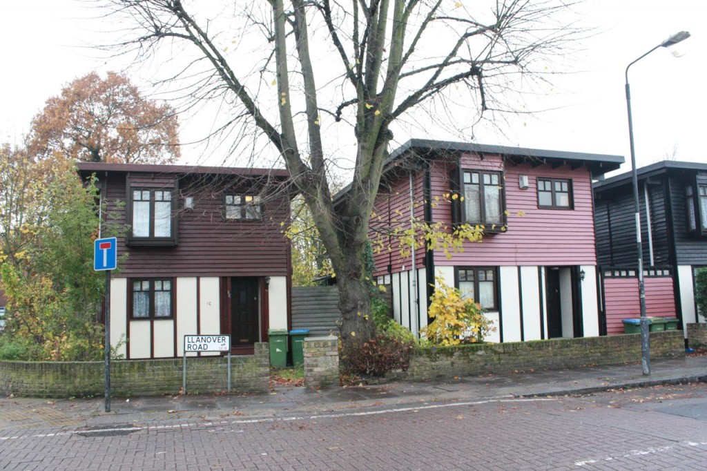
Segal Self-build houses in Llanover Road

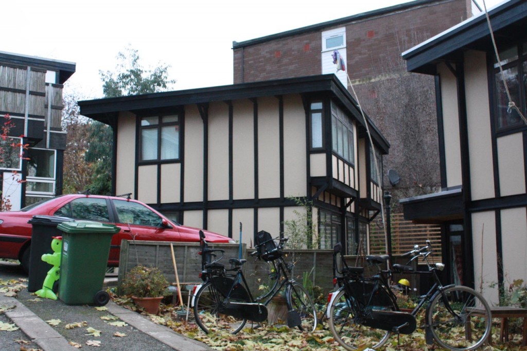
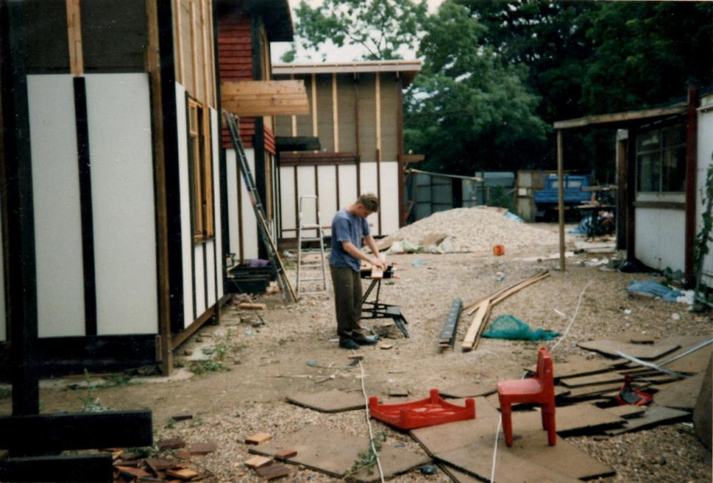
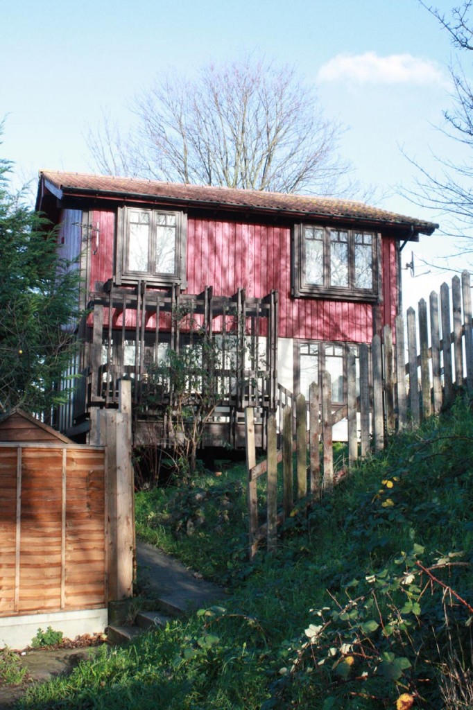
While walking along Herbert Road photographing buildings of local interest, I walked right past some of the most interesting – the group of 5 wooden-framed houses at the top of Llanover Road. These houses were built by the people who lived in them as part of a cooperative self-build group, following a design by the architect Walter Segal. Some of the builders still live there, and I was lucky to be able to talk to a couple of self-builders, Gordon and Dee, about how they did it. They generously lent me their album of photos recording the build – some of them are included below.

Walter Segal was a German-born architect who moved to London in 1936. In 1963 he pioneered his eponymous building method when he constructed  a “temporary” wood-framed building in a back garden in Highgate to house his extended family while their main home was being extended. That building is still standing today, the first of many constructed using the Segal method. Quite a few Segal houses have been built in south-east London, and those in Lewisham are particularly well known. The architect himself provided guidance and encouragement to the Lewisham builders. After he died in 1985 two of the roads where his houses stand were named after him:  Walters Way in Honor Oak and Segal Close near Blyth Hill. Two of the houses in Walters Way were open to the public in last year’s London Open House, whose brochure described them as:

Each house is unique, many extended and built using a method developed by Walter Segal, who led the project in the 1980s. Both houses have benefitted from extensions and renovations. Sustainable features include solar electric. water and space heating. Walter Segal 1987.

There’s more about the green and sustainable features on the Superhomes web site, and the Modern House web site has some great photographs and details of several South London Segal houses.

Segal House in Walters Way, Honor Oak
Walters Way, Honor Oak

Walter Segal’s method was designed to be simple, suitable for people with no previous building experience, and to avoid what he called the “tyranny of wet trades”; that is, there is no need for brick laying or plastering. The building plan is based on a set of timber frames, constructed from standard, readily available materials using basic carpentry skills, which sit on pad foundations. This means  that there is less need for levelling a site and disrupting existing trees and vegetation, and it allows houses to be erected on sloping sites which are problematic for traditional methods: Walters Way, for example,  is a steeply sloping site. The roof is attached after the frames have been erected, allowing the builders to work under cover on the rest of the building. Within the grid defined by the wooden frames builders can chose the layout of the rooms in the house and, as the walls are not load bearing, can even rearrange the internal lay-out after the build is complete.

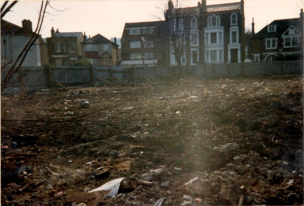
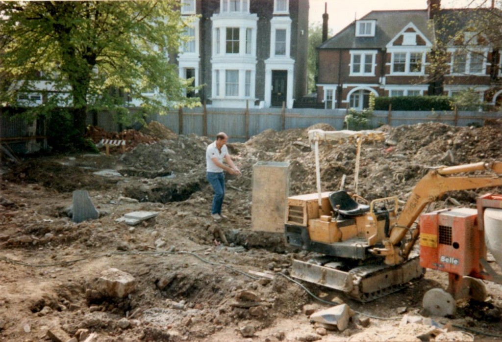
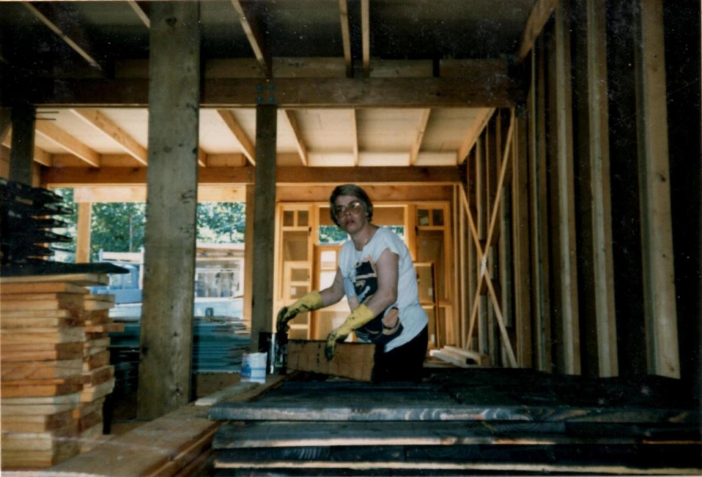
In the borough of Greenwich a number of Segal self build developments were overseen by Co-operative Housing in South-East London (CHISEL).  Gordon and Dee were part of the first of these:  the Greenwich Self Build co-operative project at Llanover Road, which officially started on 16th March 1993. The site had been occupied by a row of three Victorian houses, numbers 220 to 224 Herbert Road, according to the 1914 OS map, though they had been demolished and the site littered by fly-tipping by the time the project started. The first of Gordon and Dee’s photos below show the site as it was when they started. The fly-tipping and rubbish had been cleared away by the council – the only physical help the council contributed to the build! The self-builders had all been selected by the council, and were working on a  “Self Build For Rent” model.  They committed to putting in 20 hours a week each on the build. In return for their labour in building the houses they would be able to live in them on a reduced rent. Before starting they attended a training course, though it mainly seems to have covered how to use power tools safely.

The Llanover Road plot at the start of the project

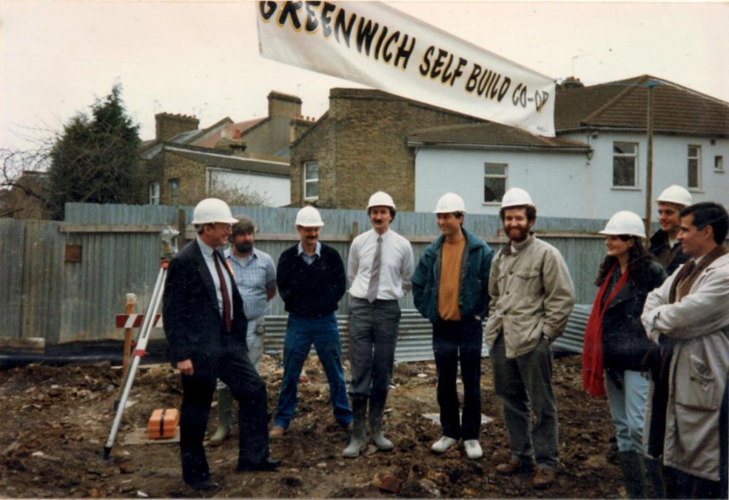
The official start was attended by local MP Nick Raynsford, seen on the left in the photo below. The architects were probably Architype, led by Jon Broome, who also worked on the other projects undertaken by the Greenwich Self Build co-operative at Parish Wharf near Woolwich Dockyard, and Birchdene and Silver Birch in Thamesmead.

Official opening with MP Nick Raynsford March 16th 1993

The first stage of the build was to dig the holes for the concrete bases for the pad foundations. The little digger in the photograph was the only “large” piece of machinery used in the whole build, and was passed on the next Greenwich project at Parish Wharf when the Llanover Road builders had finished with it.

Preparing the concrete base blocks

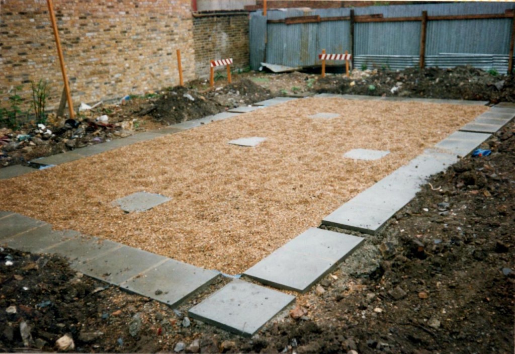
Unlike brick built houses, the foundations of Segal houses don’t run underneath the entire area of the house. Instead they have pad foundations – the upright posts of the wooden frames stand on a paving slab which is sitting on top of a point block of concrete, about 600 x 600 wide, the depth depending on local soil conditions. The ends of the wooden beams are sealed with a lead sheet which seals them very effectively against moisture. The weight of the house holds it in place. For the Llanover Road houses the flat felt roof is topped with some two and a half tons of gravel, so there is quite a weight to keep the house in place. The only connection to the ground is through services pipes and cables. In Gordon and Dee’s experience there has never been any problem with stability, even in the recent strong storms which damaged more traditionally built properties. They did say that the house sometimes sways a little though.

Base slabs in place
Base slabs in place

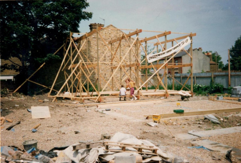
In the early parts of the work at Llanover Road all of the self builders worked together – preparing the foundation bases and constructing and erecting the frames and main structure. After that they tended to concentrate on their own properties. It was a lot of work, especially while holding down a job and bringing up a family

First frame up
First frame up
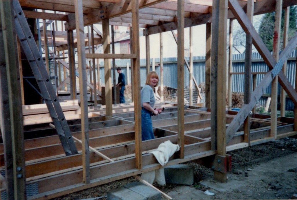
Developing the structure

The roof in the standard Segal design is flat, though with some critical differences to other flat roofs to avoid some of their problems. The waterproof membrane is not fixed down but laid loose on the roof deck, with a generous amount of overhang, like a table cloth. This allows the membrane to accommodate any movements in the building frame and to expand and contract with temperature, so it doesn’t crack or tear like fixed membranes. On top of the membrane is a 40mm layer of 20mm diameter shingle, which weighs it down and shields the membrane from direct sunlight. The Llanover Road houses had the standard Segal design flat roof, though the other Greenwich properties had pitched roofs. For the Llanover self builders the only way to get the shingle up on to the roof was to use a rope and pulley and a builders’ bucket. Shifting two and a half tons of shingle in this way was a significant undertaking!

Ready to add the roof gravel

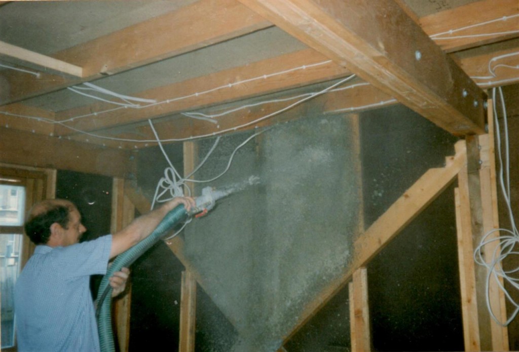
The internal timbers all had to have six coats of a special varnish. The walls and partitions were constructed with cavities, which were filled with insulation made from recycled copies of Yellow Pages using a blowing machine – one of the reasons the Segal homes are more energy efficient than other houses. The trickiest carpentry inside the house was needed to construct the stairs, especially the different shapes required for the treads when the stairs turned a corner.

Six coats of varnish/paint
Yellow pages for insulation
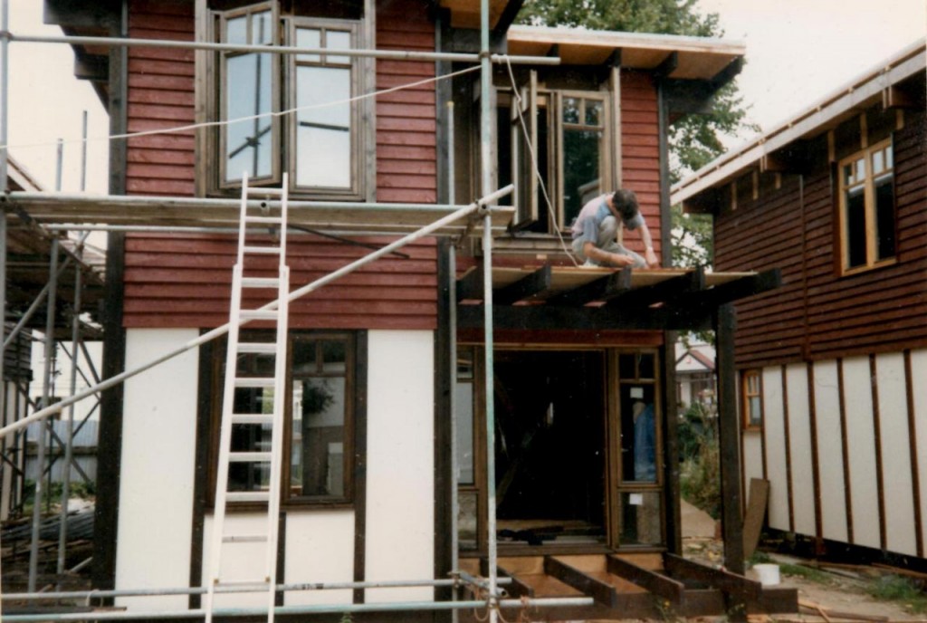
Windows and porches
Windows and porches

It took two years and nine months to complete the Llanover Road self build, and the material costs for a house were £13,500. The development was the first Segal housing project to be completed since the original ones in Lewisham. The opening ceremony was again attended by local MP Nick Raynsford, who was also the Labour Party Housing Spokesman. Inside, the completed Segal house feels surprisingly spacious. If the beams are left exposed it has an Elizabethan feel, though many self-builders paint the insides a uniform colour, making it feel like any other house.

The Greenwich Self Build co-operative went on to further Segal projects in Woolwich and Thamesmead, with the members of the original group maintaining their involvement for later developments. The Parish Wharf development is described in English Heritage’s Survey of London volume about Woolwich as follows:

Parish Wharf, off Woodhill, is of the same period, but it is something different. The self-build method espoused by Walter Segal was followed here in 1992–5 to produce eight free-standing four-bedroom houses. Using modular, dry-jointed and cheap post-and-beam timber frames, on stilts to avoid the cost of foundations, these chalet-like houses were built for themselves by members of Co-operative Housing in South-East London (CHISEL). Their architects were Architype, then led by Jon Broome, Segal’s leading disciple, with Bob Hayes as the job architect. The name, which seems puzzling here on the landward side of the railway, reprises that of a municipal depot that lay east of the former dockyard.

Segal house in Parish Wharf

As well as the Llanover Road, Parish Wharf, Birchdene and Silver Birch projects the Greenwich Self Build co-operative put in a proposal for a further Segal project in Abbey Wood, but it didn’t get the go-ahead. The co-operative was formally dissolved just a couple of years ago, in September 2011. Co-operative Housing in South-East London (CHISEL) is responsible for about 250 homes in south-east London, Colchester and Brighton, of which about a third are self-build, energy efficient Walter Segal properties that were constructed by the tenants who mostly still live in them.

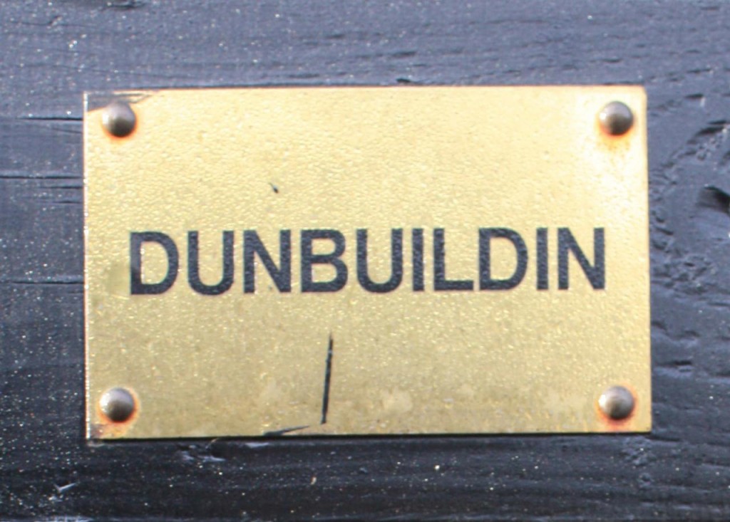
Gordon and Dee still live in the house they built themselves, 20 years ago. As the name they gave their house attests, they don’t have any burning desire to build another house.

Brass name plate on Gordon and Dee's self-built house
Brass name plate on Gordon and Dee’s self-built house

Pet Cemetery Clean-up on Sunday

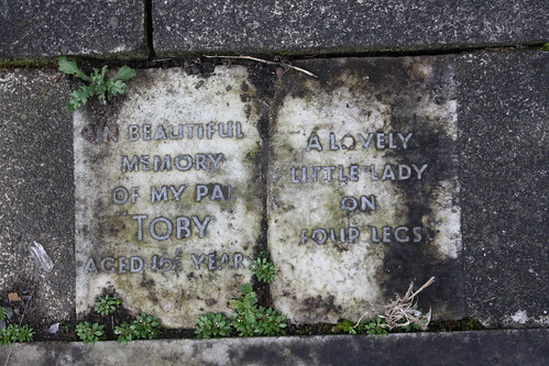
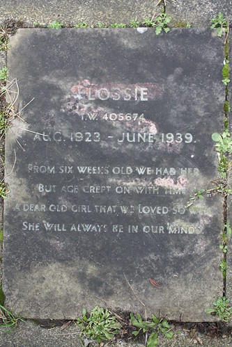
Headstone in the pet cemetery, Hornfair Park

The Friends of the Pet Cemetery in Hornfair Park have been awarded a grant from the Mayor of London’s Capital Clean-up campaign, and will be meeting on Sunday at 10.30am to celebrate and hold a short clean-up session.

Jean Patrick, the Friends’ Secretary, wrote with details:

We are pleased to tell you that the FOPC have recently been awarded a grant from the Capital Clean-Up Scheme.  This is an initiative from the Mayor of London’s office, and sponsored by McDonalds. We were successful because we demonstrated a long term commitment to the project.
To celebrate this, we are holding a short clean-up session on 24th November, 2013, from 10.30am.  This will provide you with an opportunity to see our progress so far and also, if so inclined, to help with our winter tidy up.  Please wear suitable clothing, and bring a pair of gardening gloves.
McDonald’s have requested a group photo to be taken on the day, so if you wish to be included in this photo, please ensure that you are at the cemetery by 11am.
Dogs are welcome, but please ensure that they are kept on a lead.
For those of you who have not visited the cemetery before, it is located on Shooters Hill Road, near the footbridge, and on the opposite side of the road to the Fox under the Hill pub/restaurant.
We look forward to seeing as many of you as possible.

There are some interesting memories of the pet cemetery on the Charlton Parks Reminiscence project, and information about the Blue Cross Kennels of which the pet cemetery was once part, with some old photographs, on the Thames Facing East blog.

Headstone in the pet cemetery, Hornfair Park

The Hollies

The Beeches, one of the boys houses at the Hollies

The handsome three storey Edwardian building, pictured above, set in a secluded parkland enclave in Sidcup has been converted to flats. They are prestigious homes according to the estate agent’s blurb, but not so long ago this building was home to 50 boys, some of the 570 children from Greenwich and Deptford who lived at what was, at different times, the Greenwich & Deptford Children’s Home, Sidcup Children’s Homes, Sidcup Residential School and Lamorbey Children’s Home but was usually referred to as The Hollies – a name it was officially given in 1950.

It was also where my Dad and three of his younger brothers grew up in the 1930s.

Dad’s birth certificate says he was born in 1926 at 48 Vanbrugh Hill, which was the address for The Greenwich Union Infirmary. The infirmary was later renamed St Alfege’s Hospital, was then replaced by Greenwich District Hospital which was completely demolished to make way for the new Greenwich Square. The Greenwich Union Infirmary often wasn’t mentioned by name on birth certificates because it was originally part of the Greenwich and Deptford Union Workhouse, and there was a stigma attached to the workhouses, though it later became a more general hospital.

The Hollies
The Hollies Mansion House

It was the Board of Guardians of the Greenwich Poor Law Union who acquired the 1854 mansion house called The Hollies and its 69 acre estate and commissioned local architect Thomas Dinwiddy to design the children’s home. Dinwiddy was the architect for other south-east  London public buildings such as Laurie Grove Swimming Baths and the John Roan Girls School. The Guardians’ aim, according to Bexley’s Conservation Area Appraisal,  was to set up a “model home for orphans”, though it was also to be a home for the destitute children for whom the Guardians were responsible.  As well as four three-storey blocks for boys to live in and thirteen pairs of cottages for girls, the development was designed to be self-contained and included a laundry, gymnasium, swimming pool, bakery, boot makers and infirmary, plus a working farm and the nearby Burnt Oak Lane School. The original manor house was retained as an administration block and for staff accommodation. The home opened on 30th October 1902.

Dad lived in Blackheath until 1932 when the family became homeless. They stayed with friends or slept in church halls or lived a hop-picking life in Kent  until the brothers were taken into the Hollies in 1933.

The Hollies Children's Home
The Hollies Children’s Home

The accommodation houses and cottages at the Hollies were all named after trees, and the boys blocks were called Beeches, Firs, Limes and Oaks. Dad and his next younger brother were in Oaks and the two youngest in Firs. Each boys’ house was staffed by a house father and mother, usually a married couple, two nurses and kitchen staff. The house father and mother for Oaks were called  “Dog” and “Frog” Shenton, and the superintendent was a Mr Harper who had a goatee beard and never smiled.

Life at the Hollies seems to have been strict. The boys wore grey suits and boots, and had numbered lockers for their boots and numbered places for their tooth brushes in the washroom. They were expected to do household chores, and they also worked on the farm and in the gardens. However they did get pocket money: 1d a week up to age 10 rising to a shilling a week at age 14. They would save some of this to spend on their annual holiday, the house father recording any savings  in a book. Dad also recalled  dressing up for a Christmas party at nearby Avery Hill College and going to Blackfen School.

I recently got a copy of Jad Adams and Gerry Coll’s excellent history of the Hollies from Bexley Local Studies Centre. It provides a lot of detail about the regime at the Hollies. They were almost self-sufficient. Most clothes were made on-site; there was a tailor’s shop and needlework room, and they had a jersey-making machine and a stocking machine. Their farm provided much of the food, such as milk, eggs and vegetables. The book also includes personal accounts of life in the Hollies from former residents. More personal stories about life at the Hollies can be found on The Hollies Children’s Home Reunion Group web sites.

Although some of the personal stories about life at the Hollies are unhappy, Dad never had a bad word to say about the home and seemed to have had a positive, happy experience.

The water tower and swimming baths

Dad left the Hollies in August 1943, aged 14, for a live-in job at the Bromley Court Hotel on 5s a week. The Battle of Britain was at its height, and he returned to the Hollies after the hotel was bombed. They found him another live-in job at Maples Furniture Store in Tottenham Court Road, and he also worked at the Naval and Military Club in Piccadilly. When he reached the age of 17 he volunteered for the army, 7 and 5,  and was trained in time to join the British Liberation Army in France and also served in Palestine, Hong-Kong, Germany  …  but that’s a different story. Overall, despite its difficult beginnings, Dad had a happy, good life.

Researching this story highlighted to me how lucky my generation have been compared to our parents’. Our lives haven’t been threatened and turned upside down by a world war, living in what Steven Pinker calls “the long peace”,  and we’ve benefited from the NHS, decent council housing and improvements in education that have allowed many of us to be the first generation of our families to go to university. It seems we’re now losing many of these benefits and also the social mobility that accompanied them.

The Hollies closed as a children’s home in the 1980s and most of the buildings have now been converted to housing, though the swimming pool and gym are now the Hollies Countryside Club. The estate has been designated a conservation area, described as “a good and well preserved example of a late Victorian workhouse environment”, with seven of the former children’s home buildings in the London Borough of Bexley’s local list of buildings of architectural or historic interest.

One of the cottages
One of the cottages

Mayplace Lane Get-together

Mayplace Lane near the bronze age barrow on Plum Lane

If you’re interested in helping to tidy and improve Mayplace Lane, or want to know more about proposals to prevent fly-tipping in the lane, then come along on Sunday (3rd November) at 11.00am to meet others with similar interests. Nicola sent a reminder on twitter about the get-together:

As well as clearing litter there are suggestions that lovers of the lane could also improve it by guerrilla gardening and encouraging nature,  for example by building woodpiles for hedgehogs and erecting nesting boxes. Perhaps a Neighbourhood Watch group could be set up. I’m sure these ideas will be discussed on Sunday, along with proposals to put lockable gates at each end of the lane to stop fly tipping trucks from dumping their loads of rubbish.

The gating suggestion was set out in a meeting at the Town Hall on the 19th September attended by Paul Stephen, the Community Safety Officer and Partnership Coordinator in Greenwich Council’s Safer Communities Team, Martin Ryan from CleanSweep, local councillor Danny Thorpe and a few local residents. There would need to be gates at the Plum Lane junction and just above Highview flats down near Dallin Road, and a “Friends of Mayplace Lane” group would need to be established to take responsibility for the lane after the gates had been installed. It was stated that because the lane is unadopted the council had no legal responsibility to clear fly-tipped rubbish, though they have been doing this up to now, and if gates were installed it was expected that the Friends would be responsible. Details of how the scheme would work, such as exactly what gates would be used and who would be given keys for the gates, were left for later clarification.

Before gates can be put up the council will need to get a “gating order”, for which they have to follow a process which includes a full consultation of affected people. To decide whether it was worth starting on this process an informal door-to-door poll was conducted one Saturday morning at houses in Eglinton Hill and Brinklow Crescent which back on to Mayplace Lane. The result, according to an e-mail from Councillor Danny Thorpe, was: “We have 39 responses in total, with 37 in favour and two against or not interested.” This was enough for the council to start on the gating order process. I haven’t heard yet how it’s progressing.

Snippet from1837 map in the Firepower Museum

I think Mayplace Lane is fascinating, and love the idea that perhaps it was once a route that Bronze Age people used to visit the land of their ancestors – the barrow cemetery that once adorned the top of Shooters Hill. I had read that it was an old track that predated the modern road layout, and found confirmation serendipitously at the Firepower museum‘s recent community open day. A map of Woolwich and environs from 1837 on the wall at Firepower includes an intriguing path from the top of Sandy Hill Road up to the summit of Shooters Hill. You can see it on the snippet above labelled “To Shewsbury House”. It starts just over the road from the Fox and Hounds; a pub of that name is still there today.

Why do I think that path is Mayplace Lane?  Well its northern end is in about the same place – continuing the line of Sandy Hill Road, roughly where Herbert Road is today. But also, in the 1866 OS map from Alan Godfrey shown in my earlier post about Mayplace Lane you can see that Mayplace Lane ends up close to the start of the old Shrewsbury House’s long drive way, which was roughly where the fire station is now. I’ve included the 1866 snippet again below, rotated through 180° so that South is at the top as in the 1837 map. Mayplace Lane winds up the centre of the map. Interesting that in the 29 years between the 1837 and 1866 maps some modern roads such as Eglinton Hill have been constructed – the start of the development of the Herbert Estate by British Land.

Snippet from 1866 OS Map rotated so South is at the top

Another thing that’s been puzzling me about Mayplace Lane, possibly related to gates, is the strange concrete blocks in the ground just past the Bronze Age barrow. You can see them in the photograph below – two rows of three square concrete objects a couple of yards apart. Each piece of concrete has a distinct, separate circle at its centre, as though there was a concrete post which has been cut off level with the ground. Does anyone know what they are or were? There’s nothing on the old OS maps to indicate that there was a gate or barrier at this location, and they look more 20th century than 19th. I wonder if they could be something to do with second world war defence preparations. There were other defensive structures nearby – for example Dragon’s teeth were set up in Eglinton Hill and Brinklow Crescent to impede movements of tanks and mechanised infantry. I’d love to know – but it’ll have to be another topic for my next visit to the Greenwich Heritage Centre.

Concrete structures near top of Mayplace Lane

Shooters Hill Local History Group – Prisoners of War and the Local Community

Shooters Hill Golf Course - site of a WWII PoW Camp
Shooters Hill Golf Course – site of a WWII PoW Camp

Steve e-mailed about the next Shooters Hill Local History Group meeting, which takes place on Thursday, 19th September, at Shrewsbury House starting at 8.00pm. There is a small charge to cover the cost of the room. It features a talk by local archaeologist Andy Brockman entitled “Enemies no Longer: POW Working Company 1020 and the community of Shooters Hill and Welling”.

Andy Brockman is a Conflict Archaeologist, whose previous Shooters Hill work includes the Digging Dad’s Army project and the Time Team Blitzkreig on Shooters Hill episode. He was also Lead Archaeologist on the recent Burma Spitfires Project and is project manager at the archaeology and environmental campaigning group Mortimer.

The Prisoner of War camp, according to David Lloyd Bathe’s “Steeped In History”, housed 400 German and Italian prisoners. It included barracks for the prisoners, a recreation room, kitchen, officers’ mess, infirmary and cobblers and tailors shop. The cookhouse was situated near the golf course’s 17th green. The prisoners’ activities included working in the warehouses at the North Woolwich docks and helping with the potato harvest at Woodlands Farm. Surprisingly they were allowed to move freely within a 5-mile radius of the camp during daylight hours.

Sounds like it should be an interesting evening.