New River Crossing Consultation

Gallions Reach from Barking Creek

Two thousand and twenty-eight pages in eighteen impenetrable documents have been published by Transport for London as part of their consultation on new river crossings in East London, and nowhere does it discuss the prospect of increased traffic in residential roads south of the river. A surprising omission since the poor road infrastructure south of the Thames  was one of the major issues in earlier consultations, and could be seen as the reason that the previous Thames Gateway Bridge scheme was cancelled.

Also, bizarrely, all the traffic modelling assumes that the Silvertown Tunnel is already in place! Why? Not only is it not in place, but its construction is not even part of the current consultation: there will be a separate consultation later about Silvertown. Even if the tunnel  is approved it will take longer to construct than a bridge or ferry at Gallions Reach so for several years we’ll be dealing with the impact on traffic in the absence of the tunnel, and that’s what the modelling should have shown.

This assumption that the Silvertown Tunnel has already been built pervades the Traffic Impact Report, to the extent that many of the traffic flow maps  don’t show how traffic will change compared to today, but how they will change compared to the flow after the Silvertown Tunnel has been developed. They are useless for anyone trying to work out how traffic flows will change in the future.

The consultation asks for our opinions about four possible river crossings:

1. A new modern ferry at Woolwich
2. A ferry service at Gallions Reach
3. A bridge at Gallions Reach
4. A bridge at Belvedere

We have until 18th September 2014 to respond, and can do so using an online survey. It can be completed quite quickly; there are just 15 simple questions.  Transport for London are holding some roadshows about the proposals where TfL say their staff will be able to answer any of our questions. There is one at Woolwich Library tomorrow (26th July) between 11.00am and 4.00pm and another at the Broadway Shopping centre, Bexleyheath on Saturday 30th August from 9.00am to 2.00pm.

Routing of trips using a charged Gallions Bridge from TfL's Traffic Impact Report
Routing of trips using a charged Gallions Bridge from TfL’s Traffic Impact Report

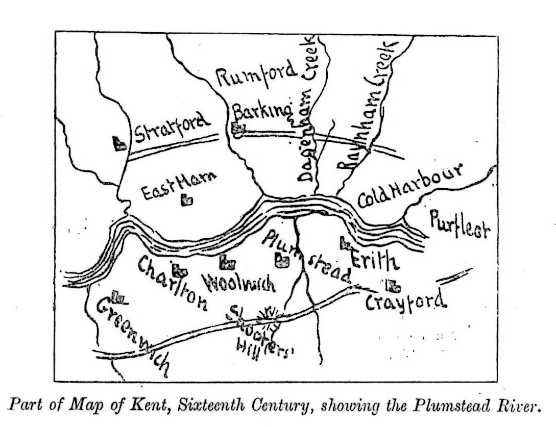
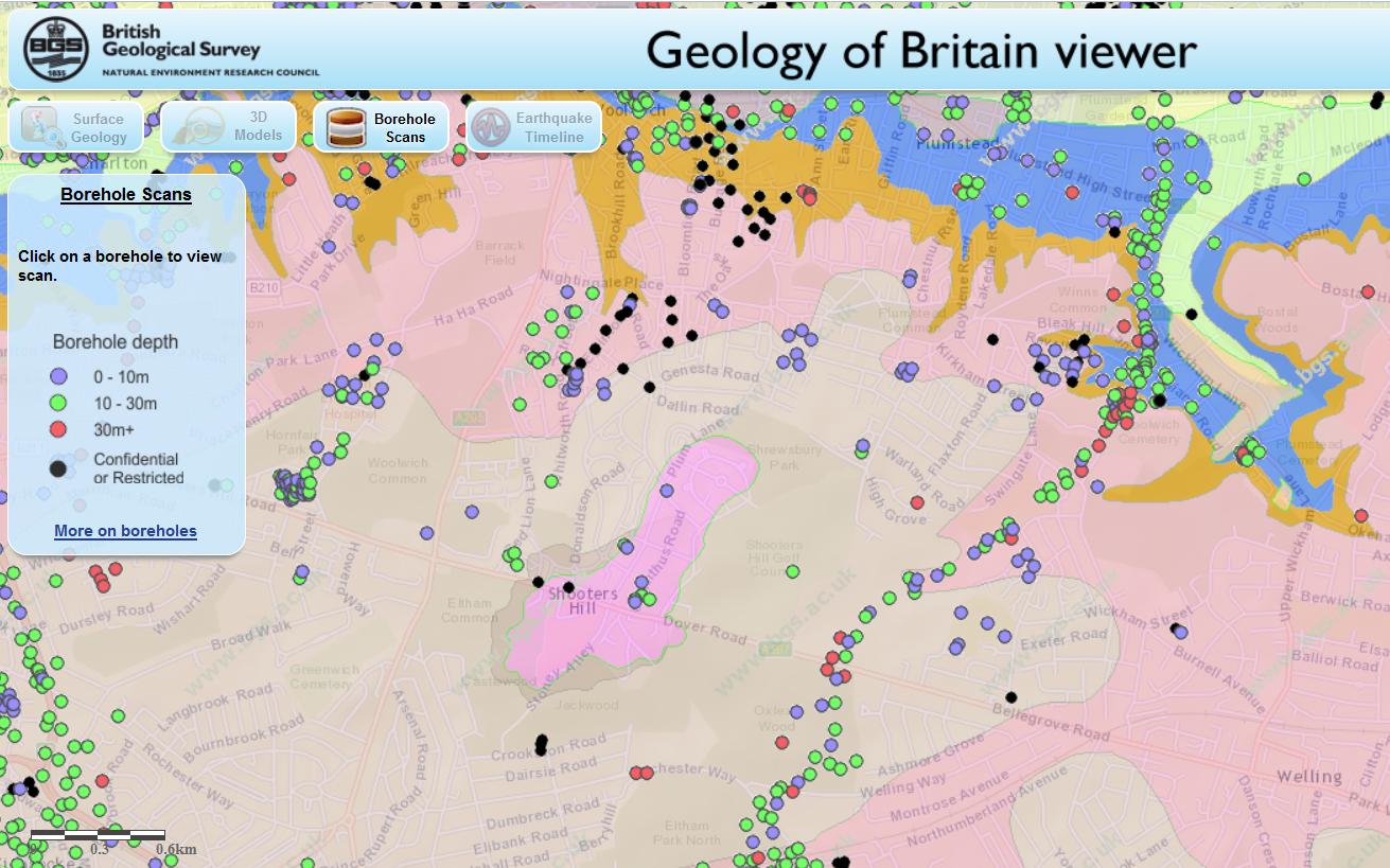
I must admit I haven’t read all 2028 pages of TfL’s technical documentation, though I did search them all for mentions of Shooters Hill, Oxleas and Plumstead: I found barely a handful that were relevant, and only one on traffic impacts. This was in a footnote to a summary table at the end of “Report F Gallions Reach Ferry and Tunnel”, which indicated that there may be critical traffic impacts on the South side:

Particularly increased traffic on tunnel approach roads in Thamesmead, Plumstead & East Wickham (on A2016, A206, A209 & A205). Highways works and traffic management will mitigate but not necessarily eliminate negative impacts

The traffic flow map above comes from the Traffic Impact Report. Compared to the map in the London Borough of Newham’s report on the Economic Impact of Gallions Reach Crossings it seems to show lower flows through residential roads in Plumstead and Bexley. This may be because it uses a different traffic modelling tool to that used by Newham. It uses a model called the London Regional Demand Model (LoRDM) which models highways using TfL’s River Crossings Highway Assignment Model (RXHAM); Newham used another TfL model called ELHAM. However TfL do add the caveat:

It should be noted that the RXHAM is strategic in nature and is used to identify broad changes in traffic patterns across the highway network, as well as the magnitude of this change. The results should not be taken as a definitive forecast of future flows, especially on minor roads or at individual junctions. Also the models do not yet assume any mitigation measures that might be introduced such as changes to junction capacities or new traffic calming measures.

The map shows some traffic increase through Plumstead and Knee Hill, but surprisingly nothing coming from the South Circular at Woolwich. I wonder where all the traffic that currently crosses the river on the Woolwich Free Ferry goes to? Later in the document in the section about the routing of trips using an enhanced Woolwich Ferry it states that “the main roads used to access the ferry south the River Thames are Beresford Street, Western Way and Eastern Way.” Again no South Circular. Is something missing from the model?

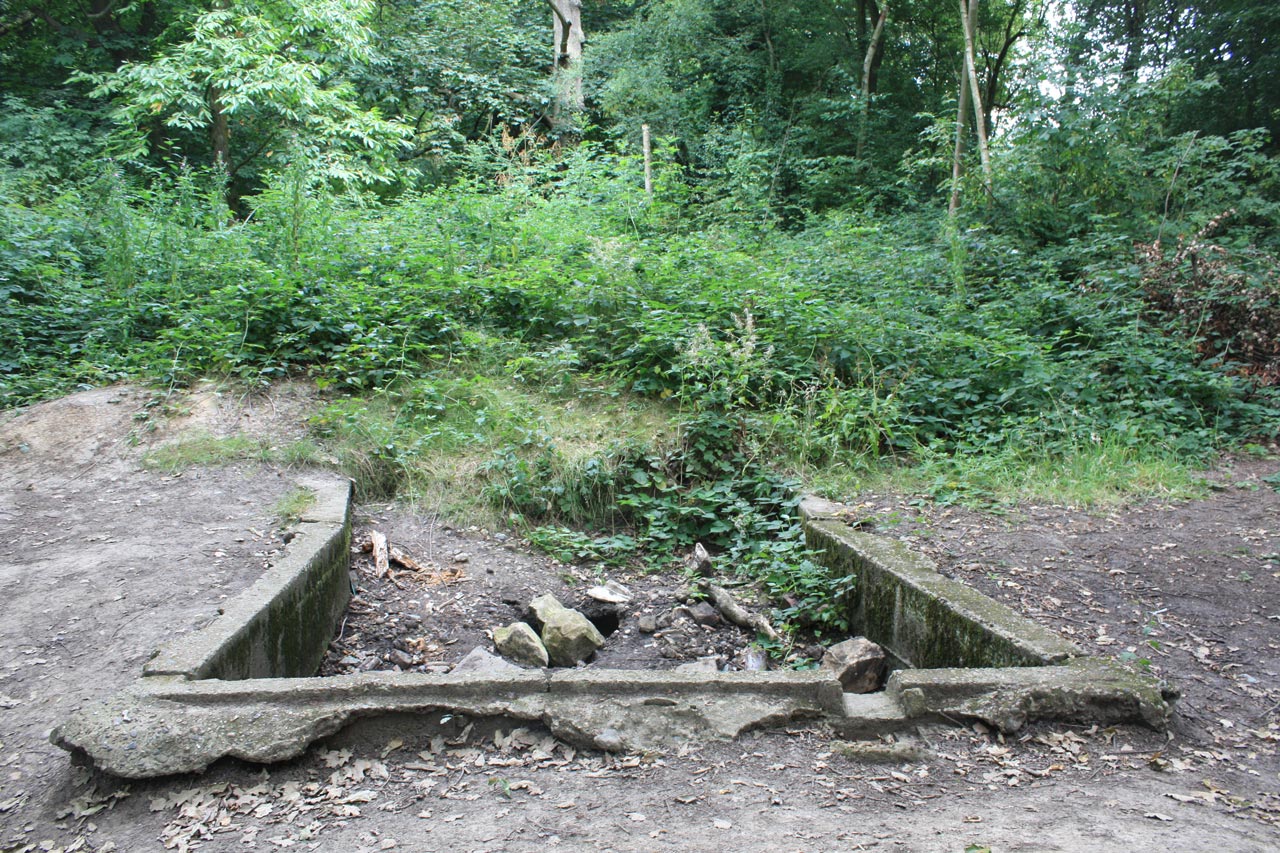
I wrote in a previous post about Oxleas Wood:

TfL’s work on the traffic impacts of a Gallions Reach crossing will not, in my opinion, be complete unless they include a convincing, costed proposal for solving the inadequacies of the transport network south of the Thames that politicians commit to. Otherwise the additional traffic generated by the new crossing will overload local residential roads leading to pressure for new roads and a renewed threat to our heritage ancient woodland.

It’s still not complete, and as it stands will lead to increased traffic through residential roads that weren’t designed to take it, leading to pressure for more road building and threatening Plumstead and Oxleas Wood.  Not to mention the end of the Woolwich Free Ferry. A campaign to oppose the Gallions Bridge is being set up.

Postscript:

I asked my questions at the roadshow in Woolwich on Saturday. As far as TfL is concerned the Silvertown Tunnel is going ahead so they felt it would be wrong to not include it in the traffic models, and they expect it to be complete before any of the other crossings. Of course if there were no Silvertown Tunnel, I was told, traffic flows over the other crossings would be significantly higher. They didn’t feel it was dishonest not to include the results of modelling without Silvertown. There will be two more consultations about the Silvertown Tunnel, but they would not be about whether it was built but how.

I expressed surprise at the results of the traffic modelling: in particular the predicted reduced traffic flows from the South Circular Road through Woolwich to a proposed Gallions Reach Bridge, and that the increased flows predicted seemed to show traffic would go along the M25 as far as the approach to the Dartford Crossing, and then turn off along the Thames to Gallions Rach to cross there. The only response was “that’s what the model shows”. There are no current plans for improved road infrastructure South of the Thames, and I was advised to express my concerns in the consultation.

HOK and Arup design for proposed Thames crossing bridge

Traffic Tunnels under Shooters Hill

Drawing from F.C. Elliston Erwood's Road Works at Shooters Hill, Kent
Drawing from F.C. Elliston Erwood’s Road Works at Shooters Hill, Kent

Traffic tunnels seem to be in vogue at the moment, whether it be the proposed Silvertown tunnel or the Mayor of London’s proposals to put stretches of the South Circular Road underground and to dig an Inner Ring Road tunnel round central London. This despite evidence from the 2011 census that car ownership in London is dropping, and research showing that building new roads generates more traffic.

Shooters Hill hasn’t been immune to tunnel planners’ dreams. An early proposal is included as an appendix to a slim 1947 monograph “Road Works at Shooters Hill, Kent, 1816”, by F.C Elliston-Erwood in the Greenwich Heritage Centre’s search room. Frank Elliston-Erwood, who lived on Shooters Hill, was a distinguished local historian. He was at different times president of the Greenwich and Lewisham Antiquarian Society and twice president of the Woolwich and District Antiquarian Society. He was a member of the WDAS for 70 years, first joining as a teenager and continuing until his death in 1968. One of his interests was the New Cross Turnpike Trust, and it was from their minute books that he extracted the information for his paper about road works on Shooters Hill.

The paper is mainly about how the New Cross Turnpike Trust tried to create employment in the economic depression which followed Wellington’s victory at Waterloo and the end of the Napoleonic Wars. It was “a period of commercial and industrial upheaval, coupled with misery, poverty and unemployment”. The Trust decided to allow £1000 out of their tolls at a rate of £50 per week to employ as many poor men as they could at a maximum wage of 10s (50p) a week in work such as the “the digging or quarrying of gravel or stones” and “the levelling or reducing of hills”. On Shooters Hill they moved gravel from the steeper parts and deposited it in hollows to smooth out the incline. The result can still be seen, for example on the western side of the hill on the road opposite Craigholm where the pavement rises above the road following the original slope of the hill. Similarly on the eastern slope there is an embankment on the Oxleas Wood side of the road.

The map and plan at the top concludes the paper. It shows a proposal for a road that bypasses the steep top of the hill, running parallel to Shooters Hill but on the Eltham side of Severndroog Castle. It was planned to run through a deep cutting and about 400 yards of lamp-lit tunnel. Needless to say the proposal was never implemented. The author of the plan clearly liked his pubs – the map includes the Bull, the Red Lion and the Fox and shows the bypass heading towards the Green Man in Blackheath. The Fox was the old Fox under the Hill, which subsequently was moved further down Shooters Hill Road.

A more recent proposal for a Shooters Hill tunnel was considered as one of the options for a new Thames Crossing which Transport for London consulted about last year. Option D6 in the Assessment of Options Report was for a Woolwich Tunnel joining the South Circular to the North Circular.  The proposal is complicated by the presence of other tunnels in the vicinity – the Woolwich Foot Tunnel and Cross Rail, not to mention the DLR, so it would have to be a deep tunnel underneath all the others. Also the steep slope up from Woolwich towards Shooters Hill makes it difficult to start a tunnel close to the river, leading to the proposal shown below with a tunnel entrance all the way up at Eltham Common. This means that the tunnel would be some five or six kilometres in length, the longest road tunnel in Britain.

Shooters Hill Tunnel section from TfL's Assessment of Options
Shooters Hill Tunnel section from TfL’s Assessment of Options
Shooters Hill Tunnel map from TfL's Assessment of Options
Shooters Hill Tunnel map from TfL’s Assessment of Options

The South Circular at Eltham Common where the entrance to the tunnel would be is shown below. Just imagine this green scene replaced by a huge, 4-lane tunnel portal, like the entrance to the Blackwall Tunnel. Fortunately the proposal was discounted. There were a number of factors leading to the decision not to take this option further. It was felt that Well Hall Road would become a bottleneck, limiting the tunnel’s capacity and reducing journey time improvements. It would be difficult to upgrade Well Hall Road because it is residential and has houses on both sides. Also it was “unlikely that the scheme could be built without negatively impacting on the housing lining the A205 through Eltham”.

The tunnel was felt to be too far away from the river to benefit residents closer to the Thames, for example in Woolwich, and would not connect to the major roads along the south side of the river, and so would not contribute to development along the river. Then there was the possible cost of up to 6km of bored tunnel, estimated at £1.5-2 billion. All things considered a Woolwich Tunnel doesn’t make sense.

South Circular at Eltham Common looking North

The TfL East London River Crossings: Assessment of Options document mentions, very briefly, another tunnel under part of  Shooters Hill. Section 6.234 on page 167, which discusses the proposal for a “local” bridge at Gallions Reach, says (my emboldening):

In the longer term, any fixed link provides the potential for the highway connections to be amended or improved over time, to best suit the prevailing traffic and regeneration needs of the area. For example, the connections to the strategic network could be improved in the long term, such as through the provision of a direct link to the North Circular together with a tunnel south to the A2. This could potentially address the local concerns about traffic on residential roads in Bexley by providing an effective by-pass, while delivering large journey time benefits to the wider area by providing a more easterly strategic orbital route. In time this could replace the Blackwall corridor as the main strategic route, and deliver benefits to regeneration in the Lower Lea Valley.

So once any Gallions Reach crossing is in place any changes in traffic level – the then prevailing traffic – could lead to the building of additional roads, such as one through Oxleas Wood, to create the major easterly strategic route.

Concern about increased traffic levels on residential roads south of the river as a result of a new river crossing at Gallions Reach were heightened by a report produced for the London Borough of Newham on the Economic Impact of Gallions Reach Crossings. It presents the results of traffic modelling of different options for a Gallions Reach crossing, generated using  Transport for London’s highway model of East London known as ELHAM. Amongst the results was a map showing northbound traffic flows in 2021 assuming a bridge was built at Gallions Reach. The snippet below shows the area south of the river.

Snippet from Figure 2.6 of Newham's Gallions Reach crossings study showing traffic flows northbound if a bridge is built
Snippet from Figure 2.6 of Newham’s Gallions Reach crossings study showing traffic flows northbound if a bridge is built

It’s a difficult map to read, and it took me some time to work out what it was saying. The green blocks represent high traffic flows, and the large block in the middle of the picture is the Gallions Bridge itself. Working southwards from the bridge, the high traffic flow roads seem to be: Western Way, down to the gyratory near Plumstead Station, then up residential Griffin Road, across Plumstead Common on Warwick Terrace and then along Swingate Road, Edison Lane, Wickham Street to meet Bellegrove Road: none of these roads is designed for large traffic flows. To the west there are also high flows  in Plum Lane, and to the east large flows down narrow Knee Hill. And, as usual, the modelling doesn’t cover what would happen if one of the other Thames crossings was blocked, which seems a common occurrence at the moment, and all the traffic heading down the A2 to the Blackwall Tunnel turned off to Gallions Reach.

There is no analysis of the impact and costs of a tunnel from Gallions Reach to the A2 in the Assessment of Options document. As can be seen on the snippet from cbrd.co.uk web site’s superb UK roads database below, if the tunnel went from Gallions Reach all the way to the A2 at Falconwood it would have to be longer than a 5-6km tunnel from Eltham Common under the Thames, and well over twice the length of the UK’s longest road tunnel the 3.2 km Queensway tunnel in Merseyside. If it were a bored tunnel it would cost more than the £1.5-2 billion estimated for a Woolwich tunnel. Should a cheaper construction option be chosen then people’s homes in Plumstead and ancient Oxleas Wood would be threatened yet again.

CBRD (Chris’s British Road Directory) Google Earth overlay for Ringway 2

If the “prevailing traffic” following development of a Gallions Reach bridge led to a revival of plans for a road to the A2, along the lines of Ringway 2, one of the consequences would be the massive road junction shown below – splat on top of Woodlands Farm. It has been suggested that a Transport for London document revealed by a recent freedom of information request shows that a road through Oxleas Wood is included in one of the traffic scenarios that TfL are modelling for the Mayor of London’s Roads Task Force.

Shooters Hill interchange on CBRD (Chris’s British Road Directory) Google Earth overlay for Ringway 2

The Infungibility of Trees

A path through Oxleas Wood

Last July was the 20th anniversary of People Against the River Crossing‘s victory in its campaign to save Oxleas Wood from a six lane motorway, yet it still seems that the woods are not safe. The statement by badger-bashing Environment Secretary Owen Paterson that “clearing ancient woodland for houses and roads could be allowed as long as developers promise to plant 100 new trees for each ancient one felled” exacerbated my insecurity because the “Disneyland absurdity” of trying to recreate an ancient woodland was one of the key arguments PARC used to defend Oxleas.

Fungible is one of my favourite words. It means interchangeable or freely exchangeable. For example a pound coin is fungible. If you lend someone a pound coin you would be happy to get any pound coin in return. People, obviously, are not fungible, though sometimes corporate bean-counting spreadsheet bashers behave as if they were.

Are trees fungible? I don’t think so. At a simple level a 500 year old Oak tree is clearly not equivalent to a new sapling, and when you take into account the land where the tree is growing, its ecology and history, it is even more clear. When one side of the equation is a  hazel or chestnut tree whose shape has developed through centuries of coppicing, that is part of an 8000 year old woodland and that stands in a historic landscape that provided the raw materials for the construction of the Royal Navy’s great wooden ships, there should be no dispute. And what about rare trees like the Wild Service Tree that are found in few places in the UK, that are difficult to grow from seeds, reproducing through suckers from existing trees,  and that are indicators of an ancient woodland ecology. Irreplaceable.

CBRD (Chris's British Road Directory) Google Earth overlay for Ringway 2
CBRD (Chris’s British Road Directory) Google Earth overlay for Ringway 2

This was the heart of the argument that the Oxleas Nine and PARC made to oppose the compulsory purchase orders for the roads to feed the East London River Crossing. The route through Oxleas Wood, Woodlands Farm and Plumstead was slightly to the east of Ringway 2,  shown on the snippet above taken from cbrd.co.uk web site’s superb UK roads database. The orders were for:

 A total of 101,713 square metres of land within the Eltham Park, Oxleas Wood and Falconwood Field area comprising:
(a) 9,223 square metres of land in Eltham Park, on both sides of the railway line between Eltham and Falconwood British Rail stations; the main part extending east from the swimming pool on the south side of the railway and a small piece lying opposite the swimming pool to the north of the railway (Plot 1);
(b) 29,777 square metres of land in Oxleas Wood, between Rochester Way in the north and the railway to the south; (Plot 2);
(c) 9,393 square metres of land at Falconwood Field east of the junction between Rochester Way and Welling Way (Plot 3); and
(d) 53,320 square metres of land in Oxleas Wood, extending in a wide strip northwards from Welling Way to Shooters Hill/Bellegrove Road (Plot 4),

As David Black explains in “The Campaign to Save Oxleas Wood”, because the order included “land forming part of a common, open space or fuel or field garden allotment” there had to be land given in exchange that was equal in area and “equally advantageous to the public”. However the land proposed to be given in exchange was part of Woodlands Farm, which already provided some amenity to the public, and it would be fenced off for ten years to allow trees to grow and even then would not have the ecosystem and history accumulated over thousands of years of the woodlands it was to be exchanged for. The objectors argued that this was not equally advantageous to the public.

The Environment Secretary seems to be saying that this is no longer a valid objection and that the only thing that matters is the number of trees planted.

This is important because there are still proposals to construct a river crossing – ferry, bridge or tunnel – at the same place as the East London River Crossing. The reports from previous consultations admit that the road network south of the Thames is inadequate to support such a crossing, but doesn’t suggest how this can be rectified, other than a throwaway suggestion of “a tunnel south to the A2”. This is not a convincing suggestion. Elsewhere the report dismisses the option of a tunnel replacing the South Circular to Woolwich in part because it would be “the longest road tunnel in the UK by some margin”; a tunnel under Plumstead and Oxleas to the A2 would be far longer. Also the proposal for a tunnel under Oxleas Wood as part of the East London River Crossing scheme was dismissed on cost grounds, unless it were a cut-and-cover tunnel, which would destroy the ancient woodland anyway.

The conclusion from the consultation about the replacement for the Woolwich Free Ferry  and the development of a new Silvertown Tunnel was that further work would be done and that for the Free Ferry options which include a new crossing at Gallions Reach a further consultation would be held at the end of last year. Presumably this has been delayed. TfL said:

In the coming months we will undertake further work to determine the traffic, environmental and regeneration impacts and benefits of the possible new river crossings, building on the initial assessments we have undertaken to date. We anticipate a further consultation later this year on options for replacing the Woolwich Ferry, including the options recently consulted on, allowing stakeholders and members of the public to consider the findings of our impact assessment work and enabling a decision to be taken on a way forward in the summer 2014.

TfL’s work on the traffic impacts of a Gallions Reach crossing will not, in my opinion, be complete unless they include a convincing, costed proposal for solving the inadequacies of the transport network south of the Thames that politicians commit to. Otherwise the additional traffic generated by the new crossing will overload local residential roads leading to pressure for new roads and a renewed threat to our heritage ancient woodland. It’ll be interesting to see whether TfL provide this as input to their promised new consultation.

Are trees in ancient woodlands fungible? If you don’t think so there is a petition on 38 Degrees asking Owen Paterson to Save Our Ancient Woodland and to “stop the proposal under ‘Biodiversity Offsetting’ to allow the destruction of our Ancient Woodlands for building.”

The pictures below show some of the flora of Oxleas Wood that we saw on Barry Gray’s Bluebell Walk last year. There are more photographs in a Flickr set, including Butchers Broom, Ladies Smock, Wood Sorrel, Wild Garlic and, of course, Bluebells.

Leaf of Wild Service Tree in Oxleas Wood
Stitchwort flowers in Oxleas Wood

The Lost River Wogebourne

Concrete tank in Oxleas Wood

…. but it should not be forgotten that its eastern slopes are primarily drained by a rivulet that emerges from Oxleas Wood, flows under the main road near the “We Anchor in Hope”, divides Plumstead Common from Bostall Hill and enters the Thames through the Plumstead Marshes. This rivulet is often alluded to as the Plumstead River, but researches made by the late W.H. Many, in 14th century manuscripts, have shown that its ancient name was the Wogebourne or Woghbourne. It is said to have originally been a tidal river.

Part of a map of Kent showing the Plumstead River from W.T. Vincent's Records of the Woolwich District
Part of a map of Kent showing the Plumstead River from W.T. Vincent’s Records of the Woolwich District

An aside in the first of Colonel Bagnold‘s articles about Shooters Hill set me off on a search for the course of the ancient river Wogebourne, from its Shooters Hill sources to its disappearance in Abbey Wood.

Where had the Wogebourne run? W.T. Vincent called it the Plumstead River, and also “An Obsolete River” which had disappeared. Its course is shown in the sixteenth century map from his Records of the Woolwich District, right. He said that it flowed “from the Halfway House, near Crossness Point up the Wickham Lane Valley, a short branch diverging eastward to the point where the abbey of Lessness stood (near Abbey Wood Station), and the other stretching past the eastern foot of Shooters Hill through Well-end (Welling) to Eltham.”  He also mentions that it was connected to the “Great Breache”.

Vincent’s map is interesting, but not very useful in finding where exactly the Wogebourne used to run. It took a trip to the Greenwich Heritage Centre to find a more detailed map in one of their drawers of fascinating old maps. It was a beautiful, coloured map of the 1920 edition of the Geological Survey of England and Wales. A scan of the relevant part is shown below. It doesn’t include much of Oxleas Wood, but shows branches of the river starting in Shooters Hill Golf Course and Woodlands Farm. It also shows the branch crossing Shooters Hill from Oxleas near the We Anchor in Hope pub. After flowing through the farm the river passes through Bourne Spring Wood south of Woolwich Cemetery and turns sharply to the North when it meets Bostall Hill, down the Wickham Lane valley.

Part of 1920 Geological Survey map showing course of River Wogebourne

Armed with my old OS Explorer Greenwich and Gravesend map, and some print outs from Nokia Maps showing water courses I headed out to see where the river flowed. Two streams are marked as flowing down the eastern hill of Oxleas Wood, though they are both dry ditches at the moment. The origin of one of them appears to be just up the hill from the concrete structure pictured at the top, which is shown as a “tank” in the grounds of the old Falconwood House on the 1914 OS map. Possibly a receptacle for spring water? The southernmost of the two branches in Shooters Hill Golf Course is pictured in my previous post about Shooters Hill Springs.

It’s quite easy to find where the Wogebourne crosses Shooters Hill, and it can be seen over the fence at the side of the petrol station. It runs as a proper stream though Woodlands Farm, albeit with very overgrown banks, and leaves the farm at Swingate Wood near the (locked) Keats/Dryden Road gate. From there a ditch runs along the edge of the Teviot Rangers JFC sports field, then behind some houses before disappearing under the Glenmore Arms pub.

Stream through Woodlands Farm

The river must run underground across East Wickham Open Space. My Explorer map shows a streak of blue behind the houses in Bournewood Road – built where Bourne Spring Wood used to be – but it was difficult to see a ditch behind the brambles. The point where it reappears on the east side of Wickham Lane is quite clear however, just a peer over a wall, and the water is flowing strongly along a stone lined channel at this point. That  distinctive right angled turn to the north shown on the map is still there, though you have to risk a  tree-root assisted scramble down a steep clay cliff in Bostall Wood, not too far from Turpin’s Cave, to see it.

River Wogebourne flowing behind Woodbrook Road

That view of the stream running along the edge of Bostall Woods is the last I saw of the old river, and I assume it continues underground into the drainage system for the Thames-side marshes. My Explorer map has more streaks of blue running between the back gardens of Bendmore Avenue and Woodhurst Road down to the railway line, but there is nothing to see there now. On the 1920 geological map the river disappears into Plumstead Marsh. Vincent said that it connected to the “Great Breache”, an incursion from the Thames near Crossness in 1531 which is shown in a map in ‘Piteous and Grievous sights’: The Thames Marshes at the Close of the Middle Ages by James A. Galloway. The Great Breach is now part of Crossness Nature Reserve.

It seems likely that the Wogebourne or Plumstead River is now referred to as the Wickham Valley Watercourse: that is my interpretation of the  “river from an upland area with its source in Oxleas Wood on Shooter’s Hill” mentioned in a document on the Wildpro web site listing London’s rivers and streams. The Wickham Valley Watercourse was taken into account by Cross Rail in their analysis of flood risks, which describes it as:

Wickham Valley Watercourse is a piped stormwater drain which crosses under the Crossrail route between Plumstead and Abbey Wood Stations from south to north. It runs parallel to the railway for several hundred metres before turning northwards towards its outfall in a lake, which feeds through one of the Marsh Dykes to Tripcock Pumping Station

It was also included in the long list of land and properties to be compulsorily purchased for the East Thames River Crossing in 1991.

It may seem strange, but I’m actually looking forward to some rainy weather so I can see some of the ditches and holes I’ve been peering into in action.

Shooters Hill Springs

Stream in Shooters Hill Golf Course

Poring and peering. I’ve been poring over old maps a lot recently, and peering over walls and fences and into ditches, trying to understand the relationship between the geology of Shooters Hill and the springs and streams that drain it. My investigation took me down to the Greenwich Heritage Centre, both for their beautiful old geological maps and to read what Colonel Bagnold, David Lloyd Bathe and W.T. Vincent had to say about Shooters Hill springs and geology. The Heritage Centre also has a box of old papers from the 1930s by local geologist Arthur L. Leach which discuss the details of the geology and report his observations.

Why did I start on this? I had noticed that some locations on the hill seemed to be always wet, and small streams sprung from them after rain. Streams that couldn’t be explained by the latest Thames Water leak. For example the woods just up the hill from Christ Church School is one streamy spot, and the steep, stony stretch of Mayplace Lane just above Highview flats another.  My curiosity was piqued.

The story of the springs of Shooters Hill goes back to the late 17th century and the area was famous for its mineral wells. Hasted records in his seminal 1797 work “The History and Topographical Survey of the County of Kent” that there was on Shooters Hill “a mineral spring, which is said constantly to overflow, and never to be frozen, in the severest winters.”  In Henry Drake’s 1866 revision this is interpreted as referring to springs in Red Lion Lane, and is expanded to say that the springs were discovered in about 1675 by John Guy and were called the “Purging Wells”. Bagnold reported that these springs were in the garden of 80 Red Lion Lane, and overflowed across the Lane and down to Nightingale Vale. It was visited by people wishing to take the waters up to the end of the nineteenth century. Diarist John Evelyn and Queen Anne were said to have used the Shooters Hill waters, and at one stage there was a grand plan to turn Shooters hill into a spa town.

The chemistry of the Shooters Hill waters was analysed by the Royal Military Academy’s James Marsh, showing that its main ingredient was Magnesium Sulphate, also known as Epsom Salts. These medicinal springs seem to have different geological origins to other springs on Shooters Hill.

W.T. Vincent's Geological Section of Shooters Hill and District
W.T. Vincent’s Geological Section of Shooters Hill and District

Shooters Hill can be thought of as comprising three geological strata. The bulk of the hill and lowest layer is London Clay. Next is a layer known as the Claygate Beds,  which itself is layers of sand and loams with thin bands of clay. On top there is a layer of gravel, known as Shooters Hill Gravel, which Wessex Archaeology describe as “well rounded flint gravel, sandy and clayey in part”. Bagnold describes it as “red, clayey gravel and sands.” It can sometimes be seen when ditches are dug, for example to put down services pipes and cables; there’s a good example at the moment in a fresh ditch by the side of the path leading to Severndroog Castle. The gravel layer is shaped a bit like an irregular doughnut sitting on top of the peak – at the very top of the hill it is very thin or even non-existent and it increases in thickness going down the hill as the Claygate Bed layer drops away more steeply. Leach shows the top surface of the London Clay sloping towards the West-South-West so the Claygate Beds and Shooters Hill Gravel are thicker in the direction of Eltham Common. The gravel is thought to cover an irregular area about a mile long by half a mile wide, as can be seen from the British Geological Survey map extract below.

(As an aside, it has been argued that the geological structure of Shooters Hill, specifically the faults shown in Vincent’s cross-section above, created London.)

The top two layers are porous, and in wet weather retain water, which cannot drain through the impermeable London Clay and so appears as springs at the edge of the upper layers where the clay becomes the surface. The spring above Christchurch school is explained by this mechanism: the BGS map shows that the Claygate Beds layer ends at exactly the point where the spring appears. Bagnold says that up until around the second half of the nineteenth century there was a dipping well at this location, and that it is believed this well was the main source of water for the Shooters Hill hamlet around the Red Lion pub until the Kent Waterworks laid on a water supply.

Other streams and water flows, where maps can be found that show them like Nokia Maps, seem to start from around the edge of the gravel/Claygate layers. For example the origin of ditches on Shooters Hill Golf Course, like the one in the photo at the top, and others in Oxleas Wood seems to lay on the boundary line.

Snippet from British Geological Survey Geology of Britain Viewer

The flow of water in Mayplace Lane is not so easily explained because the map shows that the Claygate Beds layer don’t extend that far and the western boundary of the Shooters Hill Gravel runs parallel to and quite close to Plum Lane. I’m not a trained geologist, but I wonder whether is this is accurate, for two reasons. Firstly the 1866 OS map shows that there was a gravel pit between Eglinton Hill and Mayplace Lane opposite the junction with Brent Road, so there was some gravel that far down the hill, though of course it may have been a pocket of gravel separate from the main layer.

Secondly, Alfred Leach wrote some “Further Notes on the Geology of Shooters Hill, Kent” about his observations of trenches being dug for sewers along Plum Lane from Genesta Road up to Mayplace Lane. Someone else who spent time peering into ditches! He noted that from Dallin Road upwards the trenches passed through sands and pebbles down to London Clay, apart from a few points where the gravel layer went deeper than the 8ft deep trench. That would seem to indicate that the Shooters Hill Gravel extends further north than the BGS map, though Leach thought that undisturbed gravel only extended as far as the midpoint between Furze Lodge and Dallin Road, after that it was gravel that had drifted down the slope. The southern end of Highview flats is on the same 95m contour line as the Plum Lane end of Dallin Road.

Borehole pipe on the proposed route of the East London River Crossing in the middle of Oxleas Wood
Borehole pipe in the middle of Oxleas Wood on the proposed route of the road to the East London River Crossing

It’s a pity the boreholes, shown on the BGS map, that have been used to gather geological evidence don’t cover the North-west of the hill as well as they cover the proposed route of the road to the East London River Crossing through Oxleas Woods and Plumstead.

Most of the streams and springs originating on Shooters Hill have now disappeared – diverted underground or into the drainage system. As long ago as 1890 W.T. Vincent in his Records of the Woolwich District was bemoaning the loss of streams, and mentioned a number of them. There was the Nightingale Brook which sprang from “the swampy waste behind the Royal Military Academy”, then trickled across Red Lion Lane before descending the “ravine of the once delightful Nightingale Vale”, along the eastern side of Brookhill Road down to the Woolwich Arsenal where “it filled a moat about a barbacan, and finally fell into the bosom of Father Thames.”  This stream marked the boundary between Woolwich and Plumstead. Another across Woolwich Common marked the boundary with Charlton.

Vincent also believed that Shooters Hill was the source of the River Quaggy, citing springs which rose behind the police station and crossed the Eltham Road under an arched bridge on its way to Kidbrooke. This sounds like the Lower Kid Brook described by the Kidbrooke Kite in his guide to the Kid Brooks. The Kid Brooks were tributaries to the Quaggy.

On the eastern side of the hill the Oxleas Woodland Management Plan says that Oxleas Wood and Sheperdleas Woods drain into the River Shuttle, which is a tributary to the River Cray, and Nokia Maps shows some streams heading in that direction via Rochester way and Falconwood Field. However I was intrigued by what Bagnold said about some other eastward heading streams. These fed into what Vincent calls “An Obsolete River” and the Plumstead River, and Bagnold asserts was once called the River Wogebourne or Woghbourne. I’ll talk more about my efforts to trace this lost river in my next blog post.

Wood Lodge

Wood Lodge where Algernon Blackwood was born

I recently got hold of a copy of Mike Ashley‘s fascinating in-depth biography of  Algernon Blackwood, Starlight Man The Extraordinary Life of Algernon Blackwood, which is now sitting on top of my bed-side Jenga pile of books to read.  It looks an interesting read: Blackwood led a very varied life. Wikipedia records that his career included “working as a milk farmer in Canada, operating a hotel, as a newspaper reporter in New York City, bartender, model, journalist for the New York Times, private secretary, businessman, and violin teacher”. He was also a prolific author of supernatural and ghost stories, a TV broadcaster and an occultist – a member of the Hermetic Order of the Golden Dawn.

My interest in  Blackwood is partly because he was born in Shooters Hill, in Wood Lodge – one of the grand houses on the hill which have since been demolished. The old OS maps of the area show that Wood Lodge was situated roughly where the Oxleas Cafe is now.  Starlight Man includes the photo above, the only one I’ve come across of Wood Lodge, and the following description of Blackwood’s first home:

Blackwood was born at Wood Lodge, Shooter’s Hill in north-west Kent, not far from the suburbs of London. Administratively it fell within the parish of Eltham, but it was closer to Blackheath. Wood Lodge was a significant property. Built shortly before 1800 it had been extended and developed until a surveyor’s report, in the early 1800s, called it ’a situation superior to any within this Manor’. It stood in over thirty acres of land with rights over a further twenty-three acres of adjoining woodland. Originally the house was called Nightingale Hall, and the song of the nightingale was still heard there many years later. Wildlife abounded in the adjacent woods. The house had at least three sitting rooms, seven bedrooms, two dressing rooms, a brew house and stabling for six horses, and this was before it was enlarged by another tenant in 1860. Arthur Blackwood and his growing family moved there in January 1868. The 1871 census reveals that they had eight servants and a governess.

Wood Lodge is no longer standing. The property reverted to the Crown in 1916 when it was used by the War Department as an antiaircraft unit. It remained unused for the next fifteen years, became dilapidated, and was pulled down in 1932.

It is just possible that Blackwood’s earliest memory dates from those days. In his radio talk ‘Minor Memories’ he recalled that when he was just old enough to ‘grip the lower bar of the nursery window’ he saw the face of God. His parents spoke much of God but he had no idea what he looked like. The vision turned out to be a balloon sailing over Kent from Crystal Palace but it remained an indelible memory.

Increased demands on Blackwood’s father, with a greater number of evening engagements, meant that he often returned home late, and Wood Lodge was not conveniently situated near the railway station. In June 1871 the family moved to the Manor House, Crayford. This was the home that remained fixed in Algernon’s memory. He lived there from the age of two till June 1880, when he was eleven. It was the home of his childhood, the home of the ‘Starlight Express’, and the house that appears in many of his stories.

The Starlight Express mentioned is not the Andrew Lloyd Webber musical, but a 1915 children’s play by Violet Pearn  with songs and incidental music written by Sir Edward Elgar which was based on based on Blackwood’s novel A Prisoner in Fairyland.

Oxleas Cafe, where Wood Lodge once was

Wood Lodge was mentioned by Charles Booth, the Victorian philanthropist and social researcher known for his poverty maps of London, in volume B371 of his notebooks recording his perambulations around London streets. Digitized copies of these notebooks are available through the Charles Booth Online Archive, and  Volume B371 covers Districts 46 and 48 – Greenwich, Charlton, Kidbrooke and Woolwich. On page 209 he writes:

Bicycle ride through the streets of Woolwich between 10pm and 12.30pm and a visit to the Woolwich Music Hall while staying with H.F. Donaldson at Wood Lodge Shooters Hill,

Page 209 also gives Booth’s description of Saturday night in the Market Place, Woolwich. Later pages have descriptions of people’s clothes, prices at the market (fair sirloin 6d a pound, meat (not joints but not scraps) 3d a pound), Woolwich streets such as the Dust Hole  and the Music Hall in Beresford Street. It would be only too easy to waste a lot of time browsing through these notebooks deciphering Booth’s descriptions of local streets and the social status of their inhabitants in May 1900.

Charles Booth was staying at Wood Lodge with Sir Hay Frederick Donaldson KCB, who at that time was Chief Mechanical Engineer at the Royal Ordnance Factories, Woolwich – the Royal Arsenal. I believe nearby Donaldson Road was named after Sir Frederick, who went on to become Chief Superintendent of the Royal Arsenal and was praised by Lloyd George for his “skilled, prudent, tactful, and resourceful administration”. He stepped down from his Chief Superintendent position when he was appointed Chief Technical Adviser to the Ministry of Munitions in September 1915

Sir Frederick was one of the advisers selected to go with Lord Kitchener, Secretary of State for War, on a mission to Russia which ended in disaster. The  firstworldwar.com web site gives the details:

On the afternoon of 5th June 1916 HMS Hampshire set sail for Archangel, Russia with Field Marshal Earl Kitchener aboard.

He was bound for Petrograd at the invitation of Tsar Nicholas of Russia who wanted talks with the War Minister about the war on the eastern front.  Three hours into the voyage, the cruiser struck a mine off Marwick Head, Orkney and sank almost immediately.  Kitchener and his Staff perished, along with the officers and nearly all the men of the ship.  Just 12 survivors from a crew of 655 managed to find their way ashore.

A tragic end for Donaldson, who was praised in his obituary in Nature as “an engineer of distinction” who “was associated with, and largely responsible for, the great improvements in the power and mechanism of naval and land artillery”.

Donaldson Road
Donaldson Road

Oxleas Missile Deployment Confirmed

Rapier Missile Battery on Oxleas Meadows

The Ministry of Defence has decided that a Ground Based Air Defence (GBAD) System will be deployed in Oxleas Meadows, on Blackheath and 4 other sites across East London during this summer’s Olympics. The MoD announcement said that the Rapier missiles will be in put place in the middle of July.

The announcement was made despite opposition from people living near the missile sites, including a protest march from Oxleas Wood to Blackheath and the ongoing legal action by the residents of Fred Wigg Tower in Leytonstone. This is due to be heard next Monday, July 9th, at the Royal Courts of Justice.

It seems that even the power of the Corky Fruited Water Dropwort was not enough to stop the missiles.

Corky Fruited Water Dropwort

wikipedia commons image of the Corky Fruited Water Dropwort

The Corky Fruited Water Dropwort (Oenanthe pimpinelloides) has been getting a lot of press in the last couple of days. It would appear to be the only barrier preventing deployment of a Rapier Missile Battery near the cafe in Oxleas Woods. The plant mainly grows in the west country, Devon, Somerset, Dorset and Hampshire but also in a few places around London. My New Atlas of the British and Irish Flora says it is a “tuberous perennial herb, found in hay meadows and pastures, especially those which are horse-grazed, and on roadsides. It grows in both damp and dry grassland.”  It sounds like  like an innocuous plant to have the power to deter missile batteries. The Devon Wildlife Trust describes it as follows:

Grows up to about 100 mm tall. The stem is solid, ridged and un-spotted, and it has a swollen corky base (hence the English name). The lower leaves are 2-pinnate in spring, but wither by the time of flowering. The upper leaves are 3-pronged and lanceolate, persisting into flowering. The roots terminate in rounded tubers.

Flowering takes place from June to August. The flowers are in umbels (2 to 5 cm across), on stout rays (1 to 2 cm across), which are flat-topped when in fruit. The flowers are white or pink, 2 mm across, with the outer petals unequal. Bracts and bracteoles are present. The fruits are cylindrical, ribbed, and thickened at the top with 2 erect styles.

Oxleas Cafe - Proposed Site of a Rapier Missile Battery

I first heard of the proposal to site missile batteries in the woods and on Blackheath through the Blackheath Bugle blog. It sounded so bonkers that I had to quickly check that it wasn’t 1st April – could anyone really be thinking of  shooting down a couple of hundred tons of passenger aircraft over London? Surely they would have closed the airspace around London and stopped flights at London City Airport well before they got to that? But it does seem to be under consideration and has been reported in the Mail Online, the BBC News and News Shopper.

Local MP Clive Efford is objecting to the plans because there is a risk of damaging the ancient Oxleas woodland, which is a Site of Special Scientific Interest. As the Mail Online said

Mr Efford said five troop carriers had driven into the woods last Thursday, with the rockets pulled behind them on a trailer, to carry out a military exercise.

He said: ‘The missiles have a range of only ten miles so any plane they target would come down over a densely populated part of the capital. It seems to me they can be used only as an absolutely last line of defence.’

Mr Efford added that as the Rapiers were set to be placed by the Oxleas Wood cafe, ‘at least the missile operators would eat well’. Olympic security planners fear that terrorists could mount a repeat of the 9/11 attacks by flying a hijacked civilian plane into packed Olympic venues.

I’ll be keeping an eye out for any Corky Fruited Water Dropwort next time I’m walking in Oxleas Woods. Oh, and any Rapier Missile Batteries.

Clive Efford (centre) and friends giving a Valentines Day card to the Queen Elizabeth Hospital


Snowy Shooters Hill

Sledging down Oxleas Meadows

Oxleas Meadow is the place to go when it snows. It’s the perfect place for sledging – long, broad slopes with a choice of steepnesses to suit all ages and abilities. And all ages and abilities were out there today showing off their skills.

Oxleas meadow and cafe in the snow

There was an incredible variety of sledges; old fashioned sit-up wooden-slatted toboggans, snow boards, surf boards, a bin liner, bright pink and green plastic sledges,  snowmobile style sledges, round ones looking like dustbin lids and one that I’m sure was a dustbin lid. Chaos reigned, bodies falling and rolling everywhere as sleds overturned, ran into each other and skittled other sledders. The whole scene overseen by the usual large crowd of dogs out for a walk, though on this occasion many were dressed for the weather, and a motley assortment of snow men. One enterprising group of sledders had even created a ski jump out of a park bench and a large pile of snow and were using it to launch themselves into ignominious heaps of snow and sledders.

Not far away in Shrewsbury Park a younger set of sledders enjoyed the gentler, less crowded but equally sled-able nursery slopes.

Elsewhere on the hill the snow had waved its transformative magic wand, turning the world bright and beautiful, hiding flaws and smothering imperfections. The woodlands were serene and pristine. Colours were accentuated  in the otherwise monochrome landscape; vivid red holly berries and pillar box, the previously unnoticed blue beams in a house on Shrewsbury Lane, and colourful clothing glimpsed through the woods.

Oxleas Woods snow scene
Shooters Hill water tower in the snow
Snowman in Eaglesfield Park

What an eventful weekend!


PS All the photographs are on flickr here.

Ghosts of Shooters Hill

The Midnight Hearse and More Ghosts
Elliott O'Donnell's book The Midnight Hearse and More Ghosts which contains the story of the Vanished Suitor of Shooters Hill

Elliott O’Donnell, one of the most famous ghost hunters of his day, wrote a very detailed and dramatic true account of a ghost in Shooters Hill in his story “The Vanished Suitor of Shooter’s Hill”.  This took place in Veremont House, Shooters Hill on January 3rd 1911.

Like all good ghost stories, after examining the haunted house with his pet fox-terrier, he decides to lock himself in ….

“Then I locked the front door, bolted all the windows, brewed myself some coffee over a spirit-kettle, gave the dog some milk and biscuit, and meditated where I had better sit for my vigil.”

And then, shortly after 12 o’clock had struck ….

“The scratching of an insect made my heart stand still; my sight and hearing were painfully acute. Presently a familiar sickly sensation gradually crept over me, the throbbing of my heart increased and the most desperate terror laid hold of me. The dog uttered a low, savage snarl. The house was no longer empty. Something was on the landing overhead, preparing, so my senses told me, to descend.

I could not stir, nor close my eyes—I could only sit there staring at the staircase, praying that the horror would soon emerge and that my ordeal would quickly be over. Down, down, down it came, until at last I could see it — a white, evil face surmounted by a mass of black hair. The eyes were the most alarming feature — large, dark, very lurid, very sinister—and they were fixed on mine with a mocking leer.”

The ghost turned out to be Bertha Rungate, who led Elliott to an old well where she had disposed of the body of Philip Rungate who she murdered after finding he was planning to elope with her governess. No-one knows where Veremont House was, or if it is still standing on Shooters Hill today  under another name.

Other supernatural manifestations in Shooters Hill include the white lady of Shooters Hill reputed to haunt the junction of Shooters Hill Road and Well Hall Road on 24th July each year, and the  ghostly footsteps which are said to haunt the Bull pub.

The Royal Herbert Hospital has hosted a number of ghostly occurrences, including spectral victorian nurses, a tolling death bell foreshadowing deaths on Ward  G4 and more ghostly footsteps…

“At about 3 am, as I was quietly reassuring a young soldier recovering from a collapsed lung, we both heard soft footsteps approaching the ward. I promised him a cup of tea once the visit from the expected Captain was over, and left his bedside to greet her.
As I reached the ward door, I saw that it was closed, but the measured tread seemed to pass me and continue into the ward itself. I`d love to claim that I bravely followed, but I stood rooted with terror to the spot. The spell was broken by the young soldier’s strangled yelp, and I ran to his bedside (disobeying, of course, every rule about running, except in Fire or Haemorrhage!) The unfortunate young man, gasping for breath told me that “The Sister” had come to his bed, but was “now vanishing”…His distress was acute, and I feared for his condition. The noise awoke the patient in the next bed, who put his light on, and my young soldier was able to draw long, if rasping breaths.”

Even after the hospital was converted into flats and became the Royal Herbert Pavilions there has been a sighting of a ghostly nurse.

Algernon Blackwood, spiritualist, short story writer and novelist, one of the most prolific writers of ghost stories in the history of the genre
Algernon Blackwood, supernatural story writer born in Shooters Hill

No post about the supernatural in Shooters Hill would be complete without mentioning Algernon Blackwood. He was born at Wood Lodge, a large house which used to be sited at the top of Oxleas Meadows, near where the Oxleas café is currently located.

Blackwood wrote over forty books including atmospheric gothic fiction, tales of the supernatural and stories about a psychic detective, Dr John Silence.  H.P. Lovecraft wrote about Blackwood “He is the one absolute and unquestioned master of weird atmosphere” and Everett F. Bleiler called him “the foremost British supernaturalist of the twentieth century.”

He led an erratic and interesting life, and at different times was a farmer, a journalist and a British spy in the First World War. He also met the mystics Ouspensky and Gurdjieff.

He later appeared on Britain’s first television show, Picture Page, in 1936, and in the late 1940’s broadcast a regular Saturday Night Story programme on television in which he read a series of his supernatural tales, making  him a household name. He was awarde a CBE in 1949.

So look out for spectral nurses, supernatural footsteps and ghostly white evil faces with large, dark, very lurid eyes if you are out trick-or-treating this Halloween.

And hope that  you don’t hear the ghostly tolling of the death bell!