Mayplace Lane

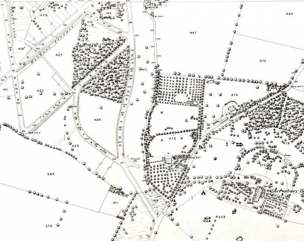
Snippet from 1866  OS Map
Snippet from 1866 OS Map

Mayplace Lane may at first sight seem like a typical back alleyway running to the garages behind houses in Eglinton Hill, but it’s much more than that. As you can see in the snippet from Alan Godfrey‘s 1866 OS Map of Shooters Hill it was there before the houses in Eglinton Hill were built, winding down behind Tower House parallelling Eglinton Hill. The Lane is thought to be part of a track that went all the way down to the Woolwich Marshes, following the line of Sandy Hill Road. According to the Survey of London Volume 48 on Woolwich, Sandy Hill Road itself “was laid out along the line of a footpath that rose diagonally through what had been called Hilly Field”. So it seems that before the roads we now know were laid out Mayplace Lane ran from the Bronze Age barrow in Plum Lane all the way to the marshes that once bordered the Thames.
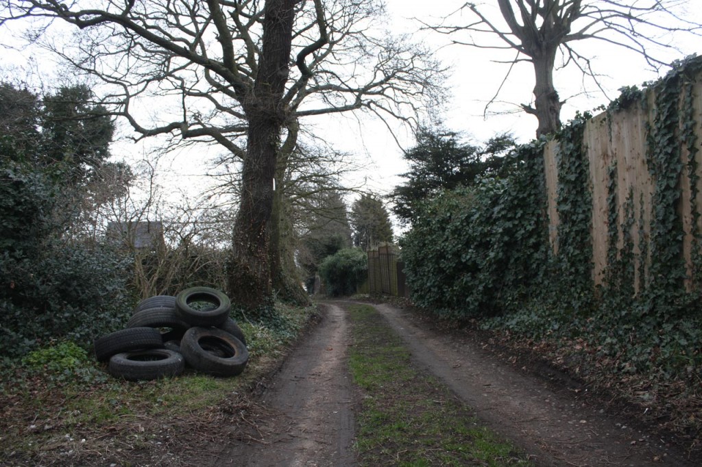
Mayplace Lane with Fly-tipped Tyres

Mayplace Lane is also, in places, a pretty and secluded path, providing a pleasant alternative route down the hill towards Woolwich, though it is a bit uneven in places especially around High View flats where it shares the hill with a permanent water flow of what appears to be spring. Well it would be pretty if it weren’t for the persistent fly tipping which has blighted the lane for years. This isn’t just the usual dumped mattresses, but lorry-loads of old tyres, building remains and, at the moment what looks like corrugated asbestos roofing sheets.,

In the past the Royal Borough of Greenwich Clean Sweep team have removed fly-tipped rubbish, though they maintain that they don’t have to because Mayplace Lane is an unadopted road. Frustratingly the current piles of rubbish have been there for some time and consequently are being scattered over a wider area.  A twitter exchange about the rubbish last week has led to e-mails being sent to our local councillors, MP Clive Efford and London Assembly Member Darren Johnson to try to get some action.

One suggestion, which I thought was a good idea,  from  @Twinsclubplus was that we should have a “Friends of Mayplace Lane”, which I guess would be a bit like the “Friends”  groups that look after local parks. It could keep an eye out for fly-tippers, make sure any tipping was reported promptly, perhaps help clear up the Lane and lobby towards getting a more permanent solution to the problem such as a lockable gate up at the Plum Lane end.

Please let me know if you’re interested in being involved with a “Friends of Mayplace Lane” group on the usual e-mail hilly@e-shootershill.co.uk.

Of course fly tipping is not confined to Mayplace Lane: it’s a borough-wide problem which has been going on for years. In the past the local neighbourhood watch and the 853 blog have both explained what to do about it, but here’s a reminder.

  • Make a note of as much information about the fly-tipped waste as possible, in particular:
    • Where it is, with the post code if you know it
    • How much waste there is, from a single item up to multiple lorry loads
    • What type of waste it is, for example demolition waste, tyres, asbestos …
    • The type of land it is on, such as a public highway, back alley, private land …
  • If possible make a note of any information about the fly-tipping incident:
    • Date and time.
    • Nearest road junction
    • Identification of who did it such as a description, car registration number etc
  • Report it either by:
    • Phone 020 8921 4661 during office hours (Monday to Friday 8am to 8pm, Saturday and Sunday 8am to 1pm)
    • Phone 020 8854 8888 emergency out of hours
    • Fill in the Royal Borough of Greenwich on-line form

In response the council say:

We will remove all small flytips (equivalent to a small van load) within 24 hours and, if possible, take action against those responsible.

Large flytips, classified as anything larger than a small van load, will be dealt with by contractors within four working days on a priority basis.

Any items that have been fly tipped at the side of the road will be collected and separated for recycling. Our teams will endeavour to stop and collect any fly tips they find, unless it would prevent them from completing their scheduled or booked work in which case they will report it so a dedicated team will remove the fly tip.

Another way of reporting fly tipping, and other problems, is to use the FixMyStreet web site, which will then forward the report to the council. This can be done either by entering a post code or interactively using their map. It allows you to attach photographs of the problem too. On FixMyStreet you can easily see all the problems reported in your area, as shown in the screen grab below.
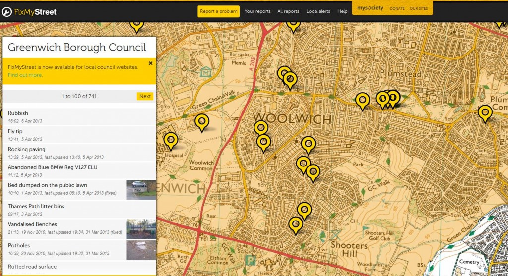
Snippet from FixMyStreet web site

I wonder how long Mayplace Lane has been there? It’s intriguing that it runs from the Plum Lane Bronze Age Barrow, one of what was once a  barrow cemetery of 6 barrows,  down to the Woolwich Marshes. Recent archaeological finds at the Plumstead Crossrail site have suggested that Bronze Age people may have built wooden causeways across the Plumstead Marshes similar to those that spanned the marshlands of the Somerset levels. Bronze Age remains have also been found just over the river in North Woolwich. During the Bronze Age it is believed that people distinguished between the land that they lived in and farmed – the land of the living-  and the land of the ancestors where their burials took place. Could Mayplace Lane have been their route from their villages around the Woolwich and Plumstead marshes up to the sacred Shooters Hill summit, the land of their ancestors?

Planning: Severndroog, All Saints and the Eagle

Severndroog Castle on Open House day

I notice the Royal Borough of Greenwich has re-vamped the planning applications search facility, which may explain why my regular PlanningFinder e-mails have been a bit brief recently, and why links to planning documents in old e-shootershill posts no longer work. A quick browse through recent applications in the Shooters Hill ward revealed some interesting applications.

Severndroog Castle Building Preservation Trust have applications for planning  and listed building consent for their long-awaited programme of repairs and alterations to the castle which are part funded by the Heritage Lottery Fund. The summary for applications 13/0228/F and 13/0229/L on the planning page is:

Repairs and alterations including new external steps and landing, new 2 metre high perimeter security fence and gates, infilling of two external door openings, new sliding glazed doors to main entrance, new kitchen and toilet facilities, replacement of lead roofing and timber viewing platform, new electricity supply cubicle. Installation of new and replacement mechanical, electrical and telephone services in connection with the above.

I believe the work is as described in their 2010 applications 10/0346/F and 10/0136/L. There will be a café on the ground floor, a space for functions on the first floor and an education space on the second floor. There will also be access to the viewing platform at the top, which has great views over London (and a video feed for those unable to climb to the top). The documents submitted with planning applications are often a great source  of historical information. In this case the 10/0346/F Conservation Management Plan provides an excellent summary of the history of Severndroog Castle, complete with maps and copies of paintings, engravings and photographs of the castle from the early 19th century onwards.

I’m looking forward to the re-opening of the castle and another chance to enjoy the view over the city from a platform that is 46 feet above the cross on St Paul’s Cathedral.

The Eagle
The Eagle

Further down the hill in Red Lion Lane it is proposed in application 13/0186/F to convert the former Eagle Tavern into 5 flats:

Conversion of existing Public House into 5 flats consisting of 1 x 3-bed, 2 x 2-bed and 2 x 1-bed self contained flats. | THE EAGLE TAVERN, 78 RED LION LANE, PLUMSTEAD, LONDON, SE18 4LE

The application says that the “street scene will not alter ” as a result of the conversion. The frontage of the pub will be retained, but a light-well will be excavated at the front of the building to allow windows for the basement flats. The style of these windows will be carried down from the feature windows of the pub. There will also be a pair of light-wells at the back of the building.

Yet another pub lost. Any comments about the application need to be in by 09/04/2013.

All Saints Church
All Saints Church

Another planning application, 13/0495/F, proposes major changes at All Saints Church on Herbert Road:

Demolition of existing parish hall, erection of a new parish/community hall and vicarage, parking and associated works, remodelling of church entrance to provide level entry.(Reconsultation). | ALL SAINTS CHURCH, HERBERT ROAD, WOOLWICH, LONDON, SE18 3QH

The idea is to replace the old church hall that is to the right of the church with a new 4-bedroom vicarage and to build a new church hall on the Ripon Road facing grassed area to the left of the church, which the agents acting for the church describe as “surplus land”.  The new church hall would be single storey, sedum-roofed and connected with the rear of the church. The Church wish to replace the old timber-framed prefabricated church hall because it is in extremely poor condition, uneconomical to repair, has poor accessibility and is inadequate to the community’s needs. They also feel the old vicarage is unsuitable because it is too large to economically heat and furnish and it doesn’t allow separation of the public and private aspects of the incumbent’s life.

The development is to be funded by selling the vicarage, over the road at 106 Herbert Road and, more controversially, building two 3-bedroom terraced houses, a 2-bedroomed flat and a 1-bedroomed flat on the back garden of the vicarage in Ripon Road. Sounds to me like a bit of garden grabbing. The covering letter for the application says:

These proposals are directly linked to our clients’ residential proposals on land adjoining no. 30 Ripon Road. A planning application seeking outline consent for the erection of 2×3 bed terraced units, 1×2 bed and 1×1 bed flats is submitted simultaneously with this application. From the details accompanying both applications it will be noted that the two developments are closely linked and for this reason it is requested that both proposals are determined together.

I couldn’t find the second planning application on the Royal Greenwich web site, and it is not clear whether it is still possible to comment on either application – the comments tab for application 13/0495/F says that “Comments may not be submitted at this time”. Together these applications would be a significant change to that small area.

Update: A notice on the lamp post near the church in Ripon Road says that comments should be sent to the council before 16th April 2013.

I guess the Royal Borough of Greenwich planning page changes are still bedding in. They didn’t allow me to register to make comments – giving the message “Unable to complete your registration – Unable to send confirmation e-mails at this time. Please try again later.”

The Vicarage
The Vicarage

Shrewsbury Park Improvements and Events

Putting up bird boxes in Shrewsbury Park

It was a cold dry morning during the week when a group of children from Timbercroft School headed over to Shrewsbury Park to help Royal Borough of Greenwich Tree Officers put some new bird boxes up in the trees there. The boxes were built by Friends of Shrewsbury Park, several of whom also came along. A total of 13 boxes were fixed up on trees in the park, and should be just in time for this years’ nest building and breeding season.

The bird boxes are the first step in a number of improvements that the Friends will be making to the park over the coming months. Work has already started on fabricating the wheelchair-friendly gates that will be erected at the park entrance near the Garland Road end of Dothill, and a sculptor is creating a carved noticeboard to stand at this entrance. Once the weather improves part of the Dothill path which is susceptible to flooding will have a new drainage system and will be resurfaced. There are also plans to plant wild flowers alongside the path: the Friends will be looking for volunteers to help with this.

The improvement work is mainly being funded by a grant of over £11,000 from the The Veolia Environmental Trust, with the council also providing some support.

Dothill - to be resurfaced and have a new drainage system
Dothill – to be resurfaced and have a new drainage system
Preparations have started for the Friends’ Summer Festival which will be held on Saturday 6th June. Previous summer festivals have been great fun. The Friends are looking for assistance  with the festival, in particular: donations of books and bric a brac; leafleting local roads over the weekend of 18th and 19th  May; setting up and running the bric a brac or books stall;  and providing music. You can contact them on fspdog@hotmail.com.

They will also be leading a bat walk around the park again this year, on Friday 17th May. It will follow a similar route to last year’s successful night-time stroll, when lots of pipistrelles were  detected with the bat detectors and seen swooping just above head-height, hunting midges and other food using their high frequency echolocation system. This year the walk will take the opportunity to check the bat boxes that were put up last year for signs of bat inhabitants.

Putting up bat boxes in Shrewsbury Park

Wood Lodge

Wood Lodge where Algernon Blackwood was born

I recently got hold of a copy of Mike Ashley‘s fascinating in-depth biography of  Algernon Blackwood, Starlight Man The Extraordinary Life of Algernon Blackwood, which is now sitting on top of my bed-side Jenga pile of books to read.  It looks an interesting read: Blackwood led a very varied life. Wikipedia records that his career included “working as a milk farmer in Canada, operating a hotel, as a newspaper reporter in New York City, bartender, model, journalist for the New York Times, private secretary, businessman, and violin teacher”. He was also a prolific author of supernatural and ghost stories, a TV broadcaster and an occultist – a member of the Hermetic Order of the Golden Dawn.

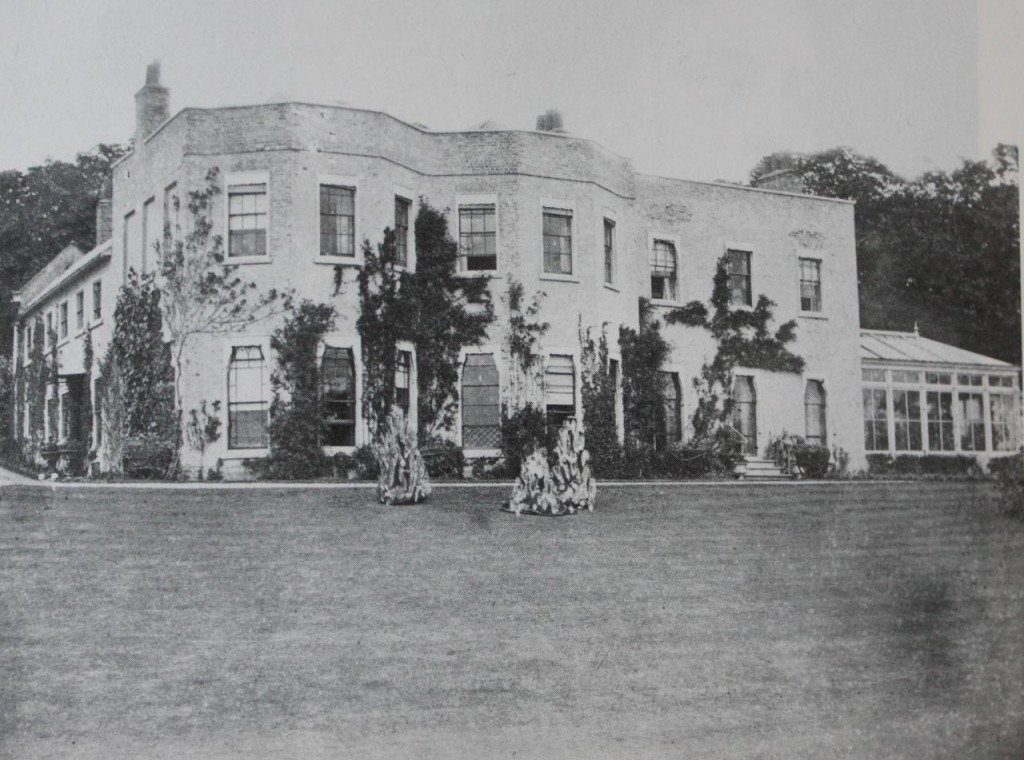
My interest in  Blackwood is partly because he was born in Shooters Hill, in Wood Lodge – one of the grand houses on the hill which have since been demolished. The old OS maps of the area show that Wood Lodge was situated roughly where the Oxleas Cafe is now.  Starlight Man includes the photo above, the only one I’ve come across of Wood Lodge, and the following description of Blackwood’s first home:

Blackwood was born at Wood Lodge, Shooter’s Hill in north-west Kent, not far from the suburbs of London. Administratively it fell within the parish of Eltham, but it was closer to Blackheath. Wood Lodge was a significant property. Built shortly before 1800 it had been extended and developed until a surveyor’s report, in the early 1800s, called it ’a situation superior to any within this Manor’. It stood in over thirty acres of land with rights over a further twenty-three acres of adjoining woodland. Originally the house was called Nightingale Hall, and the song of the nightingale was still heard there many years later. Wildlife abounded in the adjacent woods. The house had at least three sitting rooms, seven bedrooms, two dressing rooms, a brew house and stabling for six horses, and this was before it was enlarged by another tenant in 1860. Arthur Blackwood and his growing family moved there in January 1868. The 1871 census reveals that they had eight servants and a governess.

Wood Lodge is no longer standing. The property reverted to the Crown in 1916 when it was used by the War Department as an antiaircraft unit. It remained unused for the next fifteen years, became dilapidated, and was pulled down in 1932.

It is just possible that Blackwood’s earliest memory dates from those days. In his radio talk ‘Minor Memories’ he recalled that when he was just old enough to ‘grip the lower bar of the nursery window’ he saw the face of God. His parents spoke much of God but he had no idea what he looked like. The vision turned out to be a balloon sailing over Kent from Crystal Palace but it remained an indelible memory.

Increased demands on Blackwood’s father, with a greater number of evening engagements, meant that he often returned home late, and Wood Lodge was not conveniently situated near the railway station. In June 1871 the family moved to the Manor House, Crayford. This was the home that remained fixed in Algernon’s memory. He lived there from the age of two till June 1880, when he was eleven. It was the home of his childhood, the home of the ‘Starlight Express’, and the house that appears in many of his stories.

The Starlight Express mentioned is not the Andrew Lloyd Webber musical, but a 1915 children’s play by Violet Pearn  with songs and incidental music written by Sir Edward Elgar which was based on based on Blackwood’s novel A Prisoner in Fairyland.

Oxleas Cafe, where Wood Lodge once was

Wood Lodge was mentioned by Charles Booth, the Victorian philanthropist and social researcher known for his poverty maps of London, in volume B371 of his notebooks recording his perambulations around London streets. Digitized copies of these notebooks are available through the Charles Booth Online Archive, and  Volume B371 covers Districts 46 and 48 – Greenwich, Charlton, Kidbrooke and Woolwich. On page 209 he writes:

Bicycle ride through the streets of Woolwich between 10pm and 12.30pm and a visit to the Woolwich Music Hall while staying with H.F. Donaldson at Wood Lodge Shooters Hill,

Page 209 also gives Booth’s description of Saturday night in the Market Place, Woolwich. Later pages have descriptions of people’s clothes, prices at the market (fair sirloin 6d a pound, meat (not joints but not scraps) 3d a pound), Woolwich streets such as the Dust Hole  and the Music Hall in Beresford Street. It would be only too easy to waste a lot of time browsing through these notebooks deciphering Booth’s descriptions of local streets and the social status of their inhabitants in May 1900.

Charles Booth was staying at Wood Lodge with Sir Hay Frederick Donaldson KCB, who at that time was Chief Mechanical Engineer at the Royal Ordnance Factories, Woolwich – the Royal Arsenal. I believe nearby Donaldson Road was named after Sir Frederick, who went on to become Chief Superintendent of the Royal Arsenal and was praised by Lloyd George for his “skilled, prudent, tactful, and resourceful administration”. He stepped down from his Chief Superintendent position when he was appointed Chief Technical Adviser to the Ministry of Munitions in September 1915

Sir Frederick was one of the advisers selected to go with Lord Kitchener, Secretary of State for War, on a mission to Russia which ended in disaster. The  firstworldwar.com web site gives the details:

On the afternoon of 5th June 1916 HMS Hampshire set sail for Archangel, Russia with Field Marshal Earl Kitchener aboard.

He was bound for Petrograd at the invitation of Tsar Nicholas of Russia who wanted talks with the War Minister about the war on the eastern front.  Three hours into the voyage, the cruiser struck a mine off Marwick Head, Orkney and sank almost immediately.  Kitchener and his Staff perished, along with the officers and nearly all the men of the ship.  Just 12 survivors from a crew of 655 managed to find their way ashore.

A tragic end for Donaldson, who was praised in his obituary in Nature as “an engineer of distinction” who “was associated with, and largely responsible for, the great improvements in the power and mechanism of naval and land artillery”.

Donaldson Road
Donaldson Road

Falconwood Miniature Railway Public Running 2013

Welling and District Model Engineering Society public running

Welling and District Model Engineering Society are still unsure of EDF’s plans for the future of their site at the electricity station site near Falconwood railway station, but hope that they can stay put for a while longer. They have just announced their programme of public running dates for 2013, as their web site says:

We look forward to welcoming you back in 2013 for another summer of nostalgia, riding behind our steam and electric locomotives. The dates and timings have now been confirmed.
The railway and clubhouse will be open from 2:00-5:00pm. Train rides will be available for children and adults(!), with the last ticket issued at 4:30pm. Refreshments are available in the clubhouse.

Sunday April 21st
Sunday May 5th 19th
Sunday June 2nd 16th 30th
Sunday July 14th 28th
Sunday August 11th 25th
Sunday September 8th 22nd
Sunday October 6th (last running)

I’ll add the dates to the e-shootershill events calendar on the right.

If you’ve never been for a ride on the WDMES model trains, check out my predecessor’s sound recording and video of the miniature railway in action. The entrance to the WDMES site is at the left hand end of the electricity station building on Rochester Way – the entrance is shown in the photo below. There are more photos on the e-shootershill Flickr site.

Entrance to Welling and District Model Engineering Society
Model Train at Welling and District Model Engineering Society

Horticultural Skills Centre

Greenwich Parks and Open Spaces depot

I wasn’t aware that there were plans for a Horticultural Skills Centre on Shooters Hill, as well as the Equestrian Skills Centre, until I saw ?Stewart Christie’s  (@5tewartChristie) tweet yesterday about Greenwich Council’s decision to give a grant of up to £495,000 to Hadlow College for the development of such a centre. Hadlow, who also run the Equestrian Centre just down the hill,  will put £73,000 towards the cost and will be responsible for any overspend and  ongoing running costs.

It is proposed that the new centre will be built at the Parks and Open Spaces depot opposite Eaglesfield Road, which is going to be empty from April. The site already has buildings on it and from the preliminary plans it looks like the new centre will have a similar layout and footprint as the existing development, even keeping the little roundabout at the entrance. It will “encompass a teaching, administration and a facilities block, alongside polytunnels and raised beds for planting and growing”. They still need to get planning permission for any work, so we will have a chance to comment on the plans. They are working to a tight timetable: they reckon the work will take 3 to 4 months, but want to be able to open the new centre by the end of summer in time for the start of the autumn term.

As well as the grant the council will let Hadlow College have a 15 year lease on the site for a peppercorn rent. The Equestrian Centre also has just a 15 year lease.

Preliminary Plan for Horticultural Skills Centre

The aim of the new centre, according to the council report is:

This element of the Skills Centre is designed to exploit the potential for horticultural jobs both in the Royal Borough, including the Borough’s Council’s own parks and open spaces, and in surrounding areas. The Service Level Agreement will set out the scope of the skills training to be delivered, which will include pre-apprenticeship and apprenticeship training at levels 1 and 2, adult and community learning, NPTC short courses in areas (e.g. pesticide spraying), embedded literacy, numeracy and IT skills, with the aim of equipping students with a range of transferable skills that will increase individuals’ employability, and provide potential access to a range of jobs and careers.

On the 1894 and 1914 OS maps of Shooters Hill the area where the Parks and Open Spaces depot is now was occupied by a mansion called Summer Court about which I know very little, though it was occupied in 1900 by a bankrupt named William Carter. From the old maps it’s possible that an old coach house on the site, pictured below,  may be a remnant of the Summer Court buildings; I’m glad that the preliminary plans show that it will be retained within the Horticultural Skills Centre.

Old building in the Greenwich Parks and Open Spaces depot

At the bottom of Shooters Hill the Hadlow College Equestrian Centre is now occupied and has its first students, though it won’t be fully running until the start of the 2013/14 academic year in the autumn. One of the conditions of their planning approval was that they had to submit a community use scheme, allowing  for a minimum of 82 hours of community access each week, to the council planning authority and get it approved.  The Greenwich Council planning pages show that Hadlow have submitted a scheme, but the document itself is not included and comments are not being accepted. Its status is “Pending Decision”. When I dropped in to the Equestrian Centre earlier today I was told that they planned to provide riding lessons for local residents in the evenings and at weekends starting at the end of the summer.

The Horticultural Skills Centre sounds like a good idea to me, and an enhancement to the area, but like the Equestrian Centre it seems that Greenwich Council are going about it in a slightly odd way.

Royal at Last

Royal Borough of Greenwich Street Sign

More than a year after the Woolwich fireworks celebrating Greenwich becoming a Royal Borough,  Shooters Hill has its first street signs with the Royal Borough of Greenwich logo and crest. The signs are on roads in the Shrewsbury Park Estate, which has also had some maintenance to its trademark verges recently. These are given particular mention in the estate’s conservation area appraisal:

The relationship of public and private spaces on the Laing Shrewsbury Park Estate is one of its special features. The well-developed verges originally laid out with posts and chains throughout, enlarged at the entrances, complement the spacious front gardens to create a verdant and sylvan setting, which softens and warms the houses.

Over the last few months the verges have been enhanced by filling gaps with  new shrubs and succession tree planting: Parrotia persica, Olea europaea, Sophora japonica and Prunus cerasifera ‘Nigra’ have all been added to the kerb-side beds. For the non-horticultural that means Persian Ironwood, Olive, Japanese pagoda and Black Cherry Plum trees have been planted. The trees will provide colour at different times of the year and I’m looking forward to seeing them mature to their full glory, especially the “stunning autumn colour” of the Persian Ironwood.

Shrewsbury House has also had some TLC; Len Newland wrote:

Have you seen our new website?  You still have to go into it via www.shrewsburyhouse.info but this will soon be changed to .org. The House over the past few months has had something of a facelift, with new lights in the old library and room 3 now housing our books all donated by residents which can be taken out free of charge. It has also had a facelift with newly polished floors in a number of rooms. New curtains have been hung in room 3. A majority of our other rooms have also had an upgrade and the House is something to be proud of. If you have not been in there recently or if not at all, it is worth spending five minutes of your time, especially if you are thinking of holding a party or wedding.

They will be holding a table sale, which I think is a kind of  indoor car-boot sale, in aid of the house on Sunday 12th May: I’ve included the flyer below.

Table Sale Flyer

Royal Borough of Greenwich Street Sign

Lambing Day and Wildlife Walk at Woodlands Farm

Lamb at Woodlands Farm

Lambing Day Poster

The pregnant ewes have been gathered into the barn in preparation for the arrival of their lambs, and the lambing volunteers are signing up for the shifts on the lambing rota. Lambing season has started at Woodlands Farm. There will be a chance to see the new-born lambs at the farm’s Lambing Day on Sunday 7th April. Maureen at the farm e-mailed the details:

?All are welcome at the Woodlands Farm Trust Lambing Day. Come and see our new-born lambs, and enjoy the chance to buy quality local produce at reasonable prices, including home-made preserves, cakes and honey. Relax in our café, enjoy the treasure hunt or get involved in craft activities.

Entry is £1 for adults and 50p for children, and all proceeds go towards caring for our animals. A great family day out!?

What’s it like to be a lambing volunteer? For a graphic description of a ewe giving birth read Suzanna Fitpatrick’s brilliant poem “Lamb 001” which is reproduced at the end of the recent post about Shooters Hill Poets.

Pregnant Ewes in the barn at Woodlands Farm

I also heard from Lorraine, the Wildlife Officer at the farm,  that they will be holding a Spring Wildlife Walk at the Farm on Easter Monday, 1st April:

Winter is behind us so put a spring in your step and enjoy a community countryside and wildlife walk around Woodlands Farm. Led by members of the Woodlands Farm Trust. Please wear appropriate clothing including sensible footwear. The walk will probably be a bit challenging for buggies but supervised children are very welcome.
£1 per person (under 18’s free)
Free for farm volunteers and members
Meet at the Education Centre
The Woodlands Farm Trust
331 Shooters Hill, Welling, Kent DA16 3RP
Website: www.thewoodlandsfarmtrust.org
Email: wildlife@thewoodlandsfarmtrust.org
Tel: 020 8319 8900

The farm is host to many wildlife species that are of high conservation importance, including bats, common toad, hedgehog, song thrush, house sparrows, and stag beetles. There are also frogs, toads and newts at the farm ponds. It’ll be interesting to see how many creatures are out and about already.Wildlife Walk Poster

Ring-necked Parakeet feeding at Woodlands Farm

Christ Church School New Website

Christ Church Shooters Hill  Primary School
Christ Church Shooters Hill Primary School

Another new local web site has just been launched – phase 1 of the  Christ Church Primary School web site is now live. New material is still being added to the site, but it already includes a wealth of information about the school and has links to external sites with data about the school such as the Ofsted sites. The school is also on twitter @ccshprimary.

Christ Church School Badge

Christ Church are still in their temporary accommodation at the Shooters Hill Post 16 Campus while the old school buildings are extended into their old playground and a new playing area and  MUGA court created on Eltham Common. I hear the year long building programme is running slightly late, and it may be the end of this academic year before they move back to their home further up the hill.

I’ll add the new School  web site to the local links list on the right.

Footpath News

Green Chain Walk signpost at corner of Keats Road and Dryden Road

When I was preparing to write this post I was expecting that I would  be expressing disappointment and frustration about the two footpath closures in the area: the Green Chain Walk through Woodlands Farm and the path between Shooters Hill and Academy Place. However events yesterday suggest that there may be grounds for cautious optimism that the Woodlands Green Chain dispute can be resolved.

The latest issue of Ramblers‘ South East Walker newspaper suggested that the dispute was continuing in the same vein as before. There is an article by Des Garahan, Campaigns Officer for Inner London Ramblers, thanking readers for responding in support of the campaign to reopen the path, and asking for further evidence of use of the path before 1992 to help get it established as a public right of way. However the paper also printed a letter from a Rambler suggesting a more flexible approach, and saying that she “would gladly walk an alternative route if it meant that the farm were to be preserved as it is now”.

I had also heard from the farm that they had attended the Inner London Ramblers AGM with the intention of putting their case, but they “experienced hostility and rudeness, and were, for the most part, prevented from saying anything to the meeting.”  Well, as least they tried to have an open discussion about the issues. Later the farm e-mailed me stating their position:

We are writing to you to update the position with regard to the Green Chain route across Woodlands Farm. As you know, the present claimed path across the farm is neither a right of way nor a permissive path, legally it has no status. We fully accept that it is the widely advertised route of the South East London Green Chain Section 3 and Woodlands Farm has always been extremely anxious to resolve this problem as soon as possible. We feel that if we accept the current claimed route across Woodlands Farm it will result in serious damage to the character of the farm, a severe curtailment of our actives and threaten the viability of the whole project.

Since 1996 many hundreds of volunteers at Woodlands Farm have worked tirelessly a derelict urban wasteland into a very popular and successful city farm of high wildlife and biodiversity value. We are naturally saddened and very anxious that the current campaign by Inner London Ramblers and the Green Chain Working Party to establish a public right of way across Woodlands Farm with 24/7 access could kill the Woodlands Farm project stone dead. The reasons for saying this are set out in the attached documents and these have appeared in our newsletter.

Woodlands Farm map showing proposed path change

Put briefly, if a right of way were established along the route of the present claimed Green Chain, two of our largest hay meadows would be open to all and sundry with no restriction. In the past, as you know, this has resulted in arson, burglary and attacks on our livestock and threats to our staff and volunteers. We’ve been able to reduce this anti-social behaviour by locking the gates at Dryden Road and Bellegrove Road. The Woodlands Farm Trust has a perfect legal right to do this.

In order to facilitate the Green Chain Walk we have offered a perfectly feasible and enjoyable diversion, along an existing public footpath at Hillview. The WFT would then provide a permissive footpath across a short section of the farm to the Dryden Road gate, which could then be unlocked and left open. See attached map. This strategy of a diverted footpath meets with the approval of Blackheath Ramblers and North West Kent Ramblers.

As you reported previously, the 2012 AGM of the Woodlands Farm Trust voted unanimously for the Board to resist the efforts of Inner London Ramblers and the Green Chain Working Party to impose a new footpath across our fields. If there is no settlement this can only result in prolonged and costly litigation and to what end? Our proposed diversion is only 100 yards east of the current claimed footpath. Woodlands Farm Trust will resist any attempt to impose a new footpath on us and for the reasons we have stated, we feel we are now fighting for our lives.
Dr Barry Gray (Chair)
Maggie Jones (Vice Chair)

Things seemed to be escalating yesterday (Saturday) morning when I saw this tweet:

Oh dear, I thought, that doesn’t sound like it will lead to an agreement between Ramblers and the Farm  that will get the path reopened. However later in the day I received this update from Maggie Jones, Vice Chair at the farm:

A few farm Board members and volunteers met the 4 people from Ramblers this lunchtime at the Oxleas Café. After much discussion and explanation of the Farm’s position they agreed not to leaflet today and to take consideration of the Farm’s position.

And there was also this update on twitter:

So some positive developments, and cautious optimism that the dispute can be resolved to everyone’s satisfaction, but still a little way to go before the gate is reopened permanently, I guess.

MoD notice that footpath is closed permanently

I heard that the other footpath closure in the area, the MoD’s closure of the path between Shooters Hill and Academy Place is looking less optimistic. An attempt to ascertain whether the footpath was a right of way by contacting Greenwich Council, yielded this response:

As a Metropolitan Borough Council, Royal Greenwich is not required by law to hold definitive records or information pertaining to ‘Public Rights of Way, By ways, or Bridlepaths. However I can confirm to the best of my knowledge that the footpath you are referring to is private and is not a public right of way.

According to Ramblers’ Put London on the Map campaign  there is an oddity in the law which means that footpaths in London do not have the same legal protection as footpaths in other parts of the country. London Boroughs do not have to maintain definitive maps of rights of way, and so nearly all of them don’t do so. This makes it difficult to find out if a path is a right of way. Justin Cooke, Senior Policy Officer at Ramblers told me in an e-mail:

But if it turns out it is MOD land and use of the path has always been by permission, i.e. they allowed it but never granted anyone a right to use the path in doing so, then they would have the right to close it as they have done.

I should stress that Ramblers haven’t given up on the issue and it has been passed on to their local volunteer for the area for further action.

There’s one other avenue to follow up: local MP Clive Efford is a keen supporter of Ramblers, as he said in an e-mail about the 80th anniversary of the Kinder Scout Trespass which included the photo below. I’m looking forward to his response to a request for support in getting the path reopened ….

Clive Efford at the Kinder Scout anniversary