The Lost River Wogebourne

Concrete tank in Oxleas Wood

…. but it should not be forgotten that its eastern slopes are primarily drained by a rivulet that emerges from Oxleas Wood, flows under the main road near the “We Anchor in Hope”, divides Plumstead Common from Bostall Hill and enters the Thames through the Plumstead Marshes. This rivulet is often alluded to as the Plumstead River, but researches made by the late W.H. Many, in 14th century manuscripts, have shown that its ancient name was the Wogebourne or Woghbourne. It is said to have originally been a tidal river.

Part of a map of Kent showing the Plumstead River from W.T. Vincent's Records of the Woolwich District
Part of a map of Kent showing the Plumstead River from W.T. Vincent’s Records of the Woolwich District

An aside in the first of Colonel Bagnold‘s articles about Shooters Hill set me off on a search for the course of the ancient river Wogebourne, from its Shooters Hill sources to its disappearance in Abbey Wood.

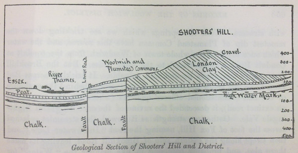
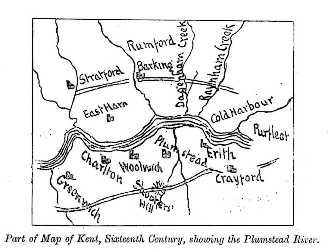
Where had the Wogebourne run? W.T. Vincent called it the Plumstead River, and also “An Obsolete River” which had disappeared. Its course is shown in the sixteenth century map from his Records of the Woolwich District, right. He said that it flowed “from the Halfway House, near Crossness Point up the Wickham Lane Valley, a short branch diverging eastward to the point where the abbey of Lessness stood (near Abbey Wood Station), and the other stretching past the eastern foot of Shooters Hill through Well-end (Welling) to Eltham.”  He also mentions that it was connected to the “Great Breache”.

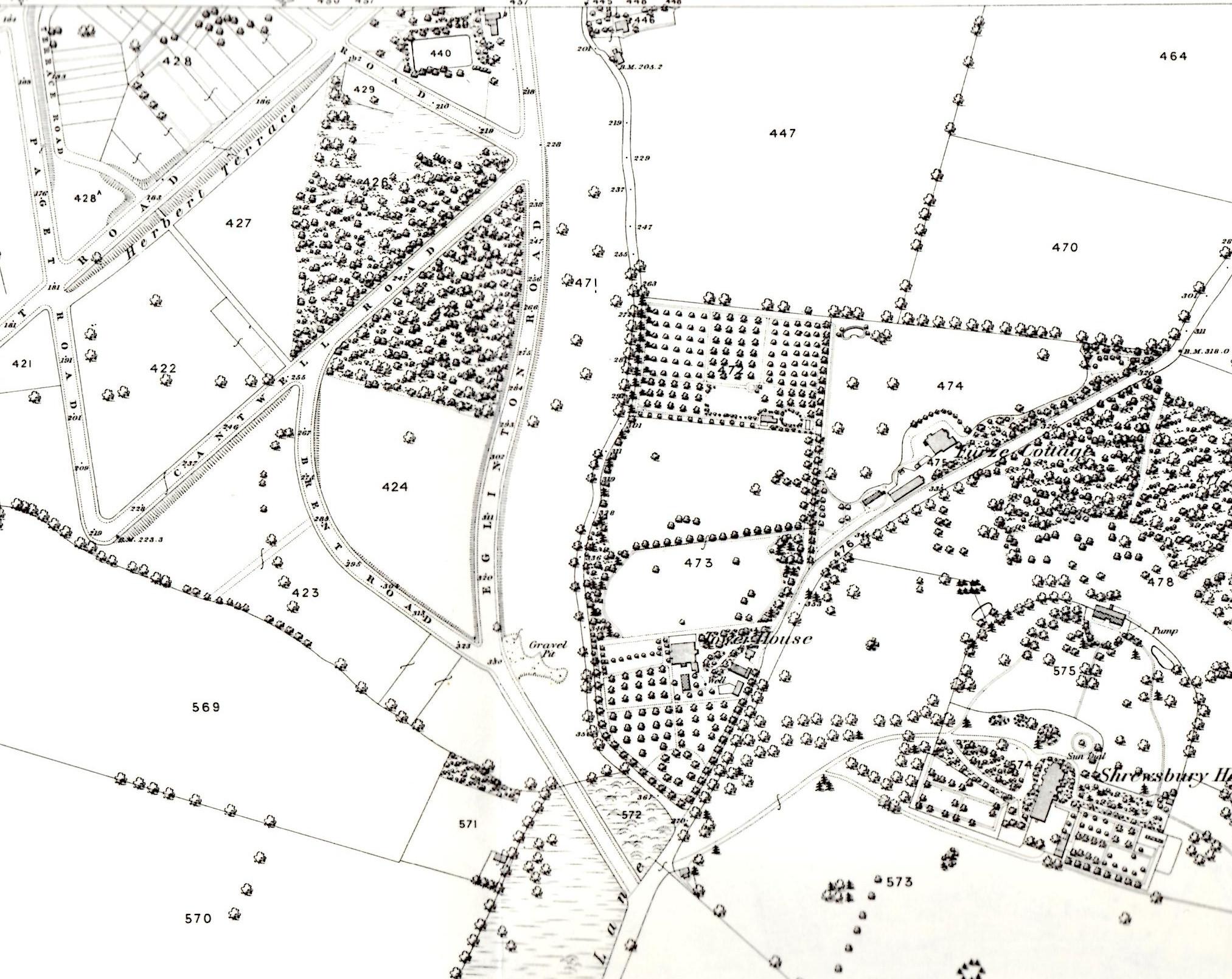
Vincent’s map is interesting, but not very useful in finding where exactly the Wogebourne used to run. It took a trip to the Greenwich Heritage Centre to find a more detailed map in one of their drawers of fascinating old maps. It was a beautiful, coloured map of the 1920 edition of the Geological Survey of England and Wales. A scan of the relevant part is shown below. It doesn’t include much of Oxleas Wood, but shows branches of the river starting in Shooters Hill Golf Course and Woodlands Farm. It also shows the branch crossing Shooters Hill from Oxleas near the We Anchor in Hope pub. After flowing through the farm the river passes through Bourne Spring Wood south of Woolwich Cemetery and turns sharply to the North when it meets Bostall Hill, down the Wickham Lane valley.

Part of 1920 Geological Survey map showing course of River Wogebourne

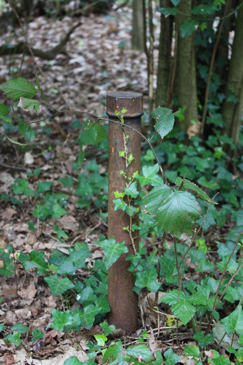
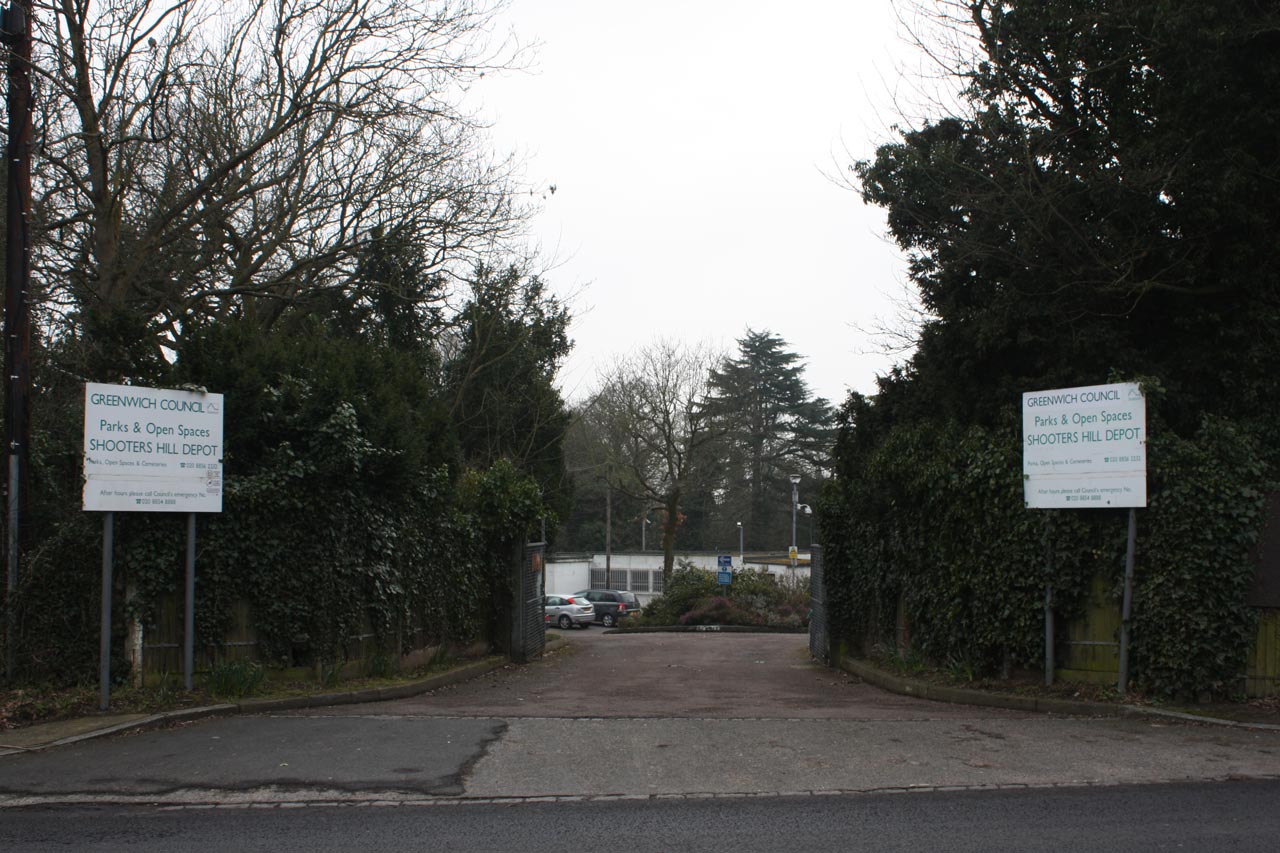
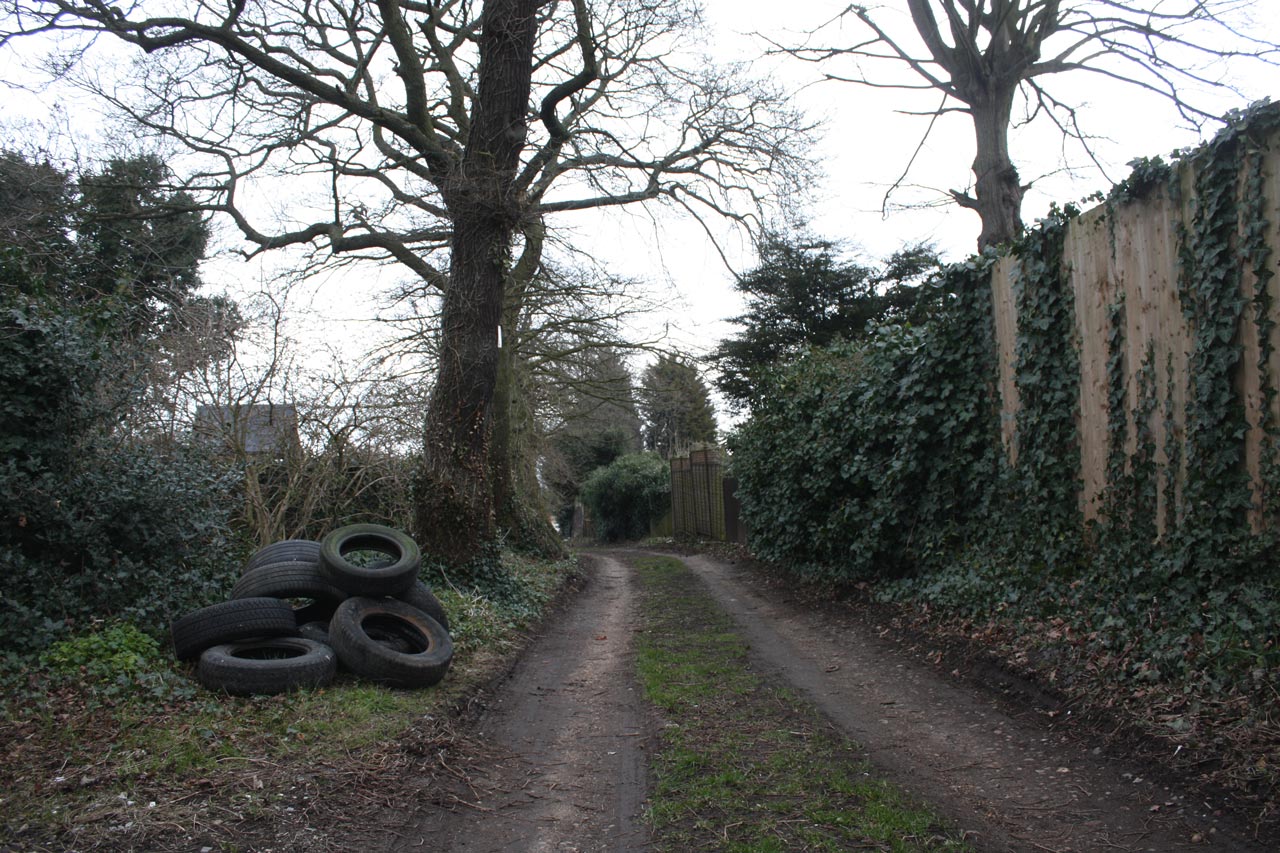
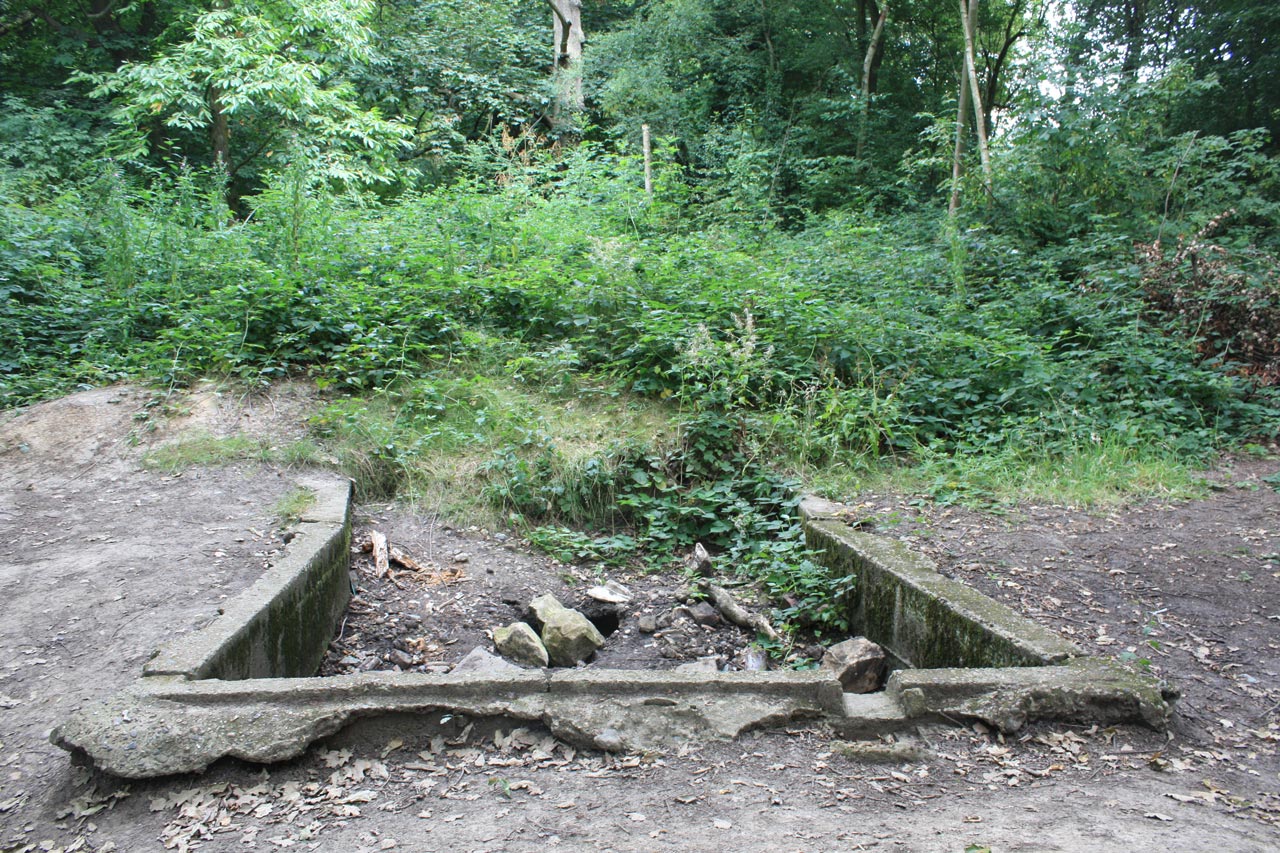
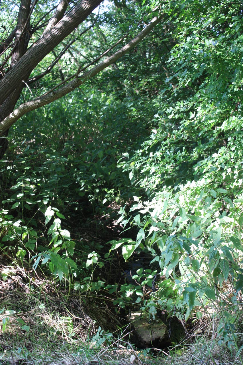
Armed with my old OS Explorer Greenwich and Gravesend map, and some print outs from Nokia Maps showing water courses I headed out to see where the river flowed. Two streams are marked as flowing down the eastern hill of Oxleas Wood, though they are both dry ditches at the moment. The origin of one of them appears to be just up the hill from the concrete structure pictured at the top, which is shown as a “tank” in the grounds of the old Falconwood House on the 1914 OS map. Possibly a receptacle for spring water? The southernmost of the two branches in Shooters Hill Golf Course is pictured in my previous post about Shooters Hill Springs.

It’s quite easy to find where the Wogebourne crosses Shooters Hill, and it can be seen over the fence at the side of the petrol station. It runs as a proper stream though Woodlands Farm, albeit with very overgrown banks, and leaves the farm at Swingate Wood near the (locked) Keats/Dryden Road gate. From there a ditch runs along the edge of the Teviot Rangers JFC sports field, then behind some houses before disappearing under the Glenmore Arms pub.

Stream through Woodlands Farm

The river must run underground across East Wickham Open Space. My Explorer map shows a streak of blue behind the houses in Bournewood Road – built where Bourne Spring Wood used to be – but it was difficult to see a ditch behind the brambles. The point where it reappears on the east side of Wickham Lane is quite clear however, just a peer over a wall, and the water is flowing strongly along a stone lined channel at this point. That  distinctive right angled turn to the north shown on the map is still there, though you have to risk a  tree-root assisted scramble down a steep clay cliff in Bostall Wood, not too far from Turpin’s Cave, to see it.

River Wogebourne flowing behind Woodbrook Road

That view of the stream running along the edge of Bostall Woods is the last I saw of the old river, and I assume it continues underground into the drainage system for the Thames-side marshes. My Explorer map has more streaks of blue running between the back gardens of Bendmore Avenue and Woodhurst Road down to the railway line, but there is nothing to see there now. On the 1920 geological map the river disappears into Plumstead Marsh. Vincent said that it connected to the “Great Breache”, an incursion from the Thames near Crossness in 1531 which is shown in a map in ‘Piteous and Grievous sights’: The Thames Marshes at the Close of the Middle Ages by James A. Galloway. The Great Breach is now part of Crossness Nature Reserve.

It seems likely that the Wogebourne or Plumstead River is now referred to as the Wickham Valley Watercourse: that is my interpretation of the  “river from an upland area with its source in Oxleas Wood on Shooter’s Hill” mentioned in a document on the Wildpro web site listing London’s rivers and streams. The Wickham Valley Watercourse was taken into account by Cross Rail in their analysis of flood risks, which describes it as:

Wickham Valley Watercourse is a piped stormwater drain which crosses under the Crossrail route between Plumstead and Abbey Wood Stations from south to north. It runs parallel to the railway for several hundred metres before turning northwards towards its outfall in a lake, which feeds through one of the Marsh Dykes to Tripcock Pumping Station

It was also included in the long list of land and properties to be compulsorily purchased for the East Thames River Crossing in 1991.

It may seem strange, but I’m actually looking forward to some rainy weather so I can see some of the ditches and holes I’ve been peering into in action.

Shooters Hill Springs

Stream in Shooters Hill Golf Course

Poring and peering. I’ve been poring over old maps a lot recently, and peering over walls and fences and into ditches, trying to understand the relationship between the geology of Shooters Hill and the springs and streams that drain it. My investigation took me down to the Greenwich Heritage Centre, both for their beautiful old geological maps and to read what Colonel Bagnold, David Lloyd Bathe and W.T. Vincent had to say about Shooters Hill springs and geology. The Heritage Centre also has a box of old papers from the 1930s by local geologist Arthur L. Leach which discuss the details of the geology and report his observations.

Why did I start on this? I had noticed that some locations on the hill seemed to be always wet, and small streams sprung from them after rain. Streams that couldn’t be explained by the latest Thames Water leak. For example the woods just up the hill from Christ Church School is one streamy spot, and the steep, stony stretch of Mayplace Lane just above Highview flats another.  My curiosity was piqued.

The story of the springs of Shooters Hill goes back to the late 17th century and the area was famous for its mineral wells. Hasted records in his seminal 1797 work “The History and Topographical Survey of the County of Kent” that there was on Shooters Hill “a mineral spring, which is said constantly to overflow, and never to be frozen, in the severest winters.”  In Henry Drake’s 1866 revision this is interpreted as referring to springs in Red Lion Lane, and is expanded to say that the springs were discovered in about 1675 by John Guy and were called the “Purging Wells”. Bagnold reported that these springs were in the garden of 80 Red Lion Lane, and overflowed across the Lane and down to Nightingale Vale. It was visited by people wishing to take the waters up to the end of the nineteenth century. Diarist John Evelyn and Queen Anne were said to have used the Shooters Hill waters, and at one stage there was a grand plan to turn Shooters hill into a spa town.

The chemistry of the Shooters Hill waters was analysed by the Royal Military Academy’s James Marsh, showing that its main ingredient was Magnesium Sulphate, also known as Epsom Salts. These medicinal springs seem to have different geological origins to other springs on Shooters Hill.

W.T. Vincent's Geological Section of Shooters Hill and District
W.T. Vincent’s Geological Section of Shooters Hill and District

Shooters Hill can be thought of as comprising three geological strata. The bulk of the hill and lowest layer is London Clay. Next is a layer known as the Claygate Beds,  which itself is layers of sand and loams with thin bands of clay. On top there is a layer of gravel, known as Shooters Hill Gravel, which Wessex Archaeology describe as “well rounded flint gravel, sandy and clayey in part”. Bagnold describes it as “red, clayey gravel and sands.” It can sometimes be seen when ditches are dug, for example to put down services pipes and cables; there’s a good example at the moment in a fresh ditch by the side of the path leading to Severndroog Castle. The gravel layer is shaped a bit like an irregular doughnut sitting on top of the peak – at the very top of the hill it is very thin or even non-existent and it increases in thickness going down the hill as the Claygate Bed layer drops away more steeply. Leach shows the top surface of the London Clay sloping towards the West-South-West so the Claygate Beds and Shooters Hill Gravel are thicker in the direction of Eltham Common. The gravel is thought to cover an irregular area about a mile long by half a mile wide, as can be seen from the British Geological Survey map extract below.

(As an aside, it has been argued that the geological structure of Shooters Hill, specifically the faults shown in Vincent’s cross-section above, created London.)

The top two layers are porous, and in wet weather retain water, which cannot drain through the impermeable London Clay and so appears as springs at the edge of the upper layers where the clay becomes the surface. The spring above Christchurch school is explained by this mechanism: the BGS map shows that the Claygate Beds layer ends at exactly the point where the spring appears. Bagnold says that up until around the second half of the nineteenth century there was a dipping well at this location, and that it is believed this well was the main source of water for the Shooters Hill hamlet around the Red Lion pub until the Kent Waterworks laid on a water supply.

Other streams and water flows, where maps can be found that show them like Nokia Maps, seem to start from around the edge of the gravel/Claygate layers. For example the origin of ditches on Shooters Hill Golf Course, like the one in the photo at the top, and others in Oxleas Wood seems to lay on the boundary line.

Snippet from British Geological Survey Geology of Britain Viewer

The flow of water in Mayplace Lane is not so easily explained because the map shows that the Claygate Beds layer don’t extend that far and the western boundary of the Shooters Hill Gravel runs parallel to and quite close to Plum Lane. I’m not a trained geologist, but I wonder whether is this is accurate, for two reasons. Firstly the 1866 OS map shows that there was a gravel pit between Eglinton Hill and Mayplace Lane opposite the junction with Brent Road, so there was some gravel that far down the hill, though of course it may have been a pocket of gravel separate from the main layer.

Secondly, Alfred Leach wrote some “Further Notes on the Geology of Shooters Hill, Kent” about his observations of trenches being dug for sewers along Plum Lane from Genesta Road up to Mayplace Lane. Someone else who spent time peering into ditches! He noted that from Dallin Road upwards the trenches passed through sands and pebbles down to London Clay, apart from a few points where the gravel layer went deeper than the 8ft deep trench. That would seem to indicate that the Shooters Hill Gravel extends further north than the BGS map, though Leach thought that undisturbed gravel only extended as far as the midpoint between Furze Lodge and Dallin Road, after that it was gravel that had drifted down the slope. The southern end of Highview flats is on the same 95m contour line as the Plum Lane end of Dallin Road.

Borehole pipe on the proposed route of the East London River Crossing in the middle of Oxleas Wood
Borehole pipe in the middle of Oxleas Wood on the proposed route of the road to the East London River Crossing

It’s a pity the boreholes, shown on the BGS map, that have been used to gather geological evidence don’t cover the North-west of the hill as well as they cover the proposed route of the road to the East London River Crossing through Oxleas Woods and Plumstead.

Most of the streams and springs originating on Shooters Hill have now disappeared – diverted underground or into the drainage system. As long ago as 1890 W.T. Vincent in his Records of the Woolwich District was bemoaning the loss of streams, and mentioned a number of them. There was the Nightingale Brook which sprang from “the swampy waste behind the Royal Military Academy”, then trickled across Red Lion Lane before descending the “ravine of the once delightful Nightingale Vale”, along the eastern side of Brookhill Road down to the Woolwich Arsenal where “it filled a moat about a barbacan, and finally fell into the bosom of Father Thames.”  This stream marked the boundary between Woolwich and Plumstead. Another across Woolwich Common marked the boundary with Charlton.

Vincent also believed that Shooters Hill was the source of the River Quaggy, citing springs which rose behind the police station and crossed the Eltham Road under an arched bridge on its way to Kidbrooke. This sounds like the Lower Kid Brook described by the Kidbrooke Kite in his guide to the Kid Brooks. The Kid Brooks were tributaries to the Quaggy.

On the eastern side of the hill the Oxleas Woodland Management Plan says that Oxleas Wood and Sheperdleas Woods drain into the River Shuttle, which is a tributary to the River Cray, and Nokia Maps shows some streams heading in that direction via Rochester way and Falconwood Field. However I was intrigued by what Bagnold said about some other eastward heading streams. These fed into what Vincent calls “An Obsolete River” and the Plumstead River, and Bagnold asserts was once called the River Wogebourne or Woghbourne. I’ll talk more about my efforts to trace this lost river in my next blog post.

Suffragette Evening at Greenwich Heritage Centre

She works at the Woolwich Arsenal now  leaflet

How do you make a Suffragette Cocktail? An American recipe from 1909 says it contains gin, Italian vermouth and French vermouth stirred with ice and a dash of orange bitters, and that it has very strange effects on men, such as turning them into dish washers. Well, there’s a chance to try the Greenwich Heritage Centre’s interestingly coloured version of the cocktail next Wednesday, 31st July.

The Heritage Centre is holding a “Museum Late” Suffragette Evening starting at 6.00pm, organised in collaboration with the University of Greenwich. Shooters Hill-based actor Natalie Penn will be performing extracts of her one-woman drama “Lie Back and Think of America” which she recently took on tour, commencing with two performances at Shrewsbury House in April. The Woolwich Singers will be singing popular songs from the era, including the music hall favourite “She works at the Woolwich Arsenal Now” – a munition worker’s romance written by Robert Donnelly. The sheet music for this song featured in the “Freedom of Spirit” exhibition about suffragettes in Greenwich at the Heritage Centre. Donnelly wrote  a number of sentimental songs, including “There’s love in my humble home“, “Please let Mother Come Home Again” and possibly “Don’t Go Down in the Mines, Dad“.

Other activities during the evening include historical talks, a DJ and the launch of a new publication about local suffragette Rosa May Billingshurst written by third year University of Greenwich History student Carolyn Ayers. Carolyn was the co-curator of the “Freedom of Spirit” exhibition.

The evening is also a celebration of the Heritage Centre’s tenth anniversary at the Royal Arsenal in Woolwich. Entry is free.

She works at the Woolwich Arsenal now leaflet

Shooters Hill Suffragette Plot

Freedom of Spirit Flyer

“In 1914 a suffragette plot to blow up the water reservoir on Shooters Hill was foiled” – an intriguing tweet from @TOWIWoolwich about the Greenwich Heritage Centre‘s new free exhibition on suffragettes in Greenwich set me on a hunt for more information. Which reservoir were they talking about I wondered – was it the Shooters Hill water tower, or one of the reservoirs on Woolwich Common or Jacob’s Corner, or even that under Oxleas Meadow?  Who was responsible for the plot and how were they foiled?

Museum of London Cat and Mouse Act Poster from Wikipedia

A quick search of the web using the DuckDuckGo search engine didn’t help, so off to the library to consult Bagnold and W.T. Vincent – nothing. I did find some useful information at the Heritage Centre. They have a fascinating  folder about the suffragettes in Greenwich which includes a copy of an interesting and informative little booklet by Iris Dove, entitled “Yours in the Cause, Suffragettes in Lewisham, Greenwich and Woolwich”. This mentioned  the alleged plot, and gave slightly more information – a date:  June 1914.

The Freedom of Spirit exhibition is well worth a visit. As well as telling the story of the life of Blackheath- born suffragette Rosa May Billinghurst there are displays about the suffragettes’ campaigns and the authorities’ reaction. One case holds one of the force-feeding tubes that were used on imprisoned suffragettes who were hunger striking. It’s not surprsing broken teeth resulted from the ceramic mouthpiece. I’d never heard of the “Cat and Mouse Act“, under which extremely weak hunger-striking prisoners could be released until they were well and then rearrested.

Woolwich was a centre of support for women’s right to vote, with both the local council and labour party strongly in favour. Many people travelled from Woolwich up to London for speeches by suffragette leaders and demonstrations.

I tried another web search, looking for Woolwich reservoirs rather than Shooters Hill and this yielded a number of articles in overseas newspapers, such as the New York TimesThe Singapore Free Press and Mercantile AdvertiserThe Press from New Zealand and the Otago Daily Times all with essentially the same text:  “A suffragettes’ plot was discovered to blow up the Metropolitan Water Board’s reservoir at Woolwich”.The New York Times went further:

London; Tuesday, June 16.- A plot by militants to blow up the Metropolitan Water Board’s reservoirs in the Woolwich District was communicated to the authorities last night. These reservoirs supply a large part of the Eastern district of London, and their destruction would cause widespread inconvenience.

As a result of the information, a large force of police guarded the reservoir all night.

Perhaps the local papers would have more details of the plot, I thought, so armed with a precise date I headed back to the Heritage Centre where they have drawers full of microfilmed copies of local papers going back to the nineteenth century. Trying to resist being deflected by interesting articles about a 1914 Woolwich Photographic Club outing and comparisons of Woolwich in 1914 with 1893,  I scanned through to find the suffragette plot. The Kentish Mercury from June 19th 1914 was sceptical about the reports, which must have appeared in the London newspapers too:

MILITANT SUFFRAGISTS AND THE WATER SUPPLY

A RUMOURED “RESERVOIR PLOT”

A daily contemporary announced on Tuesday that a plot by the “fool-furies” who are known as the “militant Suffragettes” to blow up the Metropolitan Water Board’s reservoirs in the Woolwich district had been communicated to the authorities. It was added that these reservoirs “supplied a large part of the eastern district of London” and that “their destruction would entail widespread inconvenience”. If the writer’s information in regard to the plot is no better than his knowledge of London’s water supply, there is little ground for alarm. As a fact, the reservoirs referred to, which are at Plumstead and Shooters’ Hill, are of altogether minor importance. Nothing is known of the “plot” at the offices of the Water Board, but, in any case, the reservoirs and works of the board are always well guarded, and it would be a difficult matter indeed to do them any serious injury.

But the Kentish Independent and Kentish Mail from the same date reported that the stories were based on an innocent enquiry:

THE RESERVOIRS RUMOURS

HASTY JUMPING TO CONCLUSIONS

Some excitement has been caused during the week through stupid rumours published by certain of our London contemporaries that Suffragettes had threatened to blow up the reservoirs of the Woolwich district

It appears that a few days ago a young lady appeared at the water tower on Shooters Hill and asked a number of questions of one of the residents near by.  How much water did the tanks hold? and where did the supply come from? and other queries were amongst those asked. The questioned one immediately jumped to the conclusion that his fair questioner must be a Suffragette, who had in view a dastardly attack upon the water tower with a bomb. The rumour soon spread, gathering picturesque and unveracious embellishments as it went along, and someone was soon found to telephone the exciting incident to the London “dailies”, who naturally made the most of it. From enquiries made by a “Kentish Independent”  representative it is found that the supposed “wild woman” was a teacher making harmless enquiries so as to be able to give a lesson to her class on how our houses are supplied with water. Innocent of the alarm her questions had given, she subsequently appeared at the water tower with the children, but was not allowed within the enclosure.

It seems the reservoir plot was just a teacher researching a lesson about water supply! However the Heritage Centre’s exhibition is a reminder of the suffering endured by many suffragettes in the battle for the vote – such a shame so many people don’t use it.

Freedom of Spirit Flyer

Images from the Past

Entrance to Beresford Square Market

Steve from the Shooters Hill Local History Group wrote with details of their meeting next Thursday, 16th May at 8.00pm at Shrewsbury House:

Images from the past:

At the next meeting of the Shooters Hill Local History Group you will be transported back forty years, to Woolwich, Plumstead Common and Shooters Hill in the 1970s. We will show three films made by local people:

THIS GIRL WENT TO MARKET – a young lady researches the history of Beresford Square market and finds her future (real life) husband.

PLUMSTEAD MAKE MERRY – the preparation for this popular local festival and the many aspects of how people enjoyed themselves at the two day event on Plumstead Common.

INN AT THE TOP – the archaeological search by members of the Shooters Hill Local History Group and friends for the “Catherine Wheel” ale house at the crest of Shooters Hill, which predated the “Bull” as a stop for stage coaches on the road to Dover.

Meeting is at Shrewsbury House, Bushmoor Crescent, Shooters Hill.

A visitor fee applies.

Sounds like a fascinating evening.

Horticultural Skills Centre Planning Application

Entrance to the proposed Horticultural Skills Centre

An application for planning permission to demolish some of the buildings at the Parks and Open Spaces Depot site on Shooters Hill and create a new Horticultural Skills Centre has been added to the Royal Borough of Greenwich planning web site. However it isn’t open for comments at the moment, and it doesn’t give any timescales for when we would need to make any comments.

This is the next step in the council’s joint project with Hadlow College to develop the Horticultural Skills Centre. Hadlow College also run the Equestrian Centre further down the hill.

The planners will need to consider policies on Metropolitan Open Land and the Green Chain in making their decision about this application. A comparison of the plan of the existing buildings with the proposed Horticulural Skills Centre plan, below, suggests that the new buildings will have a smaller footprint than the existing ones which will help prove compliance with the policies.

Existing and Proposed Plans

The new buildings sound like a great improvement on the current constructions:

The form and massing of the building along with the detailing and proportions around the windows, doors and the large roof overhangs will provide a contemporary modern design. The façade materials however, have been chosen to complement the woodland setting so the scheme will relate well to its surroundings taking references from the local woodland context.
Cedar cladding will be a dominant feature of the façade, which is then broken up by window and door elements. Blue engineering bricks are proposed for the plinths. The timber boarding will be fixed vertically and will be naturally finished. Cedar contains natural oils that act as a natural preservative providing a long lasting low maintenance finish. The metal framed windows/doors and roof fascia will be finished in polyester powder coat aluminium with an agreed colour finish which will again provide a low maintenance finish.

My only concern at the moment is with the assertion in the Design and Access Statement that the site “does not contain buildings that are listed, or are of special architectural or historic interest. There is also a low potential for archaeology on the site.” The old coach house on the site may be of historic interest and I’m pleased to see that a building marked on the western edge of the site on both the current and proposed plans suggests that it is not going to be demolished. The latter statement about archaeological potential is contradicted by the council’s Areas of High Archaeological Potential document which is part of the current consultation on the Greenwich Core Strategy. It contains the map below, delineating the Shooters Hill Settlements area of high archaeological potential, which clearly includes the site of the Horticultural Skills Centre.

Greenwich Areas of High Archaeological Potential No 7 Shooters Hill

The archeological interest stems from various interesting finds over the years, such as those from the Time Team excavations. The Areas of High Archaeological Potential document mentions:

  • Bronze Age ditch and associated bronze working slag from the area east of Cleanthus Road
  • Ditch with Early Iron Age pottery sherds and 63 kg of iron slag
  • Prehistoric/Roman pits and ‘huts’ recorded from the Woolwich and District War Memorial Hospital site
  • Remains of a Saxon musical instrument from the roadside area of Shooters Hill Hospital
  • World War II evidence that identifies the area as being part of one of the ‘Stop Lines’ that ringed London

I think the council and Hadlow College need to think again about archaeological potential and allow for it in their development plans and activities. But the new centre still looks like a benefit to the borough.

Happy May Day

Blossom in Oxleas Woods

I’ve been wondering for a while about where Mayplace Lane got its name. One possible  answer is that it once led to a place where May Day was celebrated, but it has proven difficult to find any written records of May Days on the hill.

The first place I looked was in Neil Transpontine’s excellent booklet “May Day in South London: a history” which is a fascinating social history of May Day activities from medieval to modern times.  It includes the story of Henry VIII meeting Robin Hood  at Shooters Hill on May Day, which was followed by a procession to Greenwich accompanied by musicians, paste-board giants on carts and 25000 followers. It also mentions a tradition that May Day dew is good for the complexion, and quotes Samuel Pepys arranging a trip to Woolwich to collect the May Day dew, “which Mrs Tuner hath taught here is the only thing in the world to wash her face with”.

Shooters Hill does seem to have been a venue for May Day games, particularly archery and shooting, if the account in  “The Pictorial Guide to Eltham Palace by way of Charlton and Shooters’ Hill“, published in 1845 by Henry Viztelly is true:

Leaving this lane, we enter nearly at right angles into a fair highway, leading on our left over Shooter’s Hill, and to the right towards Blackheath and London. Our road is in the former direction; so bringing “a stout heart to a stone brae,” we prepare ourselves for the lengthened but very gradual ascent of the famed hill, where of yore, at the opening of the merrie month of May, all London, – man and wife, young and old, the small as well as great, – were accustomed to disport themselves. Here a party, clad in Lincoln green would be practising at the butts; some busily adjusting their long yew bows, others examining with jealous care their well-poised fletches, whilst an accompaniment of noisy shouts of officious boys or anxious partisans announced the result of each successive shaft, as it whistled part the ear on its errand of adjudicature as to the archer’s merits. In another direction, perhaps a crowd of amused spectators would be encouraging by their cheers some adventurous smock-frocked knight, to encounter another rough tumble from his heavy carthorse in a mock-joust at the quick revolving quintain. Here, also, around a tall flower-bedecked mast, surmounted by a gaudy popinjay, a circle of youthful dancers, of both sexes, leap joyously to the jarring  music of fiddles and tinkling dulcimers, or perchance to the less pretending strains of the humbler pipe and tabor. Warm with exertion and flushed with excitement, the party at length break up, retiring for rest to pleasant bowers or reclining at full length on the soft green turf. These have given place to a boisterous party of lusty competitors, each bearing a clumsy cavalier’s or long arquebuss, and who approach to contend for the prize given for the best shot fired at the popinjay. Not least among the entertainments prepared for the pleasure-seekers to Shooter’s Hill, was the opportunity thus afforded to braggart apprentices, or the sly foresters skilled in the gentle practice of woodcraft, to exhibit their dexterity as marksmen; and on this spot, no doubt, sulky discomfiture and saucy success have fretted their brief hour away.

So maybe Mayplace Lane did lead to May Day merriment.

Mayplace Lane

Snippet from 1866  OS Map
Snippet from 1866 OS Map

Mayplace Lane may at first sight seem like a typical back alleyway running to the garages behind houses in Eglinton Hill, but it’s much more than that. As you can see in the snippet from Alan Godfrey‘s 1866 OS Map of Shooters Hill it was there before the houses in Eglinton Hill were built, winding down behind Tower House parallelling Eglinton Hill. The Lane is thought to be part of a track that went all the way down to the Woolwich Marshes, following the line of Sandy Hill Road. According to the Survey of London Volume 48 on Woolwich, Sandy Hill Road itself “was laid out along the line of a footpath that rose diagonally through what had been called Hilly Field”. So it seems that before the roads we now know were laid out Mayplace Lane ran from the Bronze Age barrow in Plum Lane all the way to the marshes that once bordered the Thames.

Mayplace Lane with Fly-tipped Tyres

Mayplace Lane is also, in places, a pretty and secluded path, providing a pleasant alternative route down the hill towards Woolwich, though it is a bit uneven in places especially around High View flats where it shares the hill with a permanent water flow of what appears to be spring. Well it would be pretty if it weren’t for the persistent fly tipping which has blighted the lane for years. This isn’t just the usual dumped mattresses, but lorry-loads of old tyres, building remains and, at the moment what looks like corrugated asbestos roofing sheets.,

In the past the Royal Borough of Greenwich Clean Sweep team have removed fly-tipped rubbish, though they maintain that they don’t have to because Mayplace Lane is an unadopted road. Frustratingly the current piles of rubbish have been there for some time and consequently are being scattered over a wider area.  A twitter exchange about the rubbish last week has led to e-mails being sent to our local councillors, MP Clive Efford and London Assembly Member Darren Johnson to try to get some action.

One suggestion, which I thought was a good idea,  from  @Twinsclubplus was that we should have a “Friends of Mayplace Lane”, which I guess would be a bit like the “Friends”  groups that look after local parks. It could keep an eye out for fly-tippers, make sure any tipping was reported promptly, perhaps help clear up the Lane and lobby towards getting a more permanent solution to the problem such as a lockable gate up at the Plum Lane end.

Please let me know if you’re interested in being involved with a “Friends of Mayplace Lane” group on the usual e-mail hilly@e-shootershill.co.uk.

Of course fly tipping is not confined to Mayplace Lane: it’s a borough-wide problem which has been going on for years. In the past the local neighbourhood watch and the 853 blog have both explained what to do about it, but here’s a reminder.

  • Make a note of as much information about the fly-tipped waste as possible, in particular:
    • Where it is, with the post code if you know it
    • How much waste there is, from a single item up to multiple lorry loads
    • What type of waste it is, for example demolition waste, tyres, asbestos …
    • The type of land it is on, such as a public highway, back alley, private land …
  • If possible make a note of any information about the fly-tipping incident:
    • Date and time.
    • Nearest road junction
    • Identification of who did it such as a description, car registration number etc
  • Report it either by:
    • Phone 020 8921 4661 during office hours (Monday to Friday 8am to 8pm, Saturday and Sunday 8am to 1pm)
    • Phone 020 8854 8888 emergency out of hours
    • Fill in the Royal Borough of Greenwich on-line form

In response the council say:

We will remove all small flytips (equivalent to a small van load) within 24 hours and, if possible, take action against those responsible.

Large flytips, classified as anything larger than a small van load, will be dealt with by contractors within four working days on a priority basis.

Any items that have been fly tipped at the side of the road will be collected and separated for recycling. Our teams will endeavour to stop and collect any fly tips they find, unless it would prevent them from completing their scheduled or booked work in which case they will report it so a dedicated team will remove the fly tip.

Another way of reporting fly tipping, and other problems, is to use the FixMyStreet web site, which will then forward the report to the council. This can be done either by entering a post code or interactively using their map. It allows you to attach photographs of the problem too. On FixMyStreet you can easily see all the problems reported in your area, as shown in the screen grab below.

Snippet from FixMyStreet web site

I wonder how long Mayplace Lane has been there? It’s intriguing that it runs from the Plum Lane Bronze Age Barrow, one of what was once a  barrow cemetery of 6 barrows,  down to the Woolwich Marshes. Recent archaeological finds at the Plumstead Crossrail site have suggested that Bronze Age people may have built wooden causeways across the Plumstead Marshes similar to those that spanned the marshlands of the Somerset levels. Bronze Age remains have also been found just over the river in North Woolwich. During the Bronze Age it is believed that people distinguished between the land that they lived in and farmed – the land of the living-  and the land of the ancestors where their burials took place. Could Mayplace Lane have been their route from their villages around the Woolwich and Plumstead marshes up to the sacred Shooters Hill summit, the land of their ancestors?

Wood Lodge

Wood Lodge where Algernon Blackwood was born

I recently got hold of a copy of Mike Ashley‘s fascinating in-depth biography of  Algernon Blackwood, Starlight Man The Extraordinary Life of Algernon Blackwood, which is now sitting on top of my bed-side Jenga pile of books to read.  It looks an interesting read: Blackwood led a very varied life. Wikipedia records that his career included “working as a milk farmer in Canada, operating a hotel, as a newspaper reporter in New York City, bartender, model, journalist for the New York Times, private secretary, businessman, and violin teacher”. He was also a prolific author of supernatural and ghost stories, a TV broadcaster and an occultist – a member of the Hermetic Order of the Golden Dawn.

My interest in  Blackwood is partly because he was born in Shooters Hill, in Wood Lodge – one of the grand houses on the hill which have since been demolished. The old OS maps of the area show that Wood Lodge was situated roughly where the Oxleas Cafe is now.  Starlight Man includes the photo above, the only one I’ve come across of Wood Lodge, and the following description of Blackwood’s first home:

Blackwood was born at Wood Lodge, Shooter’s Hill in north-west Kent, not far from the suburbs of London. Administratively it fell within the parish of Eltham, but it was closer to Blackheath. Wood Lodge was a significant property. Built shortly before 1800 it had been extended and developed until a surveyor’s report, in the early 1800s, called it ’a situation superior to any within this Manor’. It stood in over thirty acres of land with rights over a further twenty-three acres of adjoining woodland. Originally the house was called Nightingale Hall, and the song of the nightingale was still heard there many years later. Wildlife abounded in the adjacent woods. The house had at least three sitting rooms, seven bedrooms, two dressing rooms, a brew house and stabling for six horses, and this was before it was enlarged by another tenant in 1860. Arthur Blackwood and his growing family moved there in January 1868. The 1871 census reveals that they had eight servants and a governess.

Wood Lodge is no longer standing. The property reverted to the Crown in 1916 when it was used by the War Department as an antiaircraft unit. It remained unused for the next fifteen years, became dilapidated, and was pulled down in 1932.

It is just possible that Blackwood’s earliest memory dates from those days. In his radio talk ‘Minor Memories’ he recalled that when he was just old enough to ‘grip the lower bar of the nursery window’ he saw the face of God. His parents spoke much of God but he had no idea what he looked like. The vision turned out to be a balloon sailing over Kent from Crystal Palace but it remained an indelible memory.

Increased demands on Blackwood’s father, with a greater number of evening engagements, meant that he often returned home late, and Wood Lodge was not conveniently situated near the railway station. In June 1871 the family moved to the Manor House, Crayford. This was the home that remained fixed in Algernon’s memory. He lived there from the age of two till June 1880, when he was eleven. It was the home of his childhood, the home of the ‘Starlight Express’, and the house that appears in many of his stories.

The Starlight Express mentioned is not the Andrew Lloyd Webber musical, but a 1915 children’s play by Violet Pearn  with songs and incidental music written by Sir Edward Elgar which was based on based on Blackwood’s novel A Prisoner in Fairyland.

Oxleas Cafe, where Wood Lodge once was

Wood Lodge was mentioned by Charles Booth, the Victorian philanthropist and social researcher known for his poverty maps of London, in volume B371 of his notebooks recording his perambulations around London streets. Digitized copies of these notebooks are available through the Charles Booth Online Archive, and  Volume B371 covers Districts 46 and 48 – Greenwich, Charlton, Kidbrooke and Woolwich. On page 209 he writes:

Bicycle ride through the streets of Woolwich between 10pm and 12.30pm and a visit to the Woolwich Music Hall while staying with H.F. Donaldson at Wood Lodge Shooters Hill,

Page 209 also gives Booth’s description of Saturday night in the Market Place, Woolwich. Later pages have descriptions of people’s clothes, prices at the market (fair sirloin 6d a pound, meat (not joints but not scraps) 3d a pound), Woolwich streets such as the Dust Hole  and the Music Hall in Beresford Street. It would be only too easy to waste a lot of time browsing through these notebooks deciphering Booth’s descriptions of local streets and the social status of their inhabitants in May 1900.

Charles Booth was staying at Wood Lodge with Sir Hay Frederick Donaldson KCB, who at that time was Chief Mechanical Engineer at the Royal Ordnance Factories, Woolwich – the Royal Arsenal. I believe nearby Donaldson Road was named after Sir Frederick, who went on to become Chief Superintendent of the Royal Arsenal and was praised by Lloyd George for his “skilled, prudent, tactful, and resourceful administration”. He stepped down from his Chief Superintendent position when he was appointed Chief Technical Adviser to the Ministry of Munitions in September 1915

Sir Frederick was one of the advisers selected to go with Lord Kitchener, Secretary of State for War, on a mission to Russia which ended in disaster. The  firstworldwar.com web site gives the details:

On the afternoon of 5th June 1916 HMS Hampshire set sail for Archangel, Russia with Field Marshal Earl Kitchener aboard.

He was bound for Petrograd at the invitation of Tsar Nicholas of Russia who wanted talks with the War Minister about the war on the eastern front.  Three hours into the voyage, the cruiser struck a mine off Marwick Head, Orkney and sank almost immediately.  Kitchener and his Staff perished, along with the officers and nearly all the men of the ship.  Just 12 survivors from a crew of 655 managed to find their way ashore.

A tragic end for Donaldson, who was praised in his obituary in Nature as “an engineer of distinction” who “was associated with, and largely responsible for, the great improvements in the power and mechanism of naval and land artillery”.

Donaldson Road
Donaldson Road

House Stories

100 Eglinton Hill - Cheviot Lodge
100 Eglinton Hill – Cheviot Lodge

On my tour of the buildings of interest in Shooters Hill the group of houses at the top of Eglinton Hill proved to be of particular interest, not least because of the links they provided into aspects of local and national history. I had been walking around the area guided by a scrunched up photocopy of some pages from “Buildings of Local Architectural or Historic Importance” by Councillor N.R. Adams and Borough Planning Officer C.H.J. Pollard-Britten, found in Woolwich Library. (Incidentally I have since found an updated version  online on the Royal Borough of Greenwich web site). The document had this to say about number 100 Eglinton Hill, pictured above:

Eglinton Hill No. 100 ‘Cheviot Lodge’

2-storey mid-Victorian building in yellow stock brick with red dressings and stucco dressings. Slate roof with weather boards and decorative finials to gable ends in projecting eaves; attic dormers. Single storey extension to side and glazed extension to front, conservatory to flank facing Shrewsbury Lane. Seven steps up to front door in recessed porch supported on black columns with decorated capitals in the Gothic foliated style. Built by British Land Co. who set out most of Herbert Road area in 1868. Sold to Robert Brownlow Dale who owned Brownlow Dale Drapers 6 – 12 Hare Street, Woolwich and sold again in 1882 to Joseph Randall of builders Kirk and Randall who built Tilbury Docks, Greenock Barracks and many other government buildings. Randall added a billiard room and the Conservatory but building has remained little altered since then.

The British Land Company played a significant part in developing the Herbert Estate, as this part of Shooters Hill   between Plumstead Common Road and the Dover Road was known, and built many of the properties hereabouts. They were established in the mid nineteenth century  to extend the vote to more people by allowing them to own small plots of land – at that time only landowners were eligible to vote – though they later became a development company which still exists today.

Robert Brownlow Dale must have liked the area as he moved to Clavering Lodge in Wrottesley Road where he died in 1892. The Woolwich-based company Kirk and Randall were major builders in Victorian London. They are mentioned a number of times in English Heritage’s Woolwich Survey, their local buildings including the Tramshed and the Church of St Michael and All Angels down near Woolwich Dockyard. They built all across the city: as well as the government buildings mentioned, they were responsible for the  Comedy Theatre in Panton Street, Shops in Duke Street, the Greek cathedral of Aghia Sophia in Bayswater, the Wandsworth & Clapham Workhouse, Southwark’s St Saviour’s Union Infirmary …. and many more.

Detail of 145/147 Eglinton Hill
145/147 Eglinton Hill


On the opposite side of the road there is a row of imposing houses, which Adams and  Pollard-Britten describe as follows:

No. 133

Large detached late Victorian villa with basement. Projecting bay windows to basement and ground floors. Front rendered. Hipped slate roof.

Nos. 135 and 137

Pair of 3-storey plus basement semi-detached late Victorian houses with centred front doors and projecting bays to basement, ground and first  floors. No. 135 in yellow/cream Gault brick; No. 137 has brickwork painted. Hipped slate roofs. Modern front doors and modern windows to No. 137.

No. 141 and 143

Pair of mid-Victorian 2-storey semi-detached houses with cornices and parapet roofs. Projecting bat windows. Walls rendered. Modern windows to No. 141.

Nos. 145 and 147.

Pair of substantial Edwardian houses with centred pediment containing two attic windows and centred terra-cotta medallion in circular red brick. Nos. 122 to 147 form a group.

There are photographs of these houses in the Shooters Hill Interesting Buildings Flickr set. I’m aiming to include photographs of all the buildings in the list.  Number 145 is now the home of the Shooters Hill Practice for Acupuncture and Complementary Medicine, and Lesley the Acupuncturist.

153 Eglinton Hill Front Elevation by G.J. Paszkowski
153 Eglinton Hill Front Elevation
153 Eglinton Hill
153 Eglinton Hill


I don’t know why 153/155 Eglinton Hill, directly opposite Cheviot Lodge,  isn’t one of the locally listed buildings: it looks just as important as its neighbours down the hill. It was certainly of interest to G.J. Paszkowski, a student at Thames Polytechnic School of Architecture and Landscape whose 1984 project report about number 153 Eglinton Hill is in the Greenwich Heritage Centre. The report gives the history of the house from 1896 when Joseph Randall of Randall and Kirk purchased the plot of land from the British Land Company, and includes some excellent drawings of the architecture of the house, including the drawing of the front elevation above (you may need to enlarge it by clicking on the image).

The house was built at the turn of the century and started out as number 303 Eglinton Road. It changed to number 353 Eglinton Road on 4th March 1913 when new houses were built lower down the road, and then became 153 Eglinton Hill on 16th March 1920.

G.J. Paszkowski lists the occupants and owners of number 153 in his report. Houses in Eglinton Hill were popular with officers from the different regiments based in Woolwich, and the report mentions several servicemen. One was Major F.H.G. Stanton RA who moved there in 1908. Major Stanton seems to have been a cricketer at the end of the nineteenth century, who saw action  in the Second Boer War. He is listed in Creswicke’s South Africa & the Transvaal War as being one of the prisoners freed after the British forces captured Pretoria in June 1900, and  he was mentioned in dispatches for rendering special and meritorious service in 1901. Major Stanton later served in the British Salonika Army which fought on the Macedonian Front in the First World War.

Captain Alfred Herbert MacIlwaine bought the house in 1922 for £1350. He sounds very highly accomplished if the various references I have found are the same person, and they fit together from a date point of view and with the most complete biography on the Militarian Military History forum. The son of the founder of the Hull Oil Manufacturing Company, he won five England rugby caps in 1912, England winning four out of his  five games. He served in the Royal Artillery in WWI, and his courage was recognised with the MC, DSO and Croix de Guerre. After the war he was at the Royal Military Academy, and helped set up a Central Army Rugby Referees Society. He moved to what was then Rhodesia and became a farmer, but was again active in WWII when he was the primary force behind the formation of the Southern Rhodesia Artillery. Back in Rhodesia after the war  he created Troutbeck, a lakeside inn in the Nyanga mountains of Zimbabwe, where “a portrait of him sitting on his boat with a fly rod at his side and a net in his hand hangs above the eternal hearthside fire”.

Intriguingly MacIlwaine gets caught up in Rhodesia’s unilateral declaration of independence, when in 1967 he is mentioned in Hansard because his Rhodesia passport was impounded when he visited Britain: an incident that gave a footnote to a book about Rhodesian UDI: A Matter of Weeks Rather Than Months by J.R.T. Wood.

So, some interesting stories prompted by local buildings. There’s just one thing I need to follow up on, a paragraph in G.J. Paszkowski’s report:

From the Barrow in Shrewsbury Lane is a long green lane still to be found at the back of the houses in Eglinton Hill. It followed the edge of steep slopes till it reached the levels of Woolwich marshes near Woolwich Arsenal station site.  Cows still came down from grazed fields on Shooters Hill to be milked at the dairy in Ripon Road.

This is a reference to Mayplace Lane, which I had noticed appears on the earliest old OS maps, before any development. I’d love to know its history.